
Italy's Devastating Floods and Volcano Eruption: Before-and-After Satellite Images and Aid Package.
TL;DR Summary
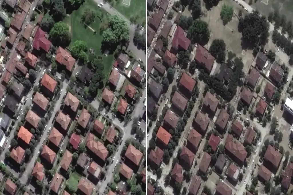
Before-and-after satellite images show the extent of devastation caused by heavy rainfall in northern Italy, which resulted in the deaths of more than a dozen people. The region was in the midst of the worst drought in 70 years, with 2022 rainfall down by 40%. Two rounds of heavy rains caused flooding, with 11.6 inches of rain falling on drought-ravaged soil, and another 7.8 inches of rain falling in just 36 hours two weeks later. The floods caused massive landslides, blocked roads, and buried homes. Twenty-three rivers have jumped their banks.
- Deadly Italian floods: Before-and-after satellite images show scale of devastation New York Post
- Italy floods aftermath – in pictures | World news The Guardian
- First the Floods, Now a Volcano Eruption: Tips for Those Travelling to Italy These Days - SchengenVisaInfo.com SchengenVisaInfo.com
- Italy Flood Damage Revealed in Before-and-After Satellite Imagery WNCT-TV 9 On Your Side
- Italy passes €2 billion aid package for those affected by deadly floods Euronews
Reading Insights
Total Reads
0
Unique Readers
10
Time Saved
1 min
vs 2 min read
Condensed
73%
338 → 91 words
Want the full story? Read the original article
Read on New York Post