
Record Rainfall Triggers 100-Year Flood Event in Nebraska
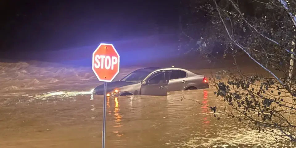
Remnants of Hurricane Polo caused historic flooding across Nebraska on September 30, 2026. Omaha experienced a 100-year flood event with water depths reaching 8 feet, leading to dozens of rescues. Lincoln set an all-time daily rainfall record of 6.15 inches. Major road closures and power outages disrupted the region, though conditions are expected to improve as waters recede.
Key points
- Omaha Fire Department reported approximately 60 rescues, including pets, from areas with 6 to 8 feet of floodwater.
- Lincoln Airport recorded 6.15 inches of rain, breaking the previous daily record of 5.45 inches set in 1910.
- The Missouri River rose by 3 feet in Omaha, while Salt Creek and Little Salt Creek in Lincoln reached record levels.
- Power outages affected over 1,000 Omaha Public Power District customers, though all were resolved by 1:30 p.m. Thursday.
- Schools in Omaha and Ralston faced significant bus delays and cancellations due to flooded roads and inaccessible bus lots.
Background
This event follows a wet September and the impact of Hurricane Polo's remnants, as noted in our October 1 archive. The flooding is distinct from the Nepal-Tibet crisis and Minnesota floods covered earlier in 2026.
How outlets are covering it
WOWT and Nebraska Public Media emphasized the severity of the Omaha flooding, describing it as a 100-year event that exceeded infrastructure design limits. The National Weather Service highlighted the historic rainfall totals, particularly in Lincoln and Millard. KOLN focused on the extensive road closures in Lancaster County, noting that while some roads reopened, dozens remained closed due to lingering floodwaters and mudslides.
Why it matters
The event highlights the vulnerability of infrastructure to extreme weather events, even in areas not typically associated with hurricane impacts. The record rainfall and flooding caused significant disruptions to daily life, including transportation, power, and education, underscoring the need for improved flood preparedness and response strategies.
What to watch
Officials expect the area to dry out over the next week. The National Weather Service and U.S. Army Corps of Engineers warned that standing water remains a primary hazard, urging motorists to avoid flooded roads. Damage assessments for the Papio NRD Levees and other infrastructure are ongoing.
- Dozens rescued from flooding in Omaha; mudslides close roads WOWT
- Drone video shows flooding at Lake Zorinsky near 168th Street after historic Omaha rain KETV
- More than a dozen roads closed across Lancaster County due to flooding KOLN | Nebraska Local News, Weather, Sports | Lincoln, NE
- Flooding of September 30, 2026 National Weather Service (.gov)
- Historic rainfall leads to flooding in eastern Nebraska Nebraska Public Media
Want the full story? Read the original reporting
Read on WOWT