
Severe storms and flood watch in effect for D.C.-area
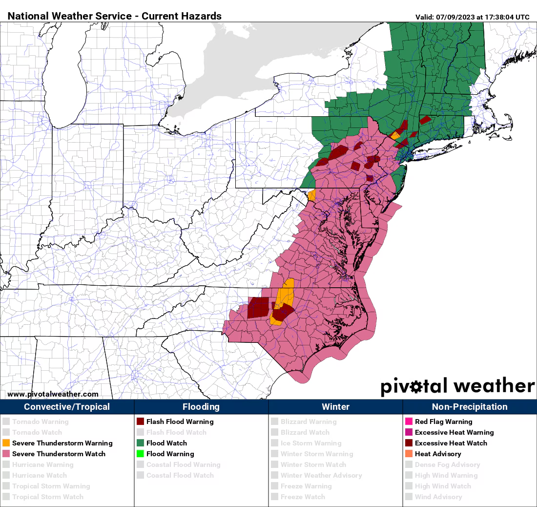
Flood and severe thunderstorm watches have been discontinued as storms move east of Interstate 95, with heavy downpours expected to continue in Baltimore and Anne Arundel County for another hour. The D.C. area mostly avoided severe storms and flooding, but flash flooding warnings have been issued for areas from northeast Maryland to New York state. After the storms exit, mainly dry conditions with temperatures in the 70s are expected, although a pop-up downpour is possible. Rainfall totals have been variable, ranging from 0.1 to 1.0 inches. Tomorrow, there is a chance of quick showers or storms, with decreasing precipitation and increasing sunshine throughout the day.
- PM Update: Severe thunderstorm watch until 8 p.m.; flood watch until 10 p.m. The Washington Post
- WEATHER ALERT - Strong storms moving through our area 13News Now
- ALERT DAY: Severe T'Storm Watch, Flood Watch in effect wgaltv
- STORM WATCH: Severe storms today with damaging wind, flooding possible; heavy rain overnight News 12 New Jersey
- D.C.-area forecast: Potent storms likely today, with a flood watch in effect The Washington Post
Reading Insights
0
9
3 min
vs 4 min read
85%
706 → 105 words
Want the full story? Read the original article
Read on The Washington Post