weather1.9 min read
Stalled Front and Isaias Moisture Drive Flooding Risks Across Florida
1 day ago•Source: WPBF

The latest weather stories, each synthesized from multiple sources with added background and context.
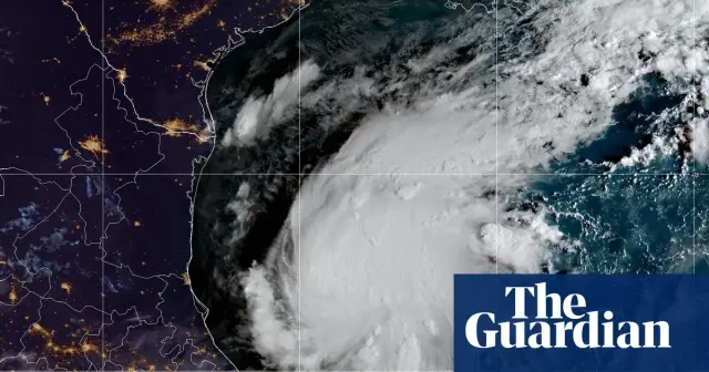
Tropical Storm Isaias intensified into the first hurricane of the 2026 Atlantic season, posing a significant threat to the northern U.S. Gulf Coast. Forecasters expect landfall between late Friday and early Saturday, with potential Category 3 strength, heavy rainfall, and storm surges up to 7 feet. Officials in Florida and Alabama have declared states of emergency, while the storm’s late-season arrival highlights the impact of a strong El Niño on Atlantic activity.
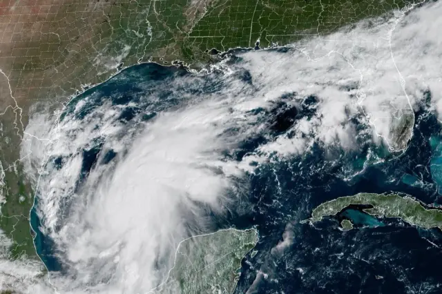
Tropical Storm Isaias formed in the Gulf of Mexico on Wednesday and is forecast to strengthen into a hurricane before making landfall on the U.S. Gulf Coast early Saturday. The National Hurricane Center expects the storm to impact the Mississippi, Alabama, or Florida panhandle, bringing heavy rainfall and coastal flooding. Florida Governor Ron DeSantis declared a state of emergency for 25 counties, while analysts warn that the storm could disrupt approximately 11.2 million barrels of oil production, potentially affecting fuel prices.
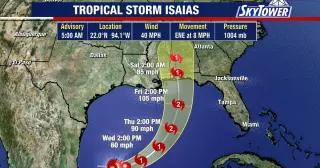
Tropical Storm Isaias has intensified into the first hurricane of the 2026 Atlantic season, with forecasters predicting it will reach Category 2 strength before making landfall on the northern Gulf Coast late Friday or early Saturday. Florida Governor Ron DeSantis has declared a state of emergency for 25 counties in response to the approaching system. The storm is currently moving east-northeast at eight miles per hour, with winds reaching 85 mph and a central pressure of 975 millibars. While wind shear is expected to weaken the system shortly before landfall, officials warn of significant storm surge and tornado risks along the coast from the Florida Panhandle to the Mississippi-Louisiana border. Residents in affected areas are urged to finalize their emergency plans as the hurricane approaches.
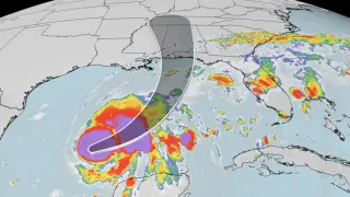
Hurricane Isaias, the 2026 Atlantic season's first hurricane, is forecast to make landfall on the northern Gulf Coast late Friday or early Saturday. The storm is expected to bring dangerous storm surge, heavy rainfall, and strong winds to Mississippi, Alabama, and the Florida Panhandle. State of emergency declarations and mandatory evacuations have been issued in response.
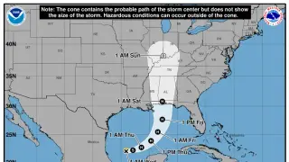
Tropical Storm Isaias has intensified into the first hurricane of the 2026 Atlantic season, with sustained winds reaching 75 mph. The National Hurricane Center forecasts landfall between eastern Louisiana and the western Florida Panhandle late Friday or early Saturday. While the storm may peak as a Category 2, it is expected to weaken to a tropical storm or lower-end hurricane upon landfall due to high wind shear. Residents in 25 Florida counties and 40 Alabama counties are under state of emergency declarations, with mandatory evacuations issued in parts of the Florida Panhandle. Primary hazards include 3 to 10 inches of rain, storm surge of 5 to 7 feet, and potential tornadoes.

Southern California is experiencing an unprecedented October heat wave, with temperatures 15 to 22 degrees above normal. Downtown Los Angeles has recorded four consecutive days above 100 degrees, shattering historical records. The extreme heat, driven by a persistent high-pressure ridge and warm ocean temperatures, is expected to persist through Thursday, with only modest relief by the weekend.
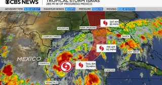
Tropical Storm Isaias intensified into a hurricane late Wednesday, becoming the first hurricane of the 2026 Atlantic season. The National Hurricane Center forecasts it will make landfall along the northern U.S. Gulf Coast between late Friday and early Saturday. A hurricane warning is in effect from Ocean Springs, Mississippi, to the Florida Bay/Gulf county line, with a storm surge warning extending to Yankeetown, Florida. The system is expected to bring 3 to 10 inches of rain to the central Gulf Coast and potentially reach the Ohio Valley by midweek next week.
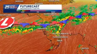
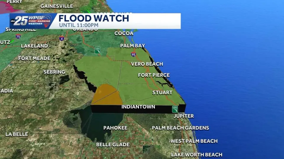
A stalled cold front is keeping South and Central Florida wet through the weekend, with a marginal risk of excessive rainfall and localized flooding. Tropical Storm Isaias has intensified into the first hurricane of the 2026 Atlantic season and is forecast to threaten the state as a Category 2 system. While the front lingers, daily rain chances remain high, with some areas potentially receiving several inches of precipitation. Conditions are expected to dry out early next week.
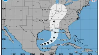
Tropical Depression Nine has intensified into Hurricane Isaias, the first hurricane of the 2026 Atlantic season. The storm is forecast to make landfall along the central Gulf Coast between Louisiana and the Florida Panhandle by Friday, bringing heavy rainfall and potential flooding to the Deep South and Carolinas.
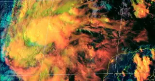
Tropical Depression 9 has intensified into Tropical Storm Isaias and is forecast to become the first hurricane of the 2026 Atlantic season by Thursday. While the system is expected to stay east of Texas, it poses risks of coastal flooding and rip currents for the state. The storm is projected to make landfall along the northern Gulf Coast, with the most severe impacts concentrated in Mississippi, Alabama, and the Florida Panhandle.
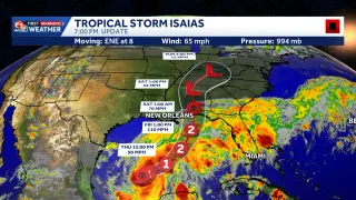
Hurricane Isaias, the first storm of the 2026 Atlantic season, has intensified to Category 1 strength in the Gulf of Mexico. It is forecast to strengthen further and make landfall along the northern Gulf Coast late Friday or early Saturday, bringing hurricane-force winds, significant storm surge, and heavy rainfall to parts of Mississippi, Alabama, and Florida.