
UN General Assembly adopts Equal Earth map, with US as sole dissenter
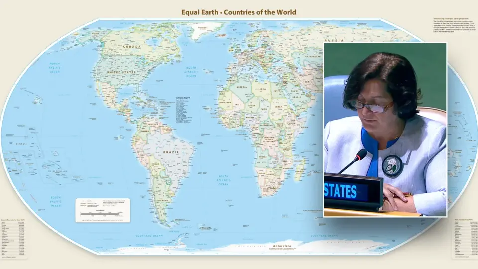
The UN General Assembly voted 164-1 to endorse the Equal Earth map, which accurately depicts Africa's size, with the US as the sole dissenter.
Key points
- The UN General Assembly adopted a resolution to promote the Equal Earth map projection, which accurately represents the relative sizes of continents, including Africa.
- The United States was the only nation to vote against the resolution, with six other countries abstaining.
- The resolution is non-binding but aims to influence the use of maps in UN bodies, schools, and digital platforms.
- The Mercator projection, widely used since the 16th century, distorts the sizes of landmasses near the poles, making Africa appear much smaller than it is.
- The Equal Earth projection, developed in 2018, preserves area but sacrifices the straight lines needed for navigation.
Background
The Mercator projection, created in 1569, has been the standard for navigation and is widely used in digital maps, including Google Maps. However, it distorts the sizes of landmasses near the poles, making Africa appear much smaller than it is. The Equal Earth projection, developed in 2018, aims to correct this by accurately representing the relative sizes of continents. The UN's adoption of the Equal Earth map is a non-binding decision but aims to influence the use of maps in various contexts.
How outlets are covering it
Fox News and the Washington Post both report on the UN's adoption of the Equal Earth map, highlighting the US as the sole dissenter. Fox News emphasizes the US's criticism of the resolution as a 'radical ideological project,' while the Washington Post focuses on the African-led campaign for the map. The BBC provides a broader context, explaining the trade-offs between different map projections, including the Mercator, Equal Earth, and Peters maps. The BBC also notes that the Equal Earth projection sacrifices the straight lines needed for navigation, which the Mercator projection provides. The sources agree on the basic facts but differ in their emphasis, with Fox News and the Washington Post focusing on the political aspects and the BBC on the technical and historical context.
Why it matters
The UN's adoption of the Equal Earth map highlights the ongoing debate about the accuracy and fairness of map projections. The resolution aims to correct the distortions of the Mercator projection, which has been widely used for centuries. The US's dissent and the broader debate reflect the complex interplay between technical, political, and cultural factors in cartography. The resolution may influence the use of maps in various contexts, including education and digital platforms, and could have implications for how different regions are perceived globally.
What to watch
The non-binding resolution may influence the use of maps in UN bodies, schools, and digital platforms. The US's dissent and the broader debate about map projections may continue to shape discussions about cartography and its implications for global perception. The adoption of the Equal Earth map by various institutions and platforms will be a key indicator of the resolution's impact.
- United Nations votes 164-1 for Equal Earth map after US brands it 'radical ideological project' Fox News
- The U.N. backed a map that shows Africa true to size. The U.S. was sole objector. washingtonpost.com
- What different world maps get right - and what they get wrong BBC
- Explanation of Vote Before the Vote for UNGA 80 Adoption on the Resolution to “Correct the Map” United States Mission to the United Nations (.gov)
- The U.N. backs a new world map showing Africa in its true relative size NPR
Want the full story? Read the original reporting
Read on Fox News