Drought-Driven Georgia Wildfires Consume 50,000+ Acres and 120 Homes
TL;DR Summary
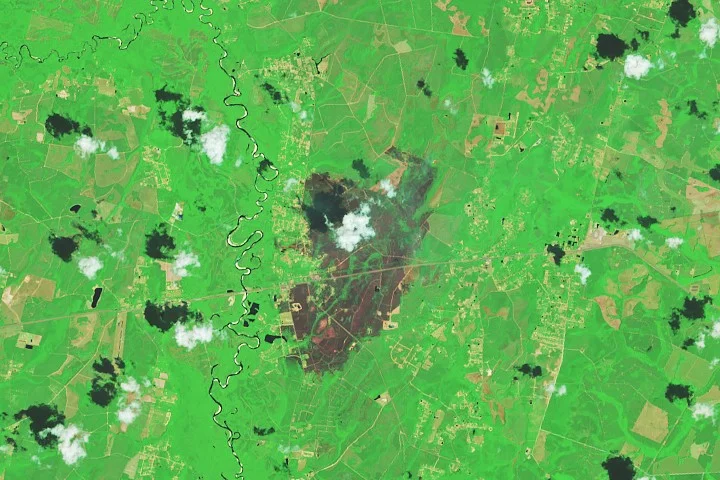
NASA’s Earth Observatory reports two large, human-caused wildfires in southern Georgia—the Pineland Road and Highway 82 fires—driven by months-long drought and strong winds, burning more than 50,000 acres and destroying at least 120 homes as of April 28, 2026. Landsat 8 imagery shows charred landscapes near Atkinson and Fruitland; containment was partial (about 23% for Pineland Road and 32% for Highway 82). Firefighting efforts are ongoing, aided by rains that have slowed the blazes. NASA also provides real-time wildfire monitoring tools (FIRMS, Worldview, Fire Event Explorer) to track activity and trends.
- Fires Rage in Georgia NASA Science (.gov)
- Georgia officials warn wildfires are still a threat as firefighters report progress NBC News
- Pineland Road Fire grows to 32,000 acres, threatens hundreds of structures WALB
- Georgia wildfires come as much of America is ready to burn Axios
- Tuesday’s rain not enough to move the wildfire needle across parts of Georgia WSB-TV
Reading Insights
Total Reads
0
Unique Readers
31
Time Saved
4 min
vs 5 min read
Condensed
89%
815 → 91 words
Want the full story? Read the original article
Read on NASA Science (.gov)