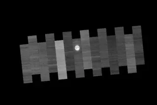
NASA’s Landsat 9 regularly points its sensors at the Moon during the full Moon to detect and correct drift, using the Moon’s stability as a reference to keep decades of Earth observations consistent, a process that runs alongside Artemis’ return to lunar exploration.
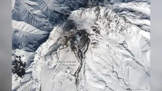
Fresh Landsat 9 imagery shows volcanic heat melting snow on Russia’s active Shiveluch volcano in Kamchatka, revealing a growing lava dome and dark flow channels; the heat from recent activity continues to reshape the snowy slopes and raises the potential for pyroclastic flows as the dome evolves.
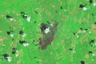
NASA’s Earth Observatory reports two large, human-caused wildfires in southern Georgia—the Pineland Road and Highway 82 fires—driven by months-long drought and strong winds, burning more than 50,000 acres and destroying at least 120 homes as of April 28, 2026. Landsat 8 imagery shows charred landscapes near Atkinson and Fruitland; containment was partial (about 23% for Pineland Road and 32% for Highway 82). Firefighting efforts are ongoing, aided by rains that have slowed the blazes. NASA also provides real-time wildfire monitoring tools (FIRMS, Worldview, Fire Event Explorer) to track activity and trends.
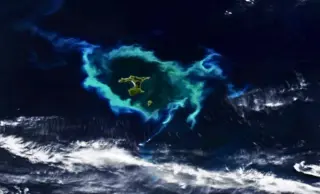
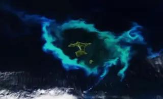
NASA’s Earth Observatory captured a giant turquoise ring off the Chatham Islands in January 2026, a massive coccolithophore phytoplankton bloom shaped by the Chatham Rise seafloor topography and surface currents; satellites (NOAA-20 VIIRS) track such events over wide areas, while no direct water sampling was performed, highlighting how underwater geology fuels surface life and can affect marine ecosystems.
NASA’s NOAA-20 satellite captured a large near-infrared image of a luminous coccolithophore-dominated plankton bloom forming a ring around New Zealand’s Chatham Islands. The bloom, one of the largest in recent decades, highlights the Chatham Rise’s role in fostering surface productivity, while the same underwater plateau is linked to frequent whale strandings in shallow waters, illustrating how ocean features can support life yet pose risks to marine mammals.
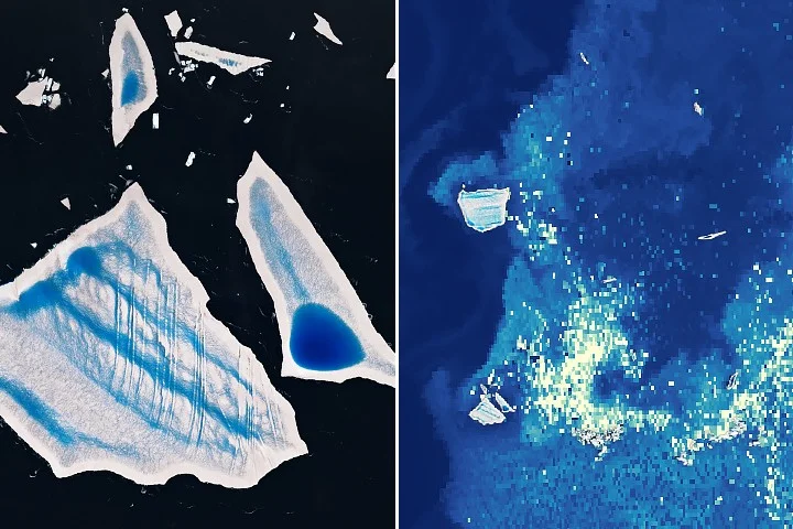
A melting Antarctic iceberg, A-23A, released nutrient-rich meltwater as it drifted into warmer South Atlantic waters, fueling a large phytoplankton bloom detectable by NASA satellites (VIIRS on Suomi NPP and the PACE mission). Scientists say light conditions and nutrients from iceberg melt promote bloom formation, with implications for the marine food web and carbon cycling; the duration and full ecological impact remain under study.
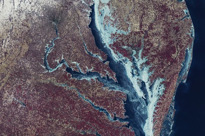
NASA’s Earth Observatory recalls a historic Chesapeake Bay freeze captured by Landsat-1 in February 1977, when ice covered about 85% of the bay with notable thickness, and compares it to the 2025–2026 season’s roughly 38% coverage. The older images showed thick ice and fragmented areas that affected infrastructure and shellfish, while today’s conditions enable rare winter activities like ice boating and continue to challenge watermen and harbor facilities. The piece situates today’s freeze in the context of the region’s long record of extreme cold and ice conditions.
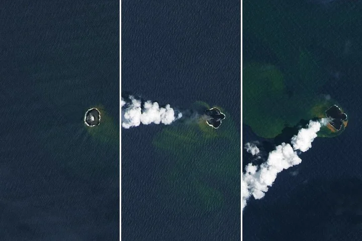
NASA’s Earth Observatory reports that Home Reef, a mid-ocean volcano near Tonga, continued erupting from December 2025 into February 2026, expanding its land area by about 8 hectares as lava flows extended the island; satellite data from Landsat 8/9, MODIS, and VIIRS tracked growth and gas plumes, while authorities say the current activity poses low risk to nearby populations.