
Cold Front Triggers Severe Storms, Tornado Risks for 38 Million in Northeast
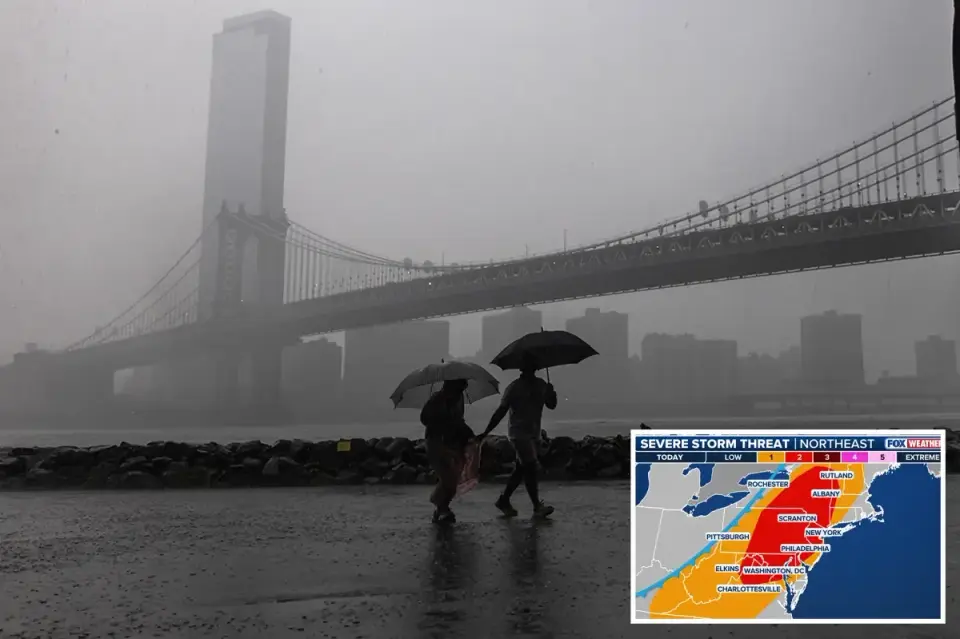
A sweeping cold front is moving through the Northeast on Thursday, August 27, 2026, placing over 38 million Americans under a Level 2 severe weather threat. Major cities including New York, Philadelphia, and Washington, D.C., face risks of supercell thunderstorms, damaging winds, large hail, and isolated tornadoes. Flash flood warnings are in effect for over 25 million people from Philadelphia to New York, with localized rainfall of 1 to 2 inches expected through early Friday. This event marks the seventh tornado risk for the New York metro area this year, a significant increase from last year's single occurrence.
Key points
- More than 38 million people in the Northeast are under a Level 2 out of 5 severe weather threat on Thursday, August 27, 2026.
- New York City, Philadelphia, and Baltimore are included in a Level 1 out of 5 tornado threat, while Washington, D.C., Philadelphia, and Baltimore face a Level 2 severe weather threat.
- Flood watches have been issued for over 25 million Americans from Philadelphia to New York City due to flash flood risks.
- The New York metro area has been placed under tornado risk seven times in 2026, compared to only once in the previous year.
- Philadelphia has already experienced four flash flood warnings in 2026, with three occurring in August, and is currently over 1.5 inches above average rainfall for the month.
Background
This event follows a pattern of severe weather in the Northeast earlier in 2026. In July, a cold front brought damaging winds and flood risks to the Great Lakes and Northeast, affecting the I-95 corridor. Another major severe weather event occurred in late July, placing over 90 million Americans under threat. The current event is part of a series of significant weather disruptions in the region this year.
Why it matters
The severe weather poses significant risks to major population centers, including potential tornadoes, flash floods, and damaging winds. The increased frequency of tornado risks in the New York metro area highlights a changing weather pattern that may require updated emergency preparedness and infrastructure resilience. Flash flood risks in areas already affected by earlier flooding could exacerbate damage and disrupt daily life for millions.
What to watch
Residents in the affected areas should monitor local weather alerts and prepare for potential power outages, travel disruptions, and flooding. Emergency services are likely to be on high alert, and local governments may issue additional warnings or evacuations if conditions worsen. The partial lunar eclipse may be obscured by storm clouds in some areas.
- 38M Americans face possible tornadoes and flooding as NYC, East Coast cities targeted by storms New York Post
- Flash flooding underway in the Northeast amid multiple rounds of storms Yahoo
- Storm and flood warnings for heavy rain, strong storms | Live updates ABC7 Eyewitness News
- Weather blog: Strong storms bring flash flood, hail, tornado threat to NYC area NBC New York
- It’s Raining Again in New York. Here’s What to Know. The New York Times
Want the full story? Read the original reporting
Read on New York Post