
Cascades wildfire risk spikes Saturday with gusty winds and very dry air
TL;DR
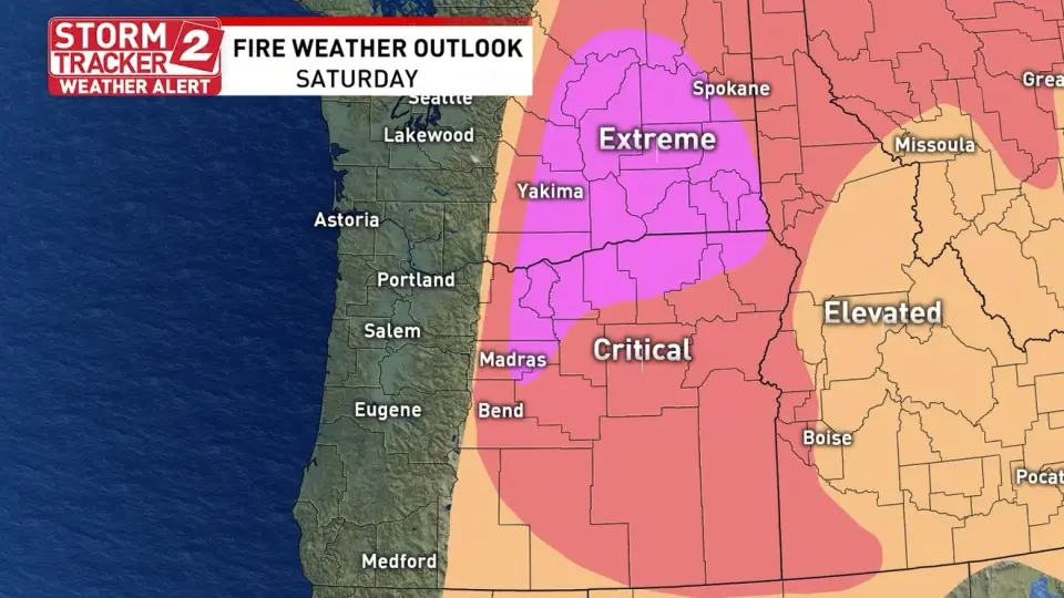
Storm Tracker 2 alerts extreme fire danger east of the Cascades on Saturday as a dry cold front moves through, bringing gusts up to 45 mph and very low humidity with PDS Red Flag Warnings across multiple zones, signaling a high risk of rapid fire growth.
- Extreme fire danger Saturday east of the Cascades as strong winds and low humidity arrive KATU
- NWS Spokane utilizes "Particularly Dangerous Situation" tool for Saturday's elevated fire danger krem.com
- Oregon’s extreme-weather forecast for weekend sparks fears of rapid spread of wildfires OregonLive.com
- Dangerous situation looms for the Northwest as intense winds could spread ongoing and new fires out of control FOX Weather
- Rare extreme ‘explosive’ fire danger alert for Eastern WA. National Guard activated Tri-City Herald
Want the full story? Read the original reporting
Read on KATU