
Early Spring Storm Brings Heavy Snow and Strong Winds to Northern Plains.
TL;DR Summary
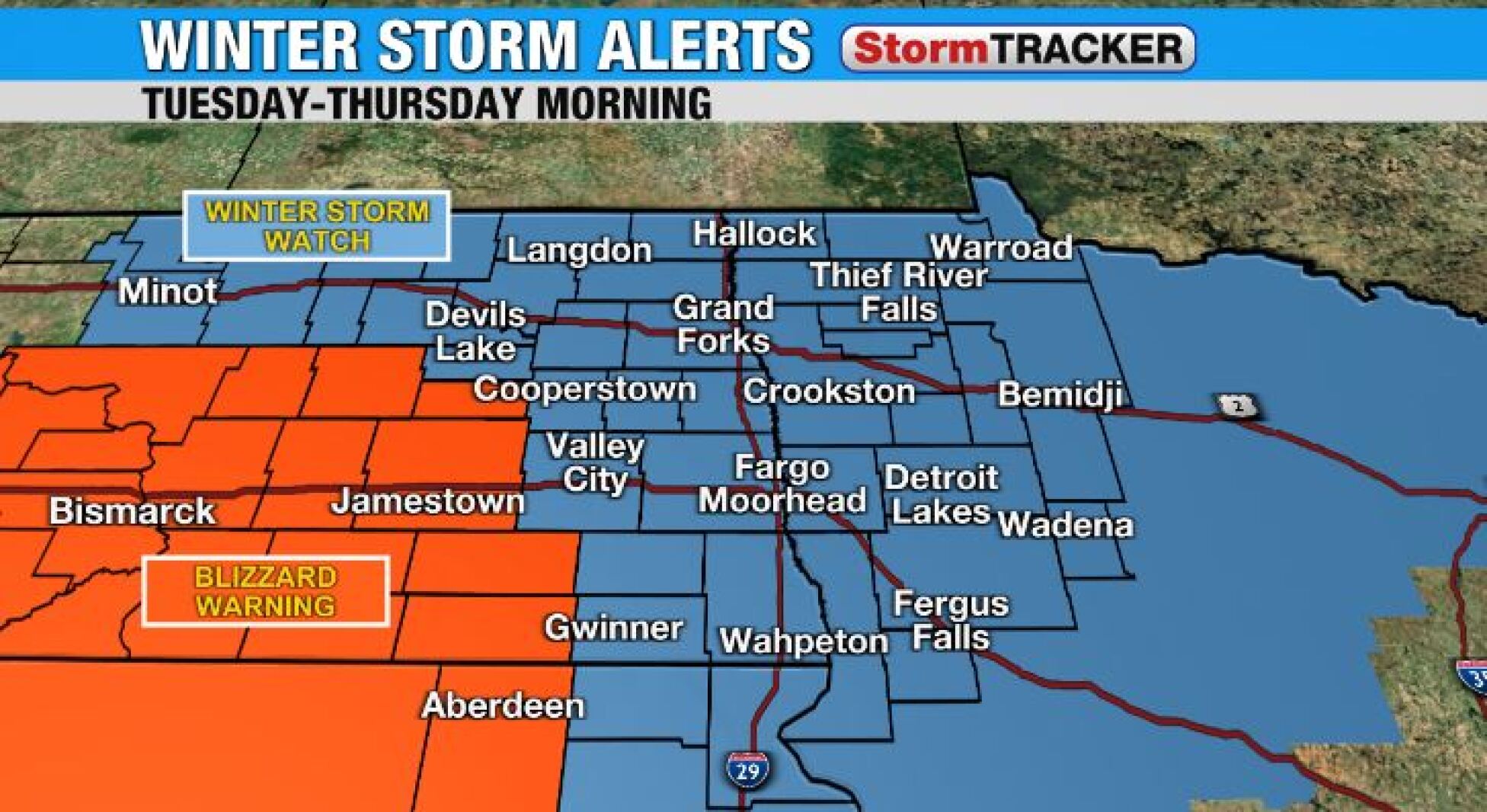
A major snowstorm is expected to hit the central Plains and Midwest region from Tuesday through Thursday, with heavy snow, strong winds, and blizzard conditions likely to cause travel disruptions and impact spring flooding. Counties west of the Red River Valley have been upgraded to a Blizzard Warning, while a Winter Storm Watch remains in effect for Fargo and Grand Forks. The storm may bring more than a foot of snow in some areas, with winds gusting up to 50-55 mph, creating whiteout conditions and making travel impossible. By Friday, the weather is expected to clear up with mostly sunny skies and temperatures near freezing.
- APRIL STORM will bring heavy snow, strong winds starting tomorrow INFORUM
- Blizzard Warnings Issued: Western South Dakota targeted by significant winter storm - KNBN NewsCenter1 Newscenter1.tv
- Major early spring storm ahead; Spring-like Easter KELOLAND.com
- UPDATE: High-impact blizzard expected Tuesday into Wednesday across the Northern Plains KFYR
- "This storm has major potential": Winter Storm Bulletins issued by the National Weather Service for the Black Hills Region - KNBN NewsCenter1 Newscenter1.tv
- View Full Coverage on Google News
Reading Insights
Total Reads
0
Unique Readers
13
Time Saved
4 min
vs 5 min read
Condensed
87%
822 → 105 words
Want the full story? Read the original article
Read on INFORUM