
Isaias Remnants Douse Western North Carolina with Up to 10 Inches of Rain
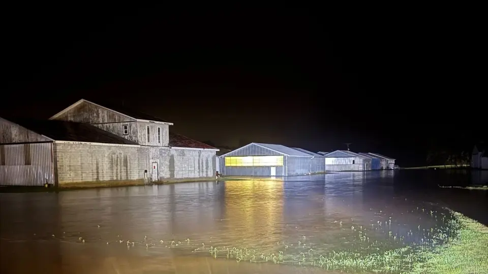
The remnants of Hurricane Isaias have moved through western North Carolina, delivering heavy rainfall that reached up to 10 inches in localized areas. This intense precipitation triggered widespread flooding, dozens of water rescues, and multiple road closures across Burke, Linville, and Lenoir counties. While the storm has transitioned into a post-tropical cyclone and is moving away from the region, officials continue to warn of rising water levels and saturated ground conditions.
Key points
- Rainfall totals in parts of western North Carolina reached 8 to 10 inches, with 4.5 to 7.5 inches recorded in Ashe and Watauga counties.
- Emergency crews conducted dozens of water rescues, including incidents on the Catawba River and near submerged vehicles on N.C. 126.
- Roads in Chesterfield, Lenoir, and Burke counties were closed due to overflowing rivers and impassable water levels.
- The National Weather Service issued flood warnings for the Broad River, with crests forecasted above the 12-foot flood stage.
- Hikers in Linville required rescue after becoming stranded in high water, and a 99-year-old resident was assisted to safety from flash flooding.
Background
This event follows the rapid intensification and landfall of Hurricane Isaias in the Florida Panhandle on October 9, 2026. The storm weakened into a post-tropical cyclone by October 10 but continued to move north through Alabama and Tennessee, bringing strong winds and heavy rain to the Carolinas. Previous coverage noted widespread power outages and the cancellation of weekend events across the region due to the storm's impact.
How outlets are covering it
WLOS highlights the specific rainfall totals, noting that parts of western North Carolina received over 8 inches. WBTV emphasizes the human impact, detailing dozens of water rescues and specific road closures in Burke and Lenoir counties. Local 3 News focuses on the broader regional context, noting that while the Tennessee Valley experienced wind gusts exceeding 60 mph, the heaviest rainfall and flooding concerns were concentrated in the mountains of western North Carolina. All sources agree that the storm's remnants caused significant disruption, though they differ in their emphasis on rainfall versus wind impacts.
Why it matters
The heavy rainfall from Isaias's remnants has caused significant flooding and emergency responses in western North Carolina, highlighting the ongoing risks posed by post-tropical cyclones. The incident underscores the importance of preparedness for severe weather events and the need for robust emergency response systems in areas prone to flooding.
What to watch
Officials are urging residents to avoid flooded areas, including parks, creek banks, and low-water crossings, and to keep access routes clear for emergency responders. The National Weather Service continues to monitor the Broad River for potential crests above flood stage. Residents are advised to monitor official weather alerts and report power outages to their electric providers.
- Rainfall totals are in from Isaias: Parts of western North Carolina get over 8 inches WLOS
- Hurricane Isaias leaves trail of destruction in Southeast: "Never expected to be 77 years old and go through this" CBS News
- Deputies shoot, kill 79-year-old after he allegedly pulls gun during mental health call WPEC
- Isaias brings flooding, rescues and road closures to western North Carolina: Photos here WBTV
- HURRICANE ISAIAS RECAP: A look back at the impacts Local 3 News
Want the full story? Read the original reporting
Read on WLOS