
Stalled Front and Isaias Moisture Drive Flooding Risks Across Florida
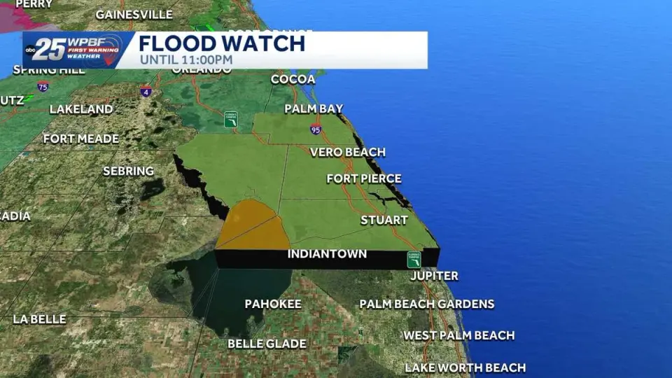
A stalled frontal boundary and tropical moisture from Hurricane Isaias are causing widespread rain and flooding risks across Florida. South and Central Florida face heavy downpours and flood watches, while the Gulf Coast expects additional localized flooding. Conditions are forecast to dry out by early next week as high pressure returns.
Key points
- South Florida faces 2-7 inches of rain with a flood watch for Indian River, Okeechobee, St. Lucie, and Martin counties until 11 p.m. on Thursday.
- Central Florida experienced up to 3 inches of rain on Wednesday with a 90% chance of precipitation, though conditions are expected to improve as Isaias moves north.
- The Gulf Coast is designated an 'Impact Day' for Thursday due to additional flooding risks from a stalled front, with high pressure returning Friday to shift winds to an easterly direction.
- Hurricane Isaias has intensified to a Category 3 storm, expected to make landfall near the Florida Panhandle by Friday night, but no major direct impacts are forecast for Southwest Florida.
- Rain chances are expected to decrease significantly by Sunday and Monday, with a mainly dry pattern returning for the workweek.
Background
Florida has experienced persistent wet weather since late September, following the remnants of Tropical Storm Dolly which brought 2-3 inches of rain to the region. A large Saharan dust plume also affected air quality in September, but the current instability is driven by a stalled front and tropical moisture.
How outlets are covering it
WPBF emphasizes the immediate flood watch in South Florida, citing 2-4 inches of rain with isolated amounts up to 7 inches. WFTV highlights the recent saturation in Central Florida, noting a 90% rain chance on Wednesday but predicting a drier trend by Monday. WINK and Gulf Coast News focus on the broader regional impact, noting that while Isaias is a major hurricane, Southwest Florida will only see rough seas and breezy conditions, with the stalled front losing influence on Friday. All sources agree that high pressure returning Friday will shift the pattern to isolated afternoon storms before drying out completely by the start of the workweek.
Why it matters
The combination of saturated ground from recent storms and new rainfall from a stalled front and Isaias moisture creates significant flash flood risks. Residents in South, Central, and Gulf Coast Florida must remain vigilant for localized flooding, while coastal areas should prepare for elevated rip current risks and rough seas associated with the nearby hurricane.
What to watch
Friday will bring slightly drier conditions with scattered afternoon storms, particularly west of Interstate 75. Saturday will see more scattered rain due to Isaias moisture, but Sunday is forecast to dry out with only 30% coverage. The workweek is expected to be mainly dry as high pressure stabilizes the region.
- Stalled front keeps rain and storms in South Florida through week WPBF
- LIVE RADAR: Downpours moving through Tampa Bay WFLA
- Rain chances rise as a front stalls nearby WINK News
- Parts of Central Florida could see up to 3 inches of rain on Wednesday WFTV
- Impact Day: Rounds of rain, storms Wednesday Gulf Coast News and Weather
Want the full story? Read the original reporting
Read on WPBF