
3D Imagery Traces Nepal Glacier Collapse to Gyirong Mudslide's Rapid Descent
TL;DR Summary
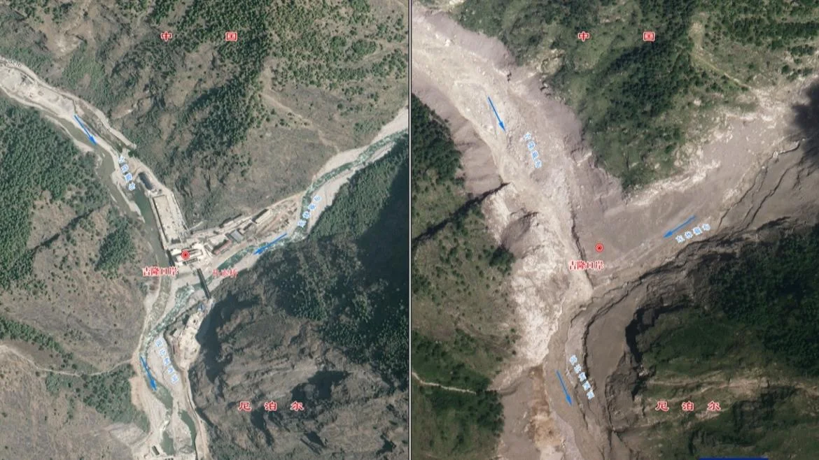
China’s Ministry of Natural Resources released 3D before-and-after imagery showing the Gyirong Port mudslide. The disaster began with a Nepal glacier collapse at about 5,140 meters, sending ice and debris into the Cuoqian River, then into the Guobaxiaqu and Donglin Tsangpo rivers. The debris flow accelerated down roughly 20 km, reaching Gyirong Port in about seven minutes at an average speed near 50 m/s, with part of the flow briefly moving upstream. The event caused extensive damage to roads, bridges and buildings, hindering rescue efforts and necessitating drone surveys and expert terrain assessments to search for secondary hazards.
Topics:world#china-nepal-border#geology#infrastructure-damage#natural-disaster#remote-sensing#science
- How do newly released 3D images explain the Gyirong mudslide? CCTV.com English
- China Says 261 Foreigners From 23 Countries Are Missing in Tibet Flood The New York Times
- Risk of lake burst near China-Nepal disaster site wanes Reuters
- China-Nepal floods: police officer filmed guiding people away from border post South China Morning Post
- FOCUS | Rescue efforts ongoing with over 2,000 rescuers deployed at mudslide-hit area in Xizang Xinhua
Reading Insights
Total Reads
1
Unique Readers
9
Time Saved
3 min
vs 4 min read
Condensed
85%
652 → 98 words
Want the full story? Read the original article
Read on CCTV.com English