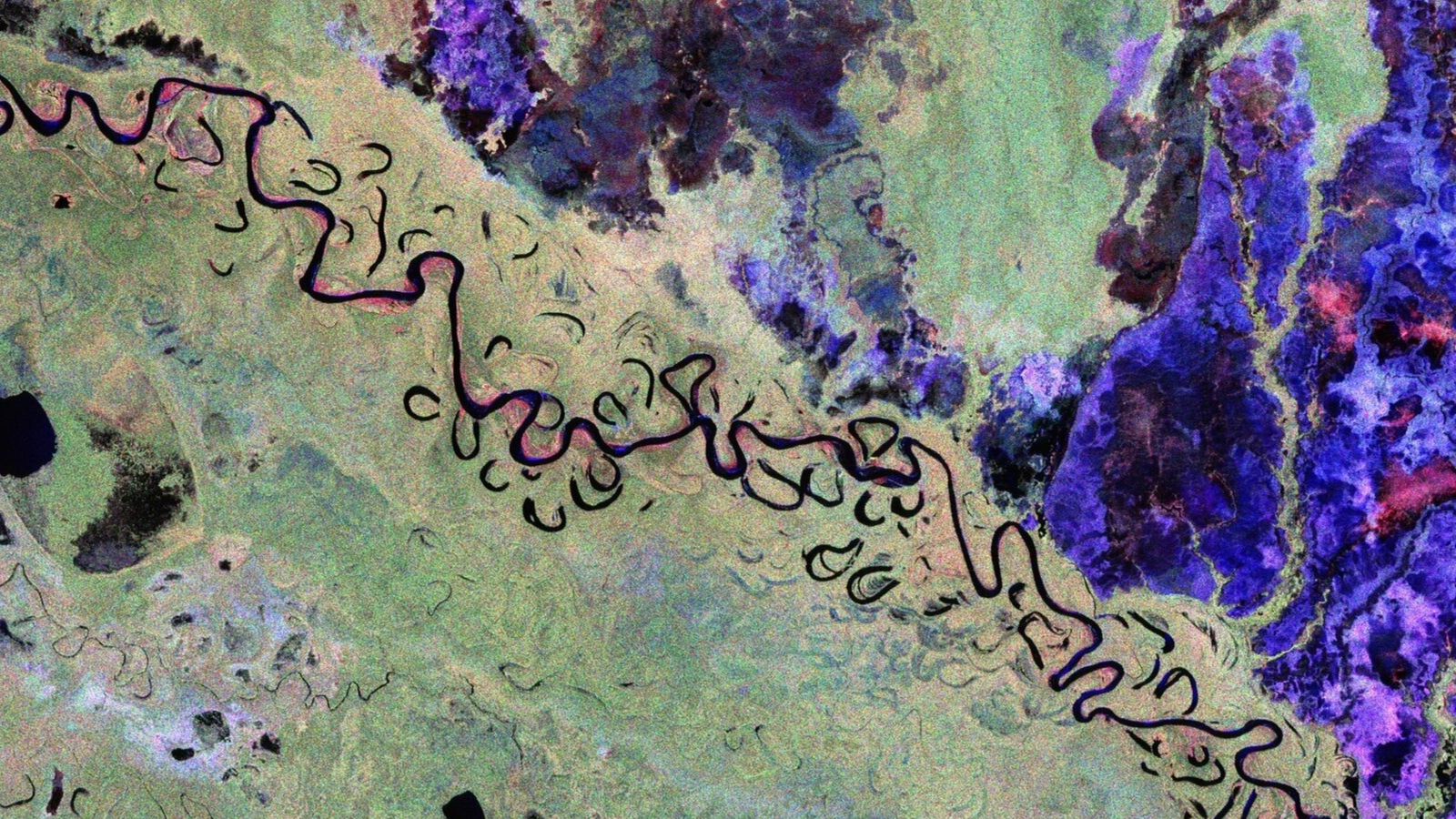
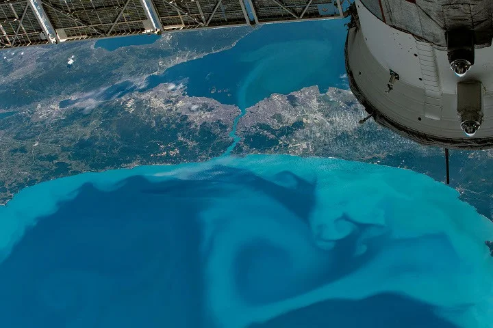
Tag

Remote Sensing

All articles tagged with #remote sensing

Global Night Lights Pulse: Rapid Brightening and Dimming Across the Planet (2014–2022)
science2 days ago

Global Night Lights Pulse: Rapid Brightening and Dimming Across the Planet (2014–2022)

A global analysis using daily NASA Black Marble night-time lights and continuous change detection (2014–2022) shows that artificial illumination is highly volatile, with locations undergoing multiple abrupt or gradual changes. The study finds 2.05 million km2 of abrupt ALAN changes and 19.04 million km2 of gradual changes, totaling far more area affected by changes than previously thought. Net radiance rose about 16% since 2014, driven by brightening (34% of the 2014 baseline) that outpaced dimming (−18%). Regions experience both directions of change, driven by factors such as urban expansion, rural electrification, gas-flaring reductions, and energy access disruptions. Asia (notably China and India) accounts for the largest cumulative change, Europe shows pronounced dimming linked to regulations, and some regions (e.g., Venezuela) dim due to economic collapse. The work challenges the view that night-time lights only steadily intensify and highlights the need to consider bidirectional, high-frequency dynamics for policy, energy transitions, and ecological implications. Open datasets and code accompany the work for global ALAN change mapping and analysis.

Cloud-Piercing NISAR Radar Maps Pacific Northwest
science13 days ago

Cloud-Piercing NISAR Radar Maps Pacific Northwest

NASA-ISRO’s NISAR satellite captured cloud-covered imagery of the Pacific Northwest on Nov. 10, 2025 using L-band radar to see through clouds, highlighting Seattle, Portland, Mount Rainier, and Mount Saint Helens. With dual SAR instruments and a large 39-foot antenna, NISAR revisits areas roughly every 12 days to monitor changes in forests, wetlands, urban areas, and infrastructure, and to detect subtle ground movements associated with natural hazards such as volcanoes, earthquakes, landslides, and floods. The data aid resource management, hazard monitoring, and environmental decision‑making.

"Exploring Martian Mysteries: Dragon Scale Rocks and Sharp Discoveries"
space-exploration2 years ago

"Exploring Martian Mysteries: Dragon Scale Rocks and Sharp Discoveries"

NASA's Curiosity rover completed a fully loaded first sol, conducting a drill to expose a fresh surface on a bedrock target, followed by remote sensing activities including ChemCam LIBS and long distance RMI mosaics to assess the stratigraphy at Gediz Vallis ridge and the distant butte Kukenan. The plan also includes monitoring of rover deck movement, search for dust devils, and atmospheric dust. The second sol involves untargeted activities and post-drive imaging in preparation for the next plan, as the rover continues to make progress along the margin of upper Gediz Vallis ridge on Mars.

"Advanced Mapping Technology Locates Microscopic Intruders"
science-and-technology2 years ago

"Advanced Mapping Technology Locates Microscopic Intruders"

Scientists are using lidar technology, traditionally used for archaeological sites, to identify tiny ants in Kenya's acacia trees with over 80% accuracy, significantly reducing the time and effort required for field surveys. This efficient technology has the potential to track tree pests and invasive species, offering a faster and more cost-effective method for biodiversity sampling and conservation efforts.

"Global Mining's Hidden Impact: Half of Sites Lack Documentation"
environment-and-energy2 years ago

"Global Mining's Hidden Impact: Half of Sites Lack Documentation"

A significant portion of the world's mining activities, including their environmental and community impacts, remains undocumented due to data gaps and lack of comprehensive inventories. Researchers face challenges in assessing the sector's global impact due to incomplete databases, such as the S&P Capital IQ Pro, and the prevalence of illegal operations. The article advocates for improved data collection and sharing, transparency, and the use of remote sensing and AI to fill information gaps. This is crucial as the demand for minerals, especially for clean technologies, is expected to increase, necessitating better data to assess future impacts and risks.

China's Milestone: Classified Optical Satellite Launched to Geostationary Orbit
space2 years ago

China's Milestone: Classified Optical Satellite Launched to Geostationary Orbit

China successfully launched the classified Yaogan-41 optical satellite into geostationary orbit using its largest launch vehicle, the Long March 5. While the satellite's purpose was described as optical remote sensing for land survey, crop yield estimation, and environmental management, outside observers believe it has military applications. If positioned in geostationary orbit, Yaogan-41 will provide continuous observation of one-third of the Earth's surface, aiding in security, meteorology, climate studies, and environmental monitoring. The launch adds to China's growing on-orbit remote sensing capabilities and follows the recent launch of an experimental reusable spacecraft.

Cicadas' Droning Din Detected by Fiber Optic Cables
science-and-technology2 years ago

Cicadas' Droning Din Detected by Fiber Optic Cables

Fiber optic cables equipped with distributed acoustic sensing (DAS) technology have inadvertently picked up the loud sounds of cicadas, offering entomologists a new way to remotely monitor insect populations. DAS, which can track seismic activity, uses fiber optic cables to analyze light disturbances caused by vibrations. The researchers in Princeton noticed a distinct buzzing frequency in the DAS data, which they suspected was the sound of the emerging Brood X cicadas. By monitoring the volume of cicada noise, entomologists can estimate population sizes and study the effects of temperature on their mating behavior. This technology could complement other monitoring techniques and provide valuable data on insect populations, especially in remote areas.

"Hidden Ancient Landscape Unearthed in Antarctica"
science-and-environment2 years ago

"Hidden Ancient Landscape Unearthed in Antarctica"

Scientists have discovered an ancient river landscape buried beneath over a mile of ice in Antarctica, providing insights into a long-lost world shaped by rivers and vegetation. The discovery, made using satellite observations, suggests the presence of other undiscovered ancient landscapes beneath the East Antarctic Ice Sheet. The findings could help scientists predict how the continent might respond to human-driven climate change. The study reveals a landscape older than 34 million years, when Antarctica was warmer and supported vegetation, before becoming mostly glaciated. Researchers aim to extract more details about the terrain to reconstruct the evolution of the ice sheet and understand its sensitivity to climate change.

"Hidden Ancient Landscape Unearthed in Antarctica"
science-and-environment2 years ago

"Hidden Ancient Landscape Unearthed in Antarctica"

Scientists have discovered an ancient river landscape buried beneath over a mile of ice in Antarctica, providing insights into a long-lost world shaped by rivers and vegetation. The discovery, made using satellite observations, suggests the presence of other undiscovered ancient landscapes beneath the East Antarctic Ice Sheet. By studying the terrain, researchers hope to understand the evolution of the ice sheet and its potential response to human-driven climate change. The findings highlight the significance of Antarctica's past and its relevance to predicting future climate scenarios.

"Hidden Ancient Landscape Unearthed in Antarctica"
science-and-environment2 years ago

"Hidden Ancient Landscape Unearthed in Antarctica"

Scientists have discovered an ancient river landscape buried beneath over a mile of ice in Antarctica, providing insights into a long-lost world shaped by rivers and vegetation. The discovery, made using satellite observations, suggests the presence of other undiscovered ancient landscapes beneath the East Antarctic Ice Sheet. By studying the terrain, researchers hope to understand the evolution of the ice sheet and its potential response to human-driven climate change. The findings highlight the significance of Antarctica's past and its relevance to predicting future climate scenarios.