
Super El Niño Surges Toward Record Strength, Forecast Signals Fall-Winter Shifts
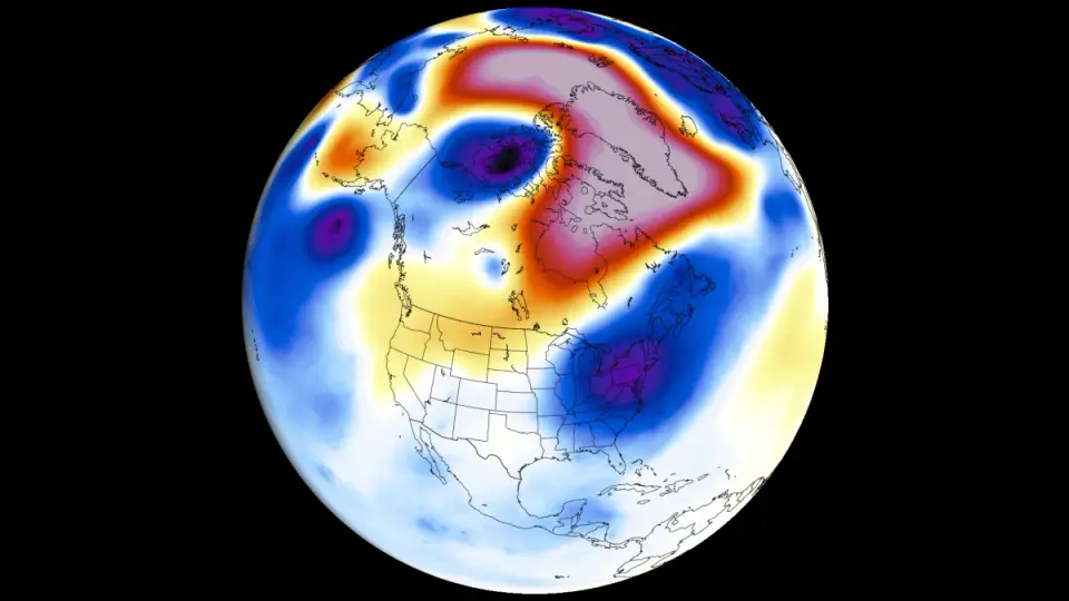
A Super El Niño is rapidly strengthening toward a near-record peak for 2026–27, with August–early fall signals showing a locked atmospheric standing wave that will reshape fall and winter patterns. In North America, expect warmer conditions across the central U.S. and Canada, wetter conditions in the eastern U.S. and parts of Canada, and a stronger Pacific jet that boosts rainfall and storm potential in the south; winter could feature a split-flow pattern with storms concentrated from the Central/Southern Plains to the Mid-Atlantic and cooler air intruding into the South, reducing northern snowfall. Europe may see warmer central/western regions with more autumn rainfall. Forecasters will provide weekly updates as the event evolves.
- Super El Niño Drives an August Weather Shift as Fall and Winter Signals Strengthen Severe Weather Europe
- The Strongest El Niño in History Is Coming. Get Ready. The American Prospect
- Record-breaking El Niño could gut California’s crab and salmon fleets Los Angeles Times
- How two wars and El Nino could fuel world hunger DW.com
- San Francisco isn’t ready for this year’s El Niño San Francisco Chronicle
Want the full story? Read the original reporting
Read on Severe Weather Europe