Satellite imagery lays bare toll of Iran war across Gulf and UAE
TL;DR Summary
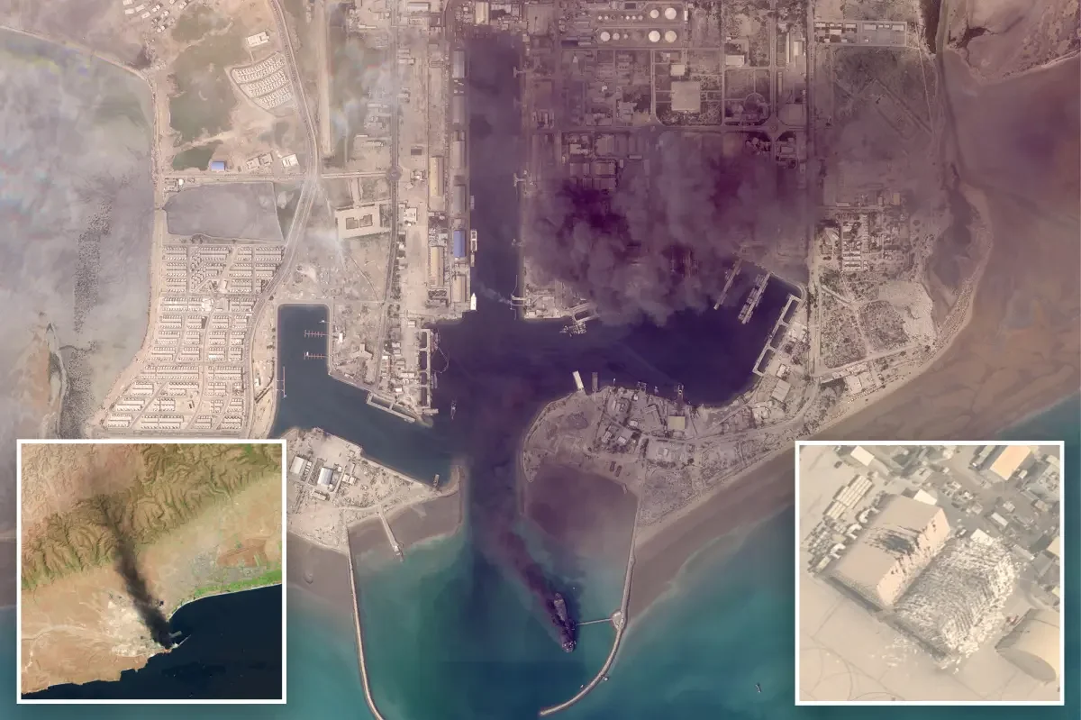
Satellite images from Planet Labs and the USGS show fires on ships in Bandar Abbas and damage at Abu Dhabi’s Al Dhafra base and a French naval facility, plus a fire at Dubai International Airport, illustrating the growing destruction in the Iran war. The imagery, released with a two‑week delay for security reasons, comes as the US and Israel strike Iranian targets and Iran retaliates with drones and missiles.
- Satellite images begin to show damage wrought by Iran war New York Post
- Open-source intelligence shuts down The Economist
- Satellite companies curb access to Mideast imagery over concern it could be used "by adversarial actors" CBS News
- Satellite images show scope of Iran strikes Reuters
- Map: Sites Damaged by Attacks in Iran WSJ
Reading Insights
Total Reads
0
Unique Readers
14
Time Saved
25 min
vs 26 min read
Condensed
99%
5,127 → 69 words
Want the full story? Read the original article
Read on New York Post