
California Declares Emergency as Record-Breaking El Niño Drives Planetary-Scale Kelvin Wave Toward Coast
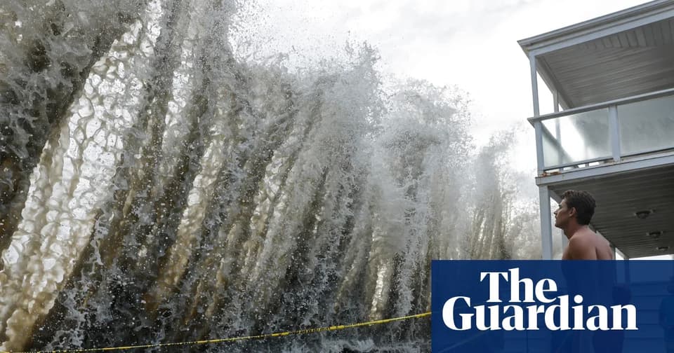
A massive, slow-moving Kelvin wave is approaching California's coast, potentially raising sea levels by up to 12 inches. This surge, driven by a historically intense El Niño, threatens to exacerbate winter storm surges and flooding. Governor Gavin Newsom has declared a state of emergency, mobilizing resources and urging residents to prepare for elevated tides and coastal erosion.
Key points
- A Kelvin wave, triggered by weakening trade winds during El Niño, is moving from the western Pacific toward the U.S. West Coast.
- The wave is expected to raise sea levels along California's coast by 6 to 12 inches, with effects lasting through the winter and into early 2027.
- This year's El Niño is forecast to be the most intense in at least 1,000 years, compounding risks from already rising global sea levels.
- Governor Gavin Newsom declared a state of emergency, staging road-closure equipment and National Guard resources for potential coastal disasters.
- The California Coastal Commission warned that storms coinciding with high tides pose the greatest risk for property damage and erosion.
Background
Previous coverage in September 2026 indicated the Kelvin wave would arrive in Southern California by early October, with earlier estimates suggesting a 4-8 inch rise. Recent storms and Hurricane Marie have already tested coastal defenses, highlighting the vulnerability of the region to compounding weather events.
How outlets are covering it
The Guardian and ABC7 Los Angeles agree on the mechanism and timing of the Kelvin wave but differ slightly on the magnitude of the sea level rise. The Guardian cites NOAA scientist Nate Mantua, stating the wave could raise levels by up to a foot (12 inches), while ABC7 meteorologist Dallas Raines estimates a 6 to 10-inch increase. Both outlets emphasize that the wave is not a tsunami but a slow, planetary-scale shift in water volume. The Guardian highlights the unprecedented intensity of the current El Niño, noting it has already surpassed historical temperature records, whereas ABC7 focuses on the practical implications for Southern California residents. Outlook Newspapers, while primarily a local publication, reinforces the concern through editorials on baseline sea level increases, aligning with the scientific consensus on long-term coastal risks.
Why it matters
The convergence of a record-breaking El Niño and a Kelvin wave creates a 'perfect storm' for coastal infrastructure. Elevated baseline sea levels mean that typical winter storms and high tides will reach further inland, increasing the likelihood of flooding, erosion, and damage to homes and roads. The state's preemptive emergency declaration signals a shift from reactive to proactive disaster management, aiming to mitigate economic and human costs before the peak of the storm season.
What to watch
The Kelvin wave is expected to reach California's coast within days, with the full impact of elevated sea levels persisting through the winter. Residents are advised to inspect flood-vulnerable areas and improve drainage. Meteorologists will monitor the interaction between the wave, El Niño-driven storms, and high tides, particularly around Thanksgiving and Christmas, to issue specific warnings for coastal flooding and erosion.
- Concern mounts over slow-moving, planetary-scale ‘Kelvin’ wave heading for California The Guardian
- Kelvin wave heads toward the West Coast WUSA9
- What is a Kelvin wave? ABC7 meteorologist Dallas Raines explains feature of El Niño headed to SoCal ABC7 Los Angeles
- The El Niño Peril No One Is Talking About L.A. Material
- Letter to the Editor: El Niño to Increase Baseline Sea Levels Outlook Newspapers
Want the full story? Read the original reporting
Read on The Guardian