
Devastating Tornadoes Ravage Mississippi, Leaving Destruction in Their Wake
TL;DR Summary
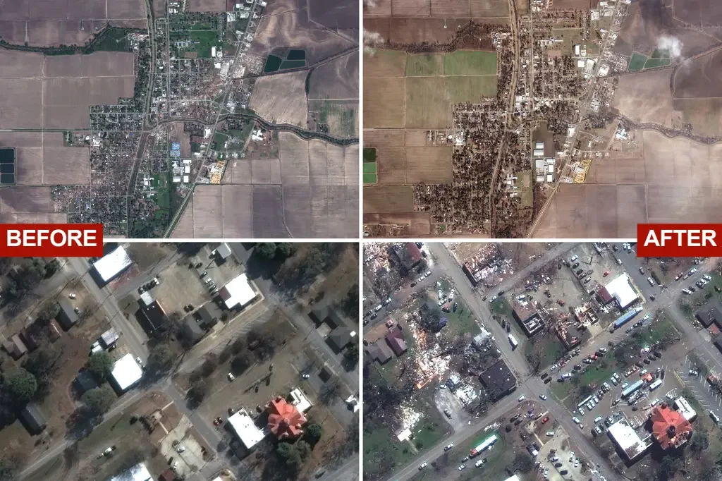
Satellite images released by Maxar Technologies show the scale of devastation in Rolling Fork, Mississippi, after a deadly tornado ripped through the town, killing at least 26 people and injuring dozens more. The tornado, preliminarily rated as an EF-4, uprooted trees, flattened houses, and scattered mobile homes. The storm obliterated entire neighborhoods, including the Rolling Fork Visitors Center & Museum and Rolling Fork Elementary School. President Biden issued an emergency declaration for Mississippi, making federal funding available to the hardest-hit areas in Carroll, Humphreys, Monroe, and Sharkey counties.
Topics:nation#devastation#emergency-declaration#mississippi#natural-disaster#satellite-images#tornado
- Striking satellite images show Mississippi town before and after deadly tornado New York Post
- Deadly Tornadoes Leave Trail Of Damage Across South The Weather Channel
- Mississippi rescuers search for survivors of deadly EF-4 tornado Eyewitness News ABC7NY
- School surveillance cameras capture moment tornado struck in Amory WAPT Jackson
- Opinion: Biden helped the people of Mississippi. As usual, Trump helped himself CNN
Reading Insights
Total Reads
0
Unique Readers
8
Time Saved
3 min
vs 4 min read
Condensed
86%
632 → 88 words
Want the full story? Read the original article
Read on New York Post