
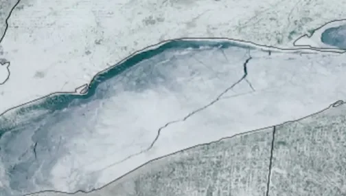
Satellites Capture 80-Mile Ice Crack Across Lake Erie
TL;DR
NOAA satellite captured an 80-mile-long crack in the ice covering Lake Erie, stretching from Port Burwell, Ontario, to near Cleveland, as the lake remains about 95.4% ice-covered, showing how moving water and winds keep shaping the frozen lake even at near-maximum freeze.
- Watch massive 80-mile crack form in ice on Lake Erie The Detroit News
- Lake Superior more than half frozen. How much ice is on Great Lakes Detroit Free Press
- See it from space! Massive crack on Lake Erie’s ice FOX 8 News
- Experts warn of climate change impact on Great Lakes fish populations by 2030s WPBN
- Large ice crack on Lake Erie seen from space 10TV
Want the full story? Read the original reporting
Read on The Detroit News