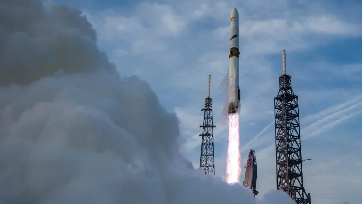
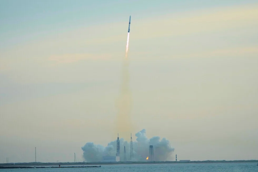
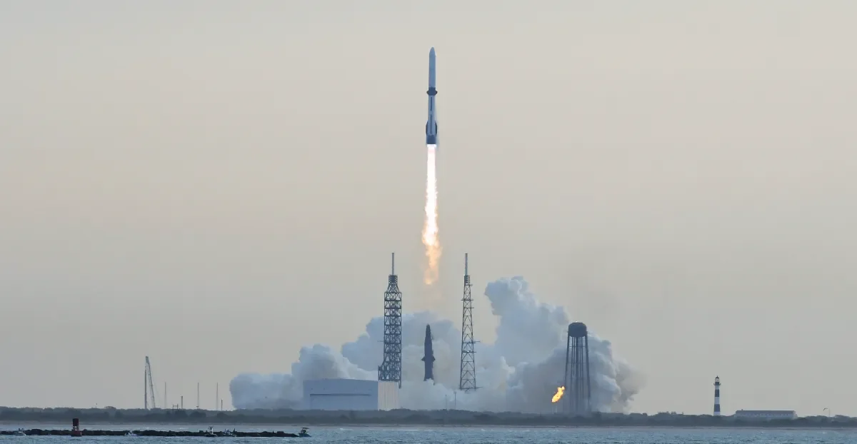
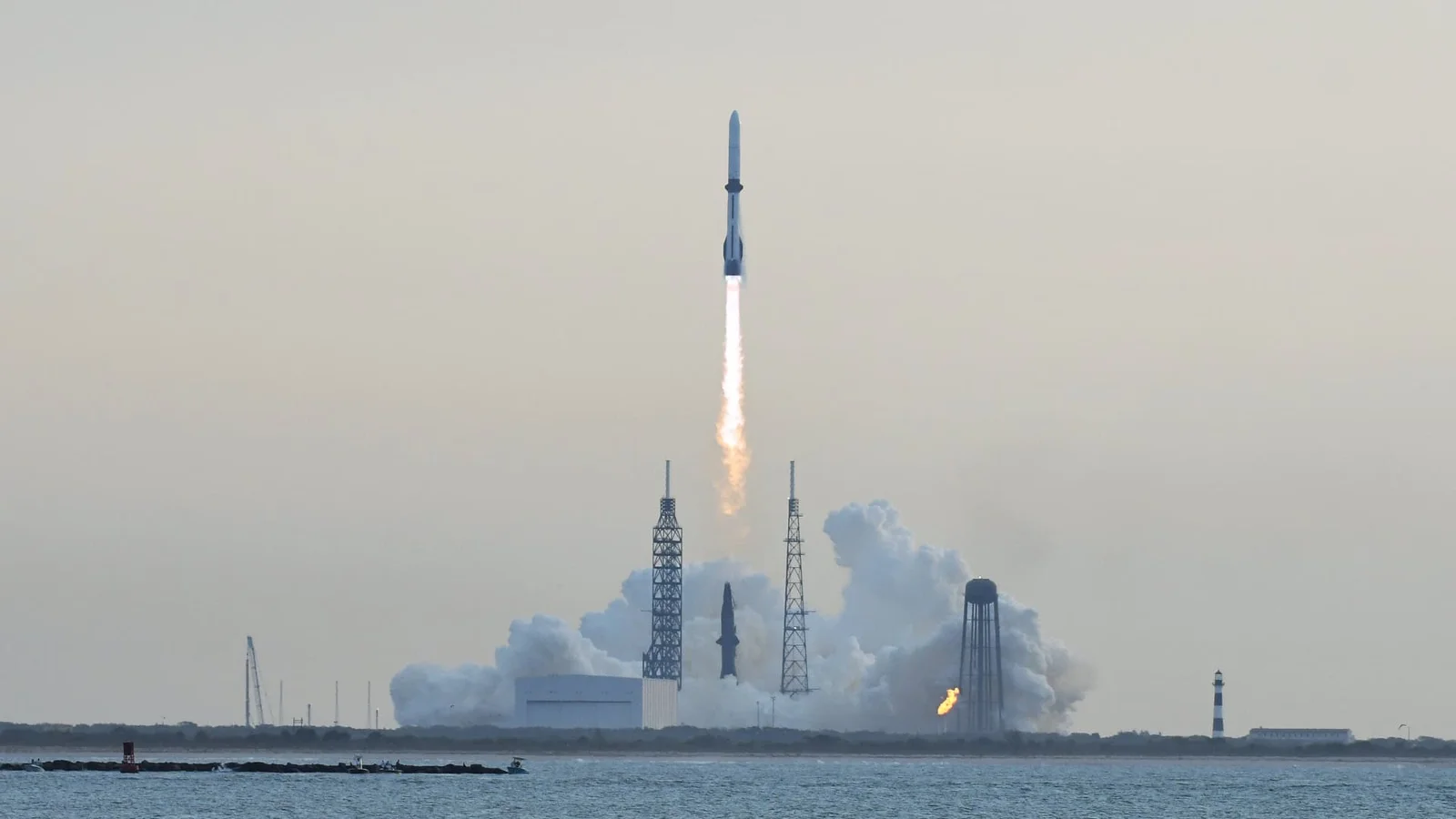
Tag

Satellite

All articles tagged with #satellite

NASA’s SWOT Satellite Maps the Ocean Floor From Space
science17 days ago

NASA’s SWOT Satellite Maps the Ocean Floor From Space

NASA and CNES’s SWOT satellite uses gravity-driven sea-surface height data to map the seafloor, enabling detection of smaller features like seamounts and abyssal hills and potentially expanding the catalog from about 44,000 to up to 100,000. The effort aims to map the entire ocean floor by 2030, complementing ship-based sonar with near-global coverage every 21 days.

Galaxy Phones Gain Direct Satellite Access With App Support
technology28 days ago

Galaxy Phones Gain Direct Satellite Access With App Support

Samsung has published a list of satellite-ready apps that can work on Galaxy devices even without cellular coverage, enabled through carrier partnerships in Europe, Japan, and North America. Galaxy S22+ and newer models generally support direct satellite connectivity (with some markets also supporting select Galaxy A series), and service varies by country. Current satellite-ready apps include Find My Mobile, Google Maps, Google Play Services, WhatsApp, Samsung Account, Samsung Health, Weather, and X (Twitter), among others.

NASA's Van Allen Probe A Crashes in Uncontrolled Reentry Over the Pacific
space1 month ago

NASA's Van Allen Probe A Crashes in Uncontrolled Reentry Over the Pacific

An aging NASA satellite, Van Allen Probe A, reentered Earth’s atmosphere in an uncontrolled event over the Pacific after fuel depletion; most of the 600-kg spacecraft is expected to burn up, with NASA estimating a 1-in-4,200 chance of bodily harm on the ground. Its twin, Van Allen Probe B, remains in orbit and is not expected to reenter before 2030. Launched in 2012 to study the Van Allen radiation belts, the probes ceased operation after fuel ran out in 2019.

Earth’s moving green center points northeast as vegetation responds to climate and CO2
environment1 month ago

Earth’s moving green center points northeast as vegetation responds to climate and CO2

Decades of satellite observations show Earth's vegetation forms a moving balance point across continents and seasons, with the global center of greenery migrating northeast as climate change and higher CO2 reshape growing conditions. The shift is dominated by Northern Hemisphere vegetation, has accelerated since 2010, and is linked to longer growing seasons and land management in reliable water regions, while drought and heat can still slow growth. Researchers suggest tracking this moving center could help explain planetary vegetation patterns and improve climate and land-use models.

Iran's Taftan Volcano Uplifts, Hinting at Wake-Up After 700,000 Years
environment1 month ago

Iran's Taftan Volcano Uplifts, Hinting at Wake-Up After 700,000 Years

Satellite data show the Taftan volcano in southeastern Iran rising about 9 cm (3.5 inches) over 10 months, signaling pressure building in a shallow hydrothermal system near the summit rather than a magma-driven eruption. Researchers say the uplift, detected by InSAR from Sentinel-1, warrants ongoing monitoring (gas emissions, seismometers, GPS) and hazard planning, since phreatic blasts could occur even without lava flows.

Biomass satellites frees its data stream to illuminate global forest carbon
science2 months ago

Biomass satellites frees its data stream to illuminate global forest carbon

ESA’s Biomass, a P-band radar satellite launched in 2025, has completed commissioning and now offers free, public access to its data to map forest structure and carbon storage. The mission begins with an 18-month global tomographic coverage, followed by multiple nine-month interferometric coverages to monitor forest change over time, with an airborne calibration campaign in Gabon aiding data validation and calibration. The effort aims to reduce uncertainties in global forest carbon stocks and support climate science and forest management.

T-Mobile Turns On Free Starlink Texting For Storm-Affected Areas
technology2 months ago

T-Mobile Turns On Free Starlink Texting For Storm-Affected Areas

As Winter Storm Fern looms, T-Mobile activated free Starlink satellite text messaging for customers in potentially impacted areas with compatible phones, enabling basic texting and Wireless Emergency Alerts when cell towers fail; existing T-Satellite customers keep service, and the provider suggests the feature is text-only to avoid network strain.

Antarctica's Hidden Subglacial Landscape Unveiled from Space
science2 months ago

Antarctica's Hidden Subglacial Landscape Unveiled from Space

A new ultra-high-resolution map of Antarctica’s bedrock beneath the ice combines satellite data and glacial-flow models to reveal a surprisingly varied subglacial landscape—from alpine valleys to eroded ice-stream troughs. Published in Science by Helen Ockenden and colleagues, the map refines projections of ice loss and sea-level rise beyond earlier radar surveys. The work highlights the importance of space-based data for understanding Antarctica, with a caveat that removing ice weight would cause the land to rebound."

NASA satellite captures detailed images of Pacific tsunami
science3 months ago

NASA satellite captures detailed images of Pacific tsunami

NASA and French satellite SWOT captured high-resolution images of a Pacific tsunami caused by a 2025 earthquake, revealing complex wave patterns and challenging traditional models that treat large tsunamis as non-dispersive. The data suggest that dispersion plays a significant role in tsunami behavior, which could improve future forecasting and hazard assessment by integrating satellite, buoy, seismic, and geodetic data. This breakthrough highlights the need to update tsunami models to account for wave dispersion and internal structure.