
Rochester faces severe storm damage and power outages as new severe weather threatens Thursday
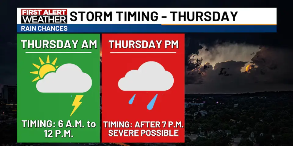
Severe thunderstorms struck southeast Minnesota and northeast Iowa between 1 a.m. and 5 a.m. on Wednesday, September 2, 2026, causing widespread damage in Rochester. Wind gusts reached 68 to 90 mph, downing trees and power lines, while rainfall ranged from 1 to 2.5 inches. Rochester Public Utilities reported over 9,000 initial power outages, dropping to approximately 1,300 to 1,500 by mid-afternoon. The National Weather Service issued a level 2 severe weather risk for Thursday, with potential for damaging winds and isolated tornadoes in the evening.
Key points
- Storms moved through the Highway 52 corridor around 1:30 a.m., with radar-estimated wind gusts of 70 to 90 mph in Rochester.
- Rochester International Airport recorded 61 mph gusts, and the Mayo Helipad recorded 68 mph gusts.
- Rainfall amounts ranged from 1 to 2.5 inches, with Owatonna receiving nearly 2.5 inches.
- Rochester Public Utilities initially reported over 9,000 customers without power, decreasing to about 1,300 to 1,500 by mid-afternoon.
- The National Weather Service issued a level 2 severe weather risk for Thursday, with potential for damaging winds and isolated tornadoes in the evening.
Background
This event follows a pattern of severe weather in the Upper Midwest, with previous storms in the region causing similar damage. The current severe weather is part of a broader atmospheric pattern that has led to multiple rounds of thunderstorms in the area.
How outlets are covering it
KTTC emphasized the wind speeds and rainfall amounts, while Post Bulletin focused on the physical damage, including fallen trees and crushed vehicles. MPR News highlighted the power outages and flooding, and ABC 6 News provided updates on the number of customers without power. All outlets agreed on the severity of the storms and the potential for further severe weather on Thursday.
Why it matters
The severe storms caused significant damage and power outages, affecting thousands of residents and businesses in Rochester and surrounding areas. The potential for further severe weather on Thursday poses additional risks to the region, requiring continued vigilance and preparedness.
What to watch
The National Weather Service expects another round of thunderstorms on Thursday, with a level 2 severe weather risk. Damaging winds are the primary concern, and isolated tornadoes cannot be ruled out. Residents are advised to stay informed and prepared for potential severe weather.
- First Alert: Recap - Wednesday morning storms; Another round of severe weather Thursday KTTC | Rochester, MN
- Photos: Overnight storms cause damage in Rochester on Sept. 2, 2026 Post Bulletin
- UPDATE: Damage caused by powerful wind gusts early Wednesday morning kimt.com
- Severe storms down trees, power lines in Rochester MPR News
- UPDATE: About 1,500 without power in Rochester after Wednesday storms kaaltv.com
Want the full story? Read the original reporting
Read on KTTC | Rochester, MN