
Hurricane Nolo Skirts Hawaii with 16-Inch Rain Threats as Third Storm in Two Months
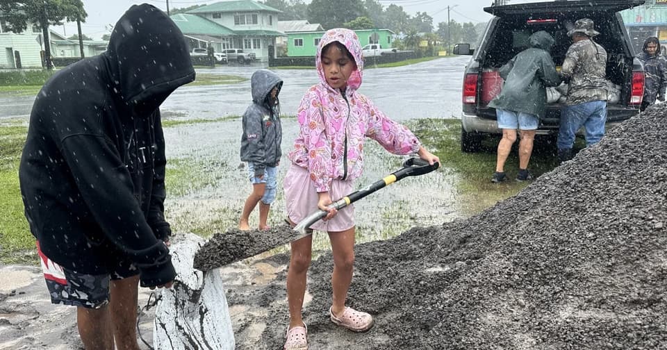
Hurricane Nolo has intensified to Category 5 status with 160 mph winds, posing a severe threat to Hawaii’s Big Island. The storm is forecast to dump 8 to 16 inches of rain, triggering life-threatening flooding and mudslides. It is the third hurricane to pass near Hawaii in two months, a trend linked to a record-setting El Niño. Federal emergency assistance has been approved for the state.
Key points
- Nolo reached Category 5 intensity with 160 mph winds early Saturday, though it later weakened to Category 2 with 100 mph winds by 8 a.m. Saturday.
- The storm is moving slowly, initially north-northwest at 10 mph, before turning northeast toward Baja California Sur by Monday.
- Rainfall totals of 8 to 16 inches are expected on the eastern and southern Big Island, with potential for 25 inches in isolated spots.
- Hawaii Governor Josh Green confirmed President Trump approved an emergency declaration for federal assistance.
- The active season is attributed to a record-setting El Niño, which has spawned more intense and frequent cyclones in the Pacific.
Background
Hawaii has faced multiple tropical systems recently, including Tropical Storm Moke in August and Hurricane Lowell in September. Previous coverage noted that Nolo was rapidly intensifying into a major hurricane, prompting cancellations and flood watches. The current event follows these earlier threats, compounding recovery efforts from Hurricane Lala, which caused significant damage in August.
How outlets are covering it
NBC News emphasizes the immediate threat of life-threatening flooding and mudslides, highlighting resident concerns about repeated storms. Hawaii News Now provides detailed meteorological data, noting Nolo’s slow movement and potential for rapid intensification into a Category 3 hurricane. Big Island Now focuses on the local impact, describing Nolo as a Category 2 hurricane creeping north with outer rainbands affecting the Big Island. Yale Climate Connections places Nolo in the broader context of a hyperactive Pacific season, noting three simultaneous hurricanes and the influence of El Niño, while also mentioning Atlantic storms like Gonzalo.
Why it matters
The repeated hurricane activity underscores the impact of climate patterns like El Niño on regional weather. The potential for catastrophic flooding and mudslides poses significant risks to life and property, particularly in areas already recovering from previous storms. Federal emergency assistance is crucial for recovery and preparedness efforts.
What to watch
Nolo is expected to continue moving slowly through the weekend before turning northeast. Residents should monitor forecasts, secure property, and prepare for potential flooding and high winds. Federal assistance will support emergency protective measures across the state.
- Hurricane Nolo expected to bring heavy rain as it skirts Hawaii’s Big Island NBC News
- Hurricane Nolo still slowly moving north, significant rainfall likely for Hawaii Island Hawaii News Now
- Category 2 Hurricane Nolo continues to creep north as outer rain bands begin to affect Big Island Big Island Now
- Hurricane Nolo expected to strengthen, bring catastrophic flooding, several feet of rain to Hawaiian Islands FOX Weather
- Nolo to bring flood, surf, and wind to Hawaii; Gonzalo develops in the Atlantic Yale Climate Connections
Want the full story? Read the original reporting
Read on NBC News