
Mandatory Evacuation Issued for Outer Banks Visitors as Persistent Nor'easter Threatens Prolonged Isolation
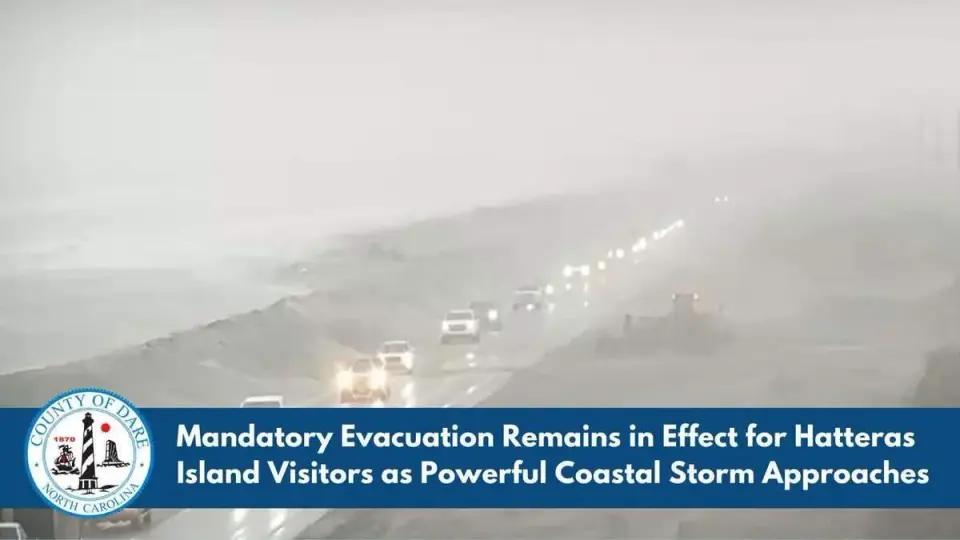
Dare County officials have issued a mandatory evacuation order for non-residents of Hatteras Island, effective Friday at 8 p.m., due to an approaching nor'easter. The storm is forecast to cause prolonged coastal flooding and ocean overwash, potentially closing NC Highway 12 for days and stranding visitors in life-threatening conditions. While the storm is not expected to become tropical, its persistence off the coast could lead to significant wind and wave impacts through next week.
Key points
- Mandatory evacuation order for Hatteras Island non-residents took effect Friday at 8 p.m., covering Rodanthe, Waves, Salvo, Avon, Buxton, Frisco, and Hatteras Village.
- Dare County officials warn that the 'window to safely depart' is rapidly closing as winds and seas build through Saturday and Sunday.
- Forecasters predict large breaking waves up to 14 feet, causing 2 to 4 feet of coastal flooding, with the greatest overwash potential beginning Saturday at 1 p.m.
- NC Highway 12 is expected to close for an extended period due to repeated ocean overwash, cutting off roadway access to the island.
- Saturday ferry services are being canceled, with the last trips scheduled for 10:30 a.m. between Ocracoke and Cedar Island, and 10 a.m. from Swan Quarter to Ocracoke.
- The storm is described as 'unusually pesky and persistent,' potentially meandering off the East Coast for several days and causing impacts through next week.
Background
This event follows a severe nor'easter in late September 2026 that severed road access to Hatteras Island and destabilized sand dunes, leading to a state of emergency and ferry evacuations. The current storm is distinct from that September event but threatens to exacerbate existing erosion and infrastructure damage.
How outlets are covering it
The Charlotte Observer and Dare County officials emphasize the immediate danger of stranding and the necessity of immediate evacuation, highlighting the closure of NC Highway 12. CNN provides a broader regional perspective, noting that while the storm is not tropical, its interaction with high pressure in Canada will drive wind gusts up to 60 mph in the Outer Banks by Sunday. CNN also highlights the prolonged nature of the threat, with coastal flooding and rough seas expected to continue through midweek, potentially worsening beach erosion. AccuWeather's Jonathan Porter characterizes the storm as 'pesky and persistent,' warning that its duration will amplify impacts, particularly in areas already damaged by the September storm.
Why it matters
The mandatory evacuation and potential prolonged isolation of Hatteras Island pose significant risks to visitor safety and local infrastructure. The storm's persistence could lead to extended power outages, road closures, and coastal flooding, impacting both residents and the local economy. The timing, just weeks after a previous severe storm, raises concerns about the resilience of coastal infrastructure and the cumulative impact of repeated weather events.
What to watch
Officials expect the greatest potential for ocean overwash to occur around each high tide, beginning Saturday at 1 p.m. and continuing through Sunday and Monday. Wind advisories are in effect across Carteret, Dare, and Hyde counties starting Saturday afternoon. The storm is forecast to linger off the coast for several days, with hazardous conditions potentially continuing into next week. Residents and visitors are urged to monitor local news and emergency alerts for updates on road closures and ferry services.
- Tourists ordered to evacuate Outer Banks island or risk being trapped by storm Charlotte Observer
- Next fall nor'easter brewing, could threaten millions from Jersey Shore to Carolina coast later this weekend FOX Weather
- Mandatory Evacuation Remains in Effect for Hatteras Island Visitors as Powerful Coastal Storm Approaches Dare County (.gov)
- Brewing nor’easter to stir up days of trouble for the Outer Banks and Mid-Atlantic CNN
- Nor'easter to bring flooding, winds, rain to parts of East Coast The Weather Channel
Want the full story? Read the original reporting
Read on Charlotte Observer