
NHC Monitors Low-Pressure System Near Cabo Verde With 20% Formation Odds
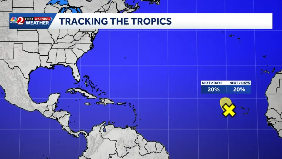
The National Hurricane Center is tracking an area of low pressure in the eastern tropical Atlantic, located a few hundred miles west of the Cabo Verde Islands. The system is producing disorganized showers and thunderstorms but faces a 20% chance of developing into a tropical storm over the next 48 hours and seven days. Strong upper-level winds are expected to hinder further development by midweek, though heavy rainfall is forecast for the islands regardless of whether the system organizes. This monitoring comes shortly after Hurricane Isaias impacted the southeastern United States.
Key points
- The disturbance is centered a few hundred miles west of the Cabo Verde Islands and is moving slowly north to north-northwest.
- Formation odds are assessed at 20% for both the 48-hour and 7-day outlooks by the National Hurricane Center.
- Environmental conditions are marginally favorable for development in the short term, but strong upper-level winds are expected to prevent further intensification after the next day or two.
- Heavy rainfall is expected across portions of the Cabo Verde Islands over the next couple of days, irrespective of whether the system develops into a named storm.
- The system currently poses no threat to Florida, which is still recovering from the impacts of Hurricane Isaias.
Background
This development follows recent tropical activity in the Atlantic basin, including the formation of Tropical Storm Fay and the intensification of Tropical Storm Odalys in late September. Earlier in the season, Gulf disturbances and remnants of Hurricane Dolly raised concerns for the Gulf Coast and Florida. Hurricane Isaias, the first hurricane of the 2026 Atlantic season, recently made landfall in Florida as a Category 2 storm, causing significant flooding and power outages before weakening to a post-tropical cyclone.
How outlets are covering it
WESH, WPEC, Gulf Coast News, and News4JAX all report on the same low-pressure system near the Cabo Verde Islands, citing the National Hurricane Center's assessment. All outlets agree on the 20% formation odds for the next 48 hours and seven days, as well as the expectation that strong upper-level winds will limit development by midweek. WESH and News4JAX emphasize the lack of threat to Florida, linking the current monitoring to the recent impact of Hurricane Isaias. Gulf Coast News highlights the heavy rainfall expected for the Cabo Verde Islands regardless of development. WPEC's content was largely obscured by technical errors, but its title indicates tracking of a new tropical wave, consistent with the other sources.
Why it matters
Monitoring tropical disturbances is critical for early warning and preparedness, especially in the wake of recent hurricane impacts. While the current system poses no direct threat to the United States, its potential development could affect the Caribbean and Atlantic regions. The heavy rainfall expected for the Cabo Verde Islands could lead to localized flooding and disruptions. Continued monitoring by the National Hurricane Center ensures that any changes in the system's trajectory or intensity are promptly communicated to affected areas.
What to watch
The National Hurricane Center will continue to monitor the low-pressure system over the next few days. If the system does not develop into a tropical storm, it will likely dissipate or move away from the Cabo Verde Islands. If it does develop, it could be named Josephine, the next name on the Atlantic hurricane list. The focus will be on tracking the system's movement and any changes in its intensity, particularly as it interacts with upper-level winds. Residents in the Cabo Verde Islands should prepare for heavy rainfall, while those in the United States should remain aware of any potential changes in the system's path.
Want the full story? Read the original reporting
Read on WESH