
Nor'easter intensifies off North Carolina, threatening severe coastal flooding from New Jersey to Maine by Sunday
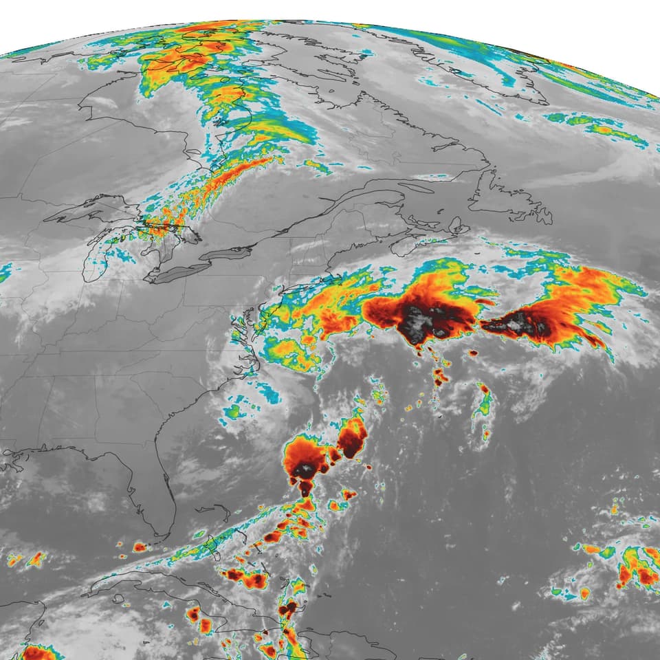
A strengthening nor'easter located 200 miles east of Cape Hatteras, North Carolina, is forecast to move northward, potentially making landfall in New Jersey on Sunday. The system is expected to generate 15-to-25-foot waves and heavy rain, posing significant risks of coastal flooding and beach erosion across the Northeast.
Key points
- The storm is currently intensifying approximately 200 miles east of Cape Hatteras, North Carolina, as of early Friday, September 25, 2026.
- Forecasters predict the system will move slowly northward, with a potential landfall or close approach to the New Jersey coast on Sunday.
- The storm is expected to produce offshore waves ranging from 15 to 25 feet, contributing to serious coastal flooding and beach erosion.
- The impact zone extends from the Carolinas to Maine, with significant coastal impacts anticipated beginning Friday night.
- The Weather Channel highlights that New York City and Boston will be among the major metropolitan areas battered by the storm through Sunday.
Background
This event follows a period of significant weather and infrastructure challenges on the East Coast. In mid-September 2026, a line of thunderstorms prompted the opening of 51 weather shelters in New York City due to flash-flood risks, with 5-7 inches of rain forecast for parts of Long Island and Connecticut. Additionally, a fiber line cut in New Jersey in late September caused major FAA outages, grounding flights at major airports like Newark and JFK. The current nor'easter adds to a pattern of severe weather and infrastructure strain in the region.
How outlets are covering it
The Washington Post emphasizes the geographic scope of the storm, noting the potential for landfall in New Jersey and the broad impact from the Carolinas to Maine, with a focus on wave heights and coastal erosion. The Weather Channel provides a more city-centric perspective, specifically highlighting that New York City and Boston will be 'battered' by the storm through Sunday, focusing on the impact on major metropolitan areas rather than the broader coastal stretch.
Why it matters
The nor'easter poses a significant threat to coastal infrastructure and safety across a densely populated region. The potential for 15-to-25-foot waves and serious coastal flooding could lead to property damage, beach erosion, and disruptions to coastal communities. The timing, following recent flash-flood risks and infrastructure outages, underscores the vulnerability of the East Coast to severe weather events in late September.
What to watch
The storm is expected to continue moving northward, with the potential for landfall in New Jersey on Sunday. Coastal communities from the Carolinas to Maine should monitor for updates on wave heights, rainfall, and potential flooding. Authorities may issue additional warnings or advisories as the storm's path and intensity become clearer in the coming days.
- A nor’easter is strengthening near the East Coast. These cities will be hit hard. The Washington Post
- Strengthening nor'easter will batter Northeast, NYC, Boston The Weather Channel
- Nor’easter to lash the East Coast with strong winds, flooding and heavy rain AP News
- Live updates: Dangerous nor'easter threatens East Coast with major flooding and damaging winds foxweather.com
- 3 Major Airlines Issue Travel Waivers For Weekend Nor’Easter Forbes
Want the full story? Read the original reporting
Read on The Washington Post