
North Jersey Endures Record Rainfall as Flash Floods Trigger Rescues
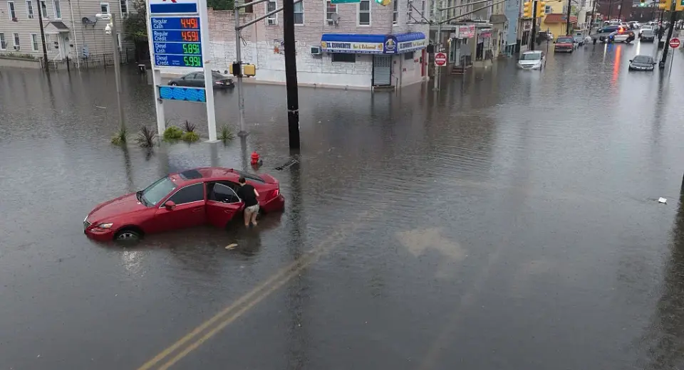
A severe storm system on Sunday morning delivered extreme rainfall to parts of North Jersey, causing flash floods, road closures, and multiple water rescues. Bergen and Passaic counties were hit hardest, with some areas recording over 4 inches of rain in three hours. While New York City remained largely dry, authorities had opened shelters in anticipation of the weather. The event is described by state climatologists as a once-in-a-generation rainfall event for several towns.
Key points
- Bergen and Passaic counties in New Jersey experienced severe flash flooding, with a Rutgers weather station in North Haledon recording over 4 inches of rain between 7 a.m. and 10 a.m. Sunday.
- Firefighters conducted water rescues in Paterson, Westwood, Closter, and Fair Lawn, with video showing a car trapped in floodwaters in Paterson.
- Paramas experienced widespread road closures due to flooding, according to Mayor Chris DiPiazza.
- New York City was largely spared, with less than an inch of rain falling in Central Park, though authorities had opened dozens of overnight shelters and cleared catch basins in preparation.
- The Hackensack and Saddle Rivers are forecast to spill their banks due to runoff, even after the rain subsided.
Background
This event follows a pattern of severe weather in the region. In early September, southeastern Texas faced record rainfall from Tropical Storm Edouard, while the Tri-State area braced for heavy rain earlier this week, prompting New York City to open 51 shelters. The current storm is distinct from the Nepal floods reported in early September, which resulted in over 1,100 deaths.
Why it matters
The extreme rainfall highlights the vulnerability of infrastructure in the New York metropolitan area to intense, short-duration storms. The need for emergency rescues and road closures disrupts daily life and poses safety risks, while the subsequent river overflow threatens further damage. The event underscores the importance of preparedness measures, such as shelter openings and catch basin clearing, even in areas that ultimately receive less precipitation.
What to watch
Forecasters expect dry conditions and seasonable weather from Monday through Wednesday, with a chance of rain returning on Thursday. However, the threat of flooding remains in some areas due to the runoff from the Hackensack and Saddle Rivers, which are expected to spill their banks on Sunday.
Want the full story? Read the original reporting
Read on Gothamist