
Southern California Braces for Rain, Flooding, and Beach Hazards as Storm System Arrives
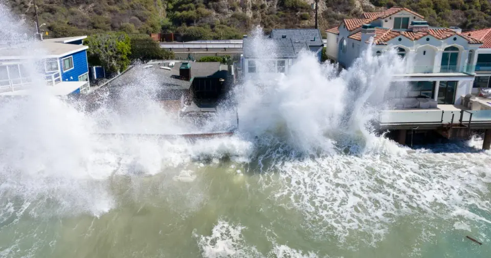
The National Weather Service forecasts significant rain and thunderstorms for Southern California from Wednesday into Thursday, with a 30% to 40% chance of widespread minor flooding and debris flows in Los Angeles and Ventura counties. The highest risk is concentrated in the Santa Monica Mountains, particularly near recent wildfire burn scars in the Palisades and Altadena areas. Rainfall totals are expected to reach 1.73 inches in Thousand Oaks and 1.31 inches at LAX. Meanwhile, the NWS San Diego office issued a beach hazard warning for Orange, Riverside, San Bernardino, and San Diego counties, citing dangerous rip currents and surf of 3 to 6 feet. Precipitation probabilities rise sharply in the evening, with areas like Anaheim and Irvine reaching 95% chance of rain by Thursday morning.
Key points
- NWS Los Angeles-Oxnard estimates a 30% to 40% chance of thunderstorms and minor flooding in L.A. and Ventura counties, with the Santa Monica Mountains identified as the highest risk zone.
- Debris flow concerns are heightened in first-year burn scars, specifically in the Palisades and Altadena areas affected by recent wildfires.
- Expected rainfall includes 1.73 inches in Thousand Oaks, 1.53 inches in Oxnard, and 1.31 inches at LAX between Wednesday and Thursday.
- NWS San Diego issued a beach hazard warning for four counties, warning of rip currents and surf of 3 to 6 feet on south- and southwest-facing beaches.
- Precipitation chances increase significantly in the evening, with Anaheim, Irvine, and San Clemente reaching 95% probability by Thursday morning.
Background
This weather system follows a recent period of extreme heat and Santa Ana winds, as noted in earlier archive coverage. It also comes in the wake of Tropical Storm Rachel, which caused severe coastal flooding and infrastructure damage in San Diego and Long Beach in early October. The current forecast represents a shift toward cooler, wetter conditions, with potential debris flow risks exacerbated by the landscape changes from recent wildfires.
Why it matters
The combination of heavy rainfall and recent wildfire burn scars creates a high risk for debris flows and localized flooding, particularly in the Santa Monica Mountains. Additionally, hazardous beach conditions pose immediate risks to swimmers and surfers across multiple counties. These weather events highlight the ongoing challenges Southern California faces in managing climate-related hazards and infrastructure resilience following extreme weather events.
What to watch
The weather system is expected to clear by Friday, potentially followed by another round of dry, windy conditions over the weekend. Residents are advised to monitor local weather updates and avoid hazardous swimming conditions at beaches. Long-term impacts may include further erosion and infrastructure damage, particularly in areas already affected by recent storms and wildfires.
- Storms descend on Southern California, raising risk of dangerous surf, flooding, debris flows Los Angeles Times
- Rain — and potentially lots of it — heading to Southern California Los Angeles Daily News
- California’s rainy season to arrive with flood threat, tornado risk and Sierra snow San Francisco Chronicle
- October storm could bring up to 2 inches of rain to SoCal NBC4 Los Angeles
- A Storm Will Bring Rain to California This Week The New York Times
Want the full story? Read the original reporting
Read on Los Angeles Times