The Sahara's Eye Unveiled: A Landsat View of the Richat Structure
TL;DR Summary
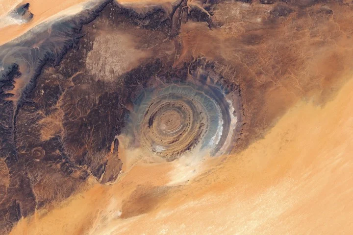
NASA’s Eye of the Sahara, the Richat Structure in Mauritania, is a 40-km-wide circular geologic dome formed by an igneous intrusion and differential erosion, not an impact crater. A Landsat 8/9 mosaic highlights concentric ridges (cuestas) and the orange-gray color differences that reflect diverse rock types, set on the Adrar Plateau amid wind-sculpted dunes and ancient river channels. First described in the 1930s and popularized after early spaceflight imagery, the feature’s striking “bull’s-eye” shape is a striking example of how geological forces shape the landscape.
Eyeing the Richat Structure NASA Science (.gov)
Reading Insights
Total Reads
0
Unique Readers
28
Time Saved
3 min
vs 4 min read
Condensed
89%
775 → 85 words
Want the full story? Read the original article
Read on NASA Science (.gov)