Tag

Earth Science

All articles tagged with #earth science

Atlantic Conveyor at Risk: New Analysis Suggests AMOC Collapse Could Be Locked In by 2100
earth-science1 day ago

Atlantic Conveyor at Risk: New Analysis Suggests AMOC Collapse Could Be Locked In by 2100

A climate-model study, using Greenland ice melt scenarios, suggests the Atlantic Meridional Overturning Circulation (AMOC) may already be locked in toward collapse, with a 10% chance under peak 2025 emissions, rising to 23% in harsher melt scenarios—and potentially 100% by 2100 in the worst case. A collapse would trigger dramatic regional impacts, including sea-level rise along the U.S. East Coast, cooler temperatures for parts of Europe, and more extreme weather. The work is a preprint and debated, but it underscores the urgency of rapid emissions reductions to avert severe climate outcomes.

Sky-based tweak could blunt El Niño before it begins
earth-science1 day ago

Sky-based tweak could blunt El Niño before it begins

A Science Advances modeling study shows that targeted marine cloud brightening over the southeast tropical Pacific could weaken, or even neutralize, developing El Niño events. In simulations of the 1997–1998 and 2015–2016 super El Niños, applying the technique from June through February restored ENSO-neutral conditions, but researchers stress this is a proof-of-concept and not a-ready-for-field approach, noting uncertainties such as potentially faster La Niña onset and other unintended climate effects that require extensive follow-up before any real-world tests.

Pacific Core-Flow Reversal Signals a More Dynamic Geodynamo
earth-science4 days ago

Pacific Core-Flow Reversal Signals a More Dynamic Geodynamo

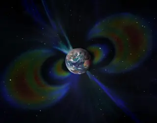
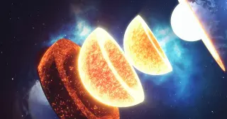
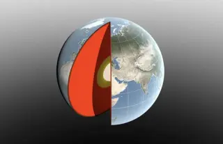
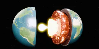
A broad region of liquid iron beneath the equatorial Pacific flipped from westward to eastward flow around 2010, revealing the outer core can change circulation more abruptly than previously thought. Using nearly 30 years of data from ground observatories plus ESA Swarm, CryoSat, CHAMP and Ørsted satellites, researchers traced how this flow reversal reshapes our view of the geodynamo and Earth's magnetic field. The finding raises questions about core–mantle–inner-core interactions and whether such reversals are temporary fluctuations or part of a longer cycle, underscoring the need for ongoing monitoring.

Coccolithophore Blooms Paint the Black Sea Turquoise
earth-science16 days ago

Coccolithophore Blooms Paint the Black Sea Turquoise

NASA’s Earth Observatory reports that spring–summer 2026 blooms of coccolithophores tint the Black Sea and the Bosphorus turquoise, a color captured by NASA’s PACE satellite; when diatoms dominate, waters can darken. These blooms are visible from space and contribute to the ocean carbon cycle, as dying coccolithophores transport carbon to the seafloor, with remote sensing aiding bloom-dynamics studies where direct sampling is limited.

Earth’s oldest crater re-dated to ~3.0 billion years ago
science16 days ago

Earth’s oldest crater re-dated to ~3.0 billion years ago

A new study dates minerals from the North Pole Dome crater in Western Australia to about 3.0 billion years ago, down from the earlier 3.47 billion-year estimate. While still the oldest known impact crater on Earth, it is roughly 800 million years older than the next-oldest confirmed crater, Yarrabubba. The researchers used zircon and other minerals in shatter cones and a shocked quartz vein, noting that later tectonic and thermal activity could produce younger features, which helps explain why previous dating may have overestimated the age.

Yellowstone’s Biscuit Basin Sparks Fresh Steam Vents After Tiny Hydrothermal Burst
earth-science16 days ago

Yellowstone’s Biscuit Basin Sparks Fresh Steam Vents After Tiny Hydrothermal Burst

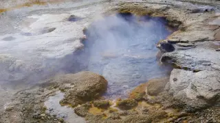
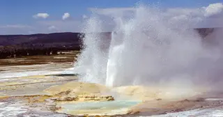
A small hydrothermal explosion at Biscuit Basin, Yellowstone, on June 13, 2026, created multiple new vents and steam-filled pools, with hot water reaching the Firehole River at about 194°F (90°C). By June 18 a new ground feature had become a vigorously boiling pool roughly 21 by 17 feet, and close-range monitoring captured this eruption on cameras about 100 meters away. The incident, following a larger 2024 blast, underscores the unpredictable, hazardous hydrothermal activity in the region and the ongoing need for monitoring to identify potential precursors.

Deep-Earth Wave Shifts Japan 6mm East After Tohoku Quake
earth-science22 days ago

Deep-Earth Wave Shifts Japan 6mm East After Tohoku Quake

GPS data show an eastward, step-like ground shift of up to 6 millimeters across nearly all of Japan about 15 minutes after the 2011 magnitude-9 Tohoku quake. Researchers say a large ScS seismic wave traveled deep into Earth, reflected off the core, and returned to the surface, reactivating plate boundaries and causing the uniform shift—a first suggested observation of this type of wave influencing the surface and with implications for understanding aftershock hazards across subduction zones.

Arctic Icebergs Seed Hidden Coral Gardens on the Seafloor
earth-science29 days ago

Arctic Icebergs Seed Hidden Coral Gardens on the Seafloor

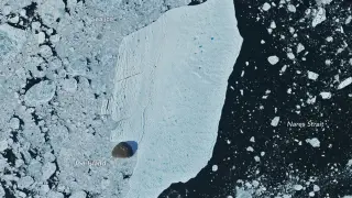
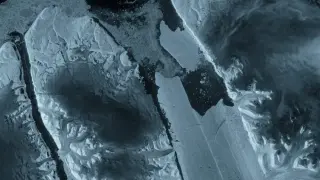
Researchers using satellite imagery and a network of undersea sensors found that debris-laden icebergs drop dropstones onto the Arctic seafloor, creating hard substrates that enable new habitats for soft corals, sea anemones, sponges and bryozoans, boosting deep-sea biodiversity. Most icebergs traced to glaciers in northeastern Greenland and the Russian High Arctic, linking iceberg flux to warming. The findings also highlight navigational and bottom-trawling hazards from deposited rocks, a risk now prompting private firms to provide timely iceberg data to mariners.

Hidden Basin Network Beneath East Antarctica Could Reshape Ice Flow
earth-science1 month ago

Hidden Basin Network Beneath East Antarctica Could Reshape Ice Flow

Researchers mapped a continent-scale bedrock system under East Antarctica—the East Antarctic Fan-Shaped Basin Province—comprising 30 pull-apart basins formed by distributed rotational extension. Using airborne gravity, magnetic surveys and seismic imaging, they suggest thinner, younger crust under much of the East Antarctic Ice Sheet, which could alter ice-flow patterns and heat transfer, with implications for ice-sheet stability and sea-level rise. The study, published in Nature Geoscience, challenges the idea of a single, stable crust beneath East Antarctica and underscores how hidden geology can influence the fate of Earth's freshwater ice.

Millennium-High Stress on California Faults Triggers Big-Quake Alarm
earth-science1 month ago

Millennium-High Stress on California Faults Triggers Big-Quake Alarm

A 1,000-year modeling study of Southern California’s San Andreas and San Jacinto faults shows current tectonic stresses at or near the highest levels in the past millennium, heightening quake hazard. The Cajon Pass junction may act as an “earthquake gate” that could allow large ruptures to cross both faults, potentially increasing damage if such an event occurs. The research does not predict when a quake could happen, but it provides a physics-based hazard framework to improve preparedness for California and other complex fault systems.

Earth’s 27° East Albedo Symmetry Stumps Climate Models
science1 month ago

Earth’s 27° East Albedo Symmetry Stumps Climate Models

Scientists report a persistent east–west albedo symmetry around 27° E—a triple symmetry that climate models currently fail to reproduce and which could refine future climate projections—alongside briefs on dolphins using individual vocal labels to avoid coercive males, urban bowerbirds decorating with human trash, and titanosaurs’ bones hosting beetle-driven ichnofacies after death.

Chimborazo: closest to space, not the highest above sea level
science1 month ago

Chimborazo: closest to space, not the highest above sea level

Everest is the highest mountain above sea level at 8,848 m, but Chimborazo in Ecuador sits farther from Earth’s center due to the planet’s equatorial bulge—about 6,384.4 km from the center versus Everest’s ~6,382.3 km, a ~2.1 km difference. Whether it’s closest to space depends on how you define space: from the center (Chimborazo wins) or from sea level (Everest wins). The key point is that “highest” and “farthest from the center” are two different measures, and Earth’s shape, not mountain height alone, drives the gap. Historical geodesy missions helped confirm the bulge and the oblate Earth.

Iceland’s Quiet Undersea Volcanoes Turn Explosive
earth-science1 month ago

Iceland’s Quiet Undersea Volcanoes Turn Explosive

Geophysicists aboard the Meteor on Expedition M201 found flat-topped, submerged volcanoes along the Reykjanes Ridge off Iceland, indicating that mid-ocean ridges can erupt explosively at shallower depths when seawater flashes to steam; a mechanism that may explain phantom islands like Surtsey and suggests future surface eruptions could occur as ice and pressure conditions change.