earth-science13.17 min read
Record-Breaking El Niño Prompts California Emergency Declarations Amid U.S. Preparedness Gaps
17 days ago•Source: Gizmodo

The latest earth science stories, each synthesized from multiple sources with added background and context.
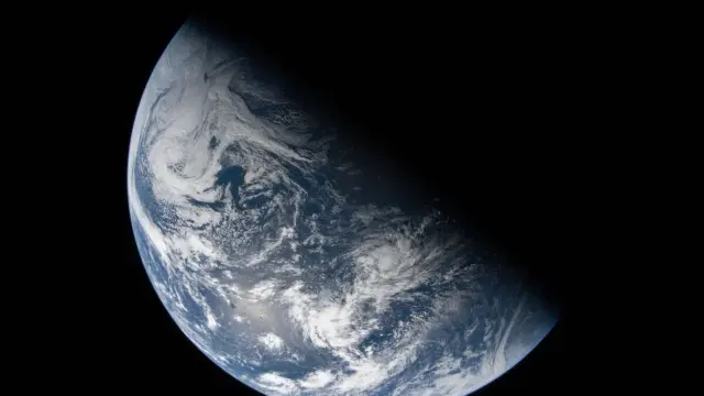
A new Nature Geoscience study suggests Earth’s mantle could hide an ancient water reservoir. In lab experiments simulating conditions about 1,800 miles beneath the surface (roughly 2 million atmospheres and 2,500°C), scientists formed two iron oxyhydroxide minerals, Fe5O12Hx and Fe7O12Hx, that can trap water across deep-mantle conditions and may host primordial or recycled water near the core–mantle boundary. While it’s not yet proven these minerals occur naturally, the findings offer a potential deep-Earth water store and shed light on the mantle’s role in Earth’s water cycle and interior structure.
Gizmodo•1 month ago
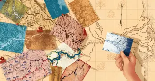
Hack's law: stream length scales roughly as drainage area to the 0.6 power, and it holds worldwide, now extending to river deltas. Through energy-efficient transport networks and landscape-evolution modeling, scientists explain why larger basins elongate rivers, how networks optimize drainage, and why this simple scaling persists even as sediments accumulate at deltas. The work links river bifurcation angles to fivefold symmetry and hints at connections to quasicrystals, revealing a universal geometry of Earth's waterways.
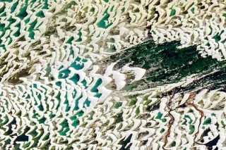
NASA’s Earth Observatory highlights Lençóis Maranhenses National Park in Brazil as a vast dune field that fills with seasonal freshwater lagoons; dunes migrate westward under strong northeast winds, lagoons peak during the wet season and dry by December, and UNESCO designated the site a World Heritage venue in 2024 for its unique geology and biodiversity.
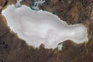
Landsat 9 imagery shows Barnes Ice Cap on Baffin Island losing its snow cover unusually early in the 2026 Arctic summer, exposing bare ice dotted with blue meltwater ponds and a widening network of meltwater channels. With snow gone, the ice warms and melts faster, indicating continued thinning and retreat (historically about 4 m per year over 40 years, with some areas retreating much faster) and earlier surface runoff that reduces refreezing.
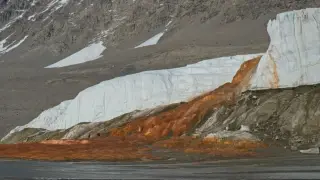
A Nature Geoscience study shows Blood Falls' vivid red water originates from ancient seawater released from beneath Taylor Glacier, with genetic analysis indicating the brine hosts predominantly marine-associated microbes. The findings support the idea of a relic marine ecosystem beneath the Dry Valleys and suggest the subglacial water was trapped during past warm periods, offering a new timeline for flooding and isolation events and illustrating life's resilience in extreme polar environments.
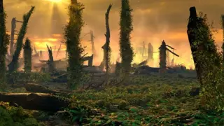
Volcanic activity helped trigger the end-Triassic mass extinction, but a giant fern spike produced dry, combustible mats that fueled massive wildfires, leaving charcoal- and PAH-rich layers in sediment cores. Ferns, resilient underground, may have amplified the crisis for tens of thousands to hundreds of thousands of years, illustrating how interconnected Earth systems can worsen disasters.
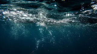
A new review warns that warming oceans and nutrient runoff are depleting dissolved oxygen in water bodies, with global ocean oxygen down ~2% since the 1950s and potentially falling another 1–7% by 2100, a trend that could disrupt aquatic ecosystems and destabilize the biosphere; the study argues aquatic deoxygenation should be added to the Planetary Boundaries framework, proposing indicators like dissolved oxygen concentration, proximity to capacity, shifts in oxygen‑sensitive species, and the Metabolic Index to track risk.
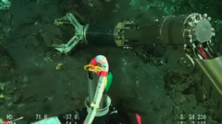
Japanese scientists aboard the Shinsei Maru found real gold embedded in pyrite near Higashi‑Aogashima Knoll’s hydrothermal vents, with concentrations up to 1.9% by weight—far higher than other deep‑sea deposits—trapped in colloform pyrite formed by vent fluids and arsenic-rich minerals; detected using secondary ion mass spectrometry (SIMS). This “invisible gold” could guide future deep‑sea exploration and mining.
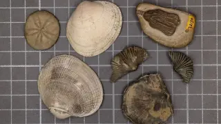
A new study links the Permian-Triassic 'Great Dying' to warming oceans with expanding oxygen-poor waters, showing species most vulnerable to higher temperatures and low oxygen died off at higher rates; the findings serve as a warning that contemporary human-driven warming could trigger a similar marine crisis if carbon emissions aren’t curbed.
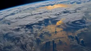
As Earth's rotation speeds up and the risk of a negative leap second grows, international timekeepers are weighing replacing leap seconds with a leap hour. A CGPM vote in October could formalize the change by 2035, aiming to reduce disruptions to GPS, banking, and other systems after past leap-second headaches like outages tied to UTC adjustments.
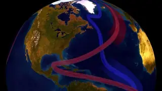
A climate-model study, using Greenland ice melt scenarios, suggests the Atlantic Meridional Overturning Circulation (AMOC) may already be locked in toward collapse, with a 10% chance under peak 2025 emissions, rising to 23% in harsher melt scenarios—and potentially 100% by 2100 in the worst case. A collapse would trigger dramatic regional impacts, including sea-level rise along the U.S. East Coast, cooler temperatures for parts of Europe, and more extreme weather. The work is a preprint and debated, but it underscores the urgency of rapid emissions reductions to avert severe climate outcomes.