
"Mapping Earthquake Risk Across the U.S.: USGS Unveils Groundbreaking Seismic Hazard Map"
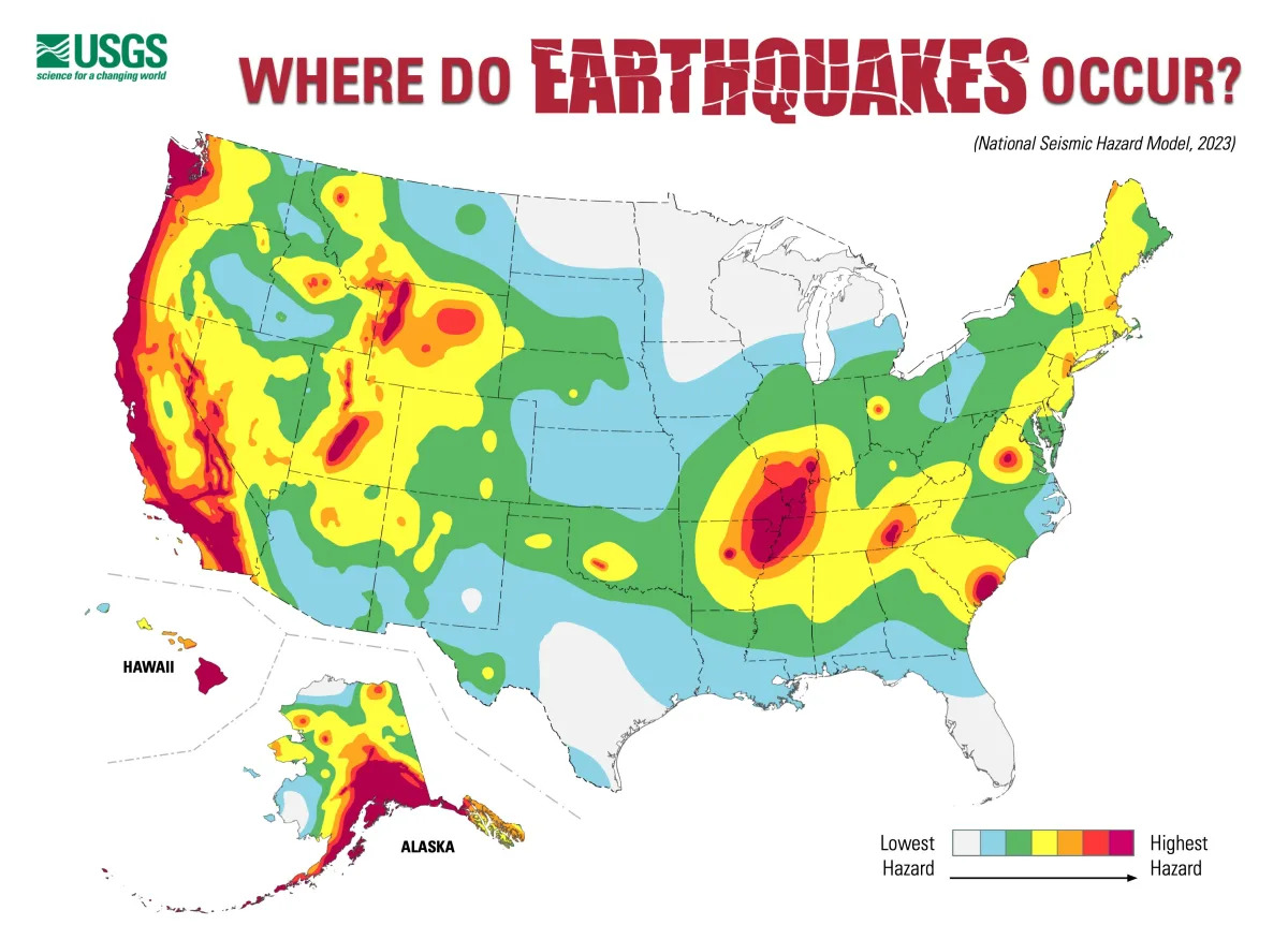
TL;DR
The United States Geological Survey has released new maps showing that nearly 75% of the U.S. could face potentially damaging earthquakes in the next century, with California, Alaska, and the central and northeastern Atlantic Coastal corridor being particularly at risk. The agency's latest earthquake model aims to enhance public safety and provide critical information for architects, engineers, and policymakers, with implications for earthquake retrofitting and construction practices.
Topics:sciencenatural-disasters#earthquake-risk#earthquakes#natural-disasters#public-safety#seismic-activity#usgs
- New map shows U.S. areas at risk of damaging earthquakes Yahoo! Voices
- New USGS maps show likelihood of big quakes in California and U.S. NBCLA
- Earthquakes a risk for 75% of US in next century: This map shows where USA TODAY
- In the news: USGS earthquake map, Berkeley residents build bus stop benches, trending NFL jacket NBC Bay Area
- Seismic Shifts: USGS Unveils Groundbreaking Earthquake Hazard Map SciTechDaily
Want the full story? Read the original reporting
Read on Yahoo! Voices