
Atmospheric River Sets San Francisco Rainfall Record, Triggering Floods and Power Outages
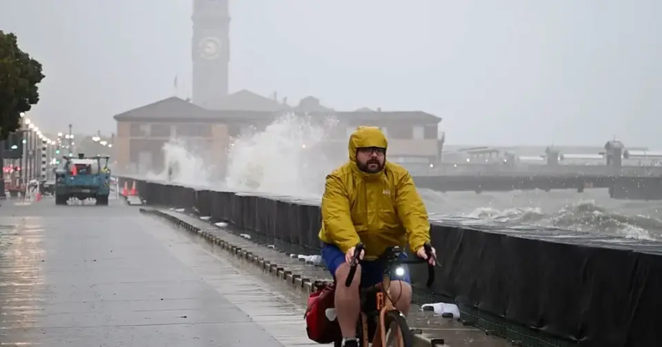
A powerful atmospheric river dumped record-breaking rain on the San Francisco Bay Area on Wednesday, November 18, 2026. Downtown San Francisco received 2.28 inches of rain by 3 p.m., breaking the previous daily record for that date set in 1918. The storm caused widespread flooding, power outages, and flight delays, with Mayor Daniel Lurie warning that the severe weather is just the beginning of a wet winter season.
Key points
- Downtown San Francisco recorded 2.28 inches of rain by 3 p.m. on Wednesday, surpassing the 1918 record of 2.24 inches for November 18.
- The National Weather Service noted that San Francisco received nearly its entire average November rainfall in less than one day.
- Flooding stranded vehicles in San Jose near the SAP Center, requiring boat rescues, while Waymo self-driving cars suspended service in San Francisco.
- Thousands of customers lost power across the Bay Area, and sewage backups created 'geysers' in the Ocean Beach neighborhood.
- Los Angeles officials warned residents in areas burned by 2025 fires to prepare for potential evacuation orders due to mudslide risks.
Background
The Bay Area had already experienced severe weather earlier in the week, including waterspouts and a brief tornado warning in Santa Cruz County, as noted in our November 17 archive. This latest storm is part of a broader pattern of intensified atmospheric rivers, which are becoming more frequent and powerful in the western United States due to climate change. The region is also currently experiencing a strong El Niño, which meteorologists say is supercharging the winter storm and flood season.
How outlets are covering it
The New York Times and The Guardian both emphasized the record-breaking nature of the rainfall and the immediate infrastructure failures, such as power outages and flooded streets. ABC7 Bay Area focused on the broader storm system, highlighting the risk of debris flows in wildfire burn scars and the potential for the storm to be upgraded to a higher impact level. NBC Bay Area provided specific data on the rainfall totals, confirming the new daily record. All sources agreed on the severity of the event but differed in their focus: some highlighted the local urban impacts, while others warned of regional risks in southern California and the Sierra Nevada.
Why it matters
This event underscores the increasing frequency and intensity of extreme weather events in California, driven by climate change and El Niño conditions. The record rainfall and resulting infrastructure failures highlight the vulnerability of urban areas to flooding and the need for improved stormwater management and emergency response systems. The warnings for southern California indicate that the impacts of this storm are not limited to the Bay Area, posing risks to other major metropolitan areas.
What to watch
Forecasters expect the rain to continue through the weekend, with additional storms predicted next week. The National Weather Service has issued warnings for significant road flooding and rockslides in mountainous areas. Residents in southern California, particularly in areas affected by recent wildfires, are advised to be prepared for potential evacuation orders. The storm is expected to move into southern California on Wednesday night and Thursday, bringing heavy rain and high surf.
- Storm Brings Torrential Rain and Floods to the San Francisco Bay Area The New York Times
- Live storm updates: Severe flooding inundates roadways leads to crashes, closures across Bay Area ABC7 Bay Area
- Downtown San Francisco sets new daily rainfall record for Nov. 18 NBC Bay Area
- Record-breaking rain lashes California’s Bay area as ‘atmospheric river’ arrives The Guardian
- Inclement weather floods roadways, knocks out power to thousands of Peninsula residents Palo Alto Online
Want the full story? Read the original reporting
Read on The New York Times