
Explore the Roman Empire's Extensive Road Network with a New Digital Atlas
TL;DR
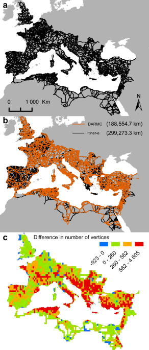
Itiner-e is a comprehensive, high-resolution digital dataset mapping nearly 300,000 km of Roman roads across the empire, created from archaeological, historical, and remote sensing sources, revealing significant gaps in certainty and coverage that can inform future research on ancient mobility and infrastructure development.
- Itiner-e: A high-resolution dataset of roads of the Roman Empire Nature
- All the Roads That Led to Ancient Rome in One New Digital Map Scientific American
- All roads in ancient Rome stretched far longer than previously known, study shows AP News
- Digital map lets you explore the Roman Empire's vast road network New Scientist
- Travel ancient Rome’s 186,000 miles of roads in new online atlas Yahoo
Want the full story? Read the original reporting
Read on Nature