
UN Vote Set to Phase Out Mercator Map in Favor of Accurate Global Projections
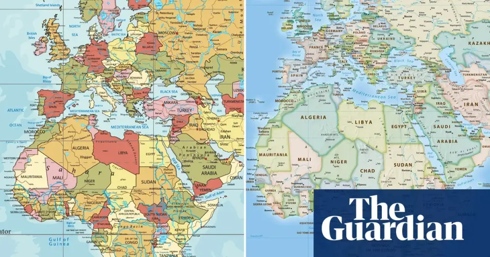
The UN General Assembly is set to vote on a resolution to formally phase out the traditional Mercator world map in favor of projections that accurately represent Africa's size. Sponsored by Togo and backed by the African Union, the move aims to replace the 1569 standard, which distorts equatorial regions, with the 2018 Equal Earth design. While non-binding, the resolution could influence education and technology, marking a shift in how global power dynamics are visually represented.
Key points
- The UN General Assembly will vote on a resolution to replace the Mercator projection with maps that accurately display Africa's scale.
- The initiative is sponsored by Togo and supported by the African Union's 54 member states, with Togo's foreign affairs minister Robert Dussey leading the effort.
- The Mercator map, introduced in 1569 for navigation, distorts sizes by making high-latitude areas appear larger and equatorial regions smaller, such as showing Africa as similar in size to Greenland when it is 14 times larger.
- The proposed alternative is the 2018 Equal Earth map, developed by an international team of cartographers, which supporters argue will decolonize global curricula and correct visual biases.
- Although UN resolutions are non-enforceable, a successful vote could lead to updates in classroom curricula and everyday technology, including platforms like Google Maps.
- Togolese authorities plan an implementation event in Lomé with UNESCO and tech companies in early 2026, following a similar successful UN vote in March regarding the slave trade.
Background
This development follows recent scrutiny of cartographic accuracy in international diplomacy, including a 2026 incident where the US State Department apologized for an AI-generated map at an AIDS conference that mislabeled several African countries. That error highlighted ongoing concerns about the reliability of automated geographic representations and the reputational risks associated with inaccurate global depictions in high-profile forums.
Why it matters
The resolution challenges the visual foundations of global power dynamics, which have historically minimized the physical presence of the Global South. By adopting an equal-area map, the move seeks to align educational and technological standards with geographic reality, potentially influencing international trade, development priorities, and the perceived importance of African nations in global institutions.
What to watch
If the vote passes, Togo plans to collaborate with UNESCO and tech brands like Google Maps in the first quarter of 2026 to map out the implementation of the new standard. The outcome will likely be influenced by the precedent set by a March 2026 UN resolution on the slave trade, which passed with 123 votes in favor.
Want the full story? Read the original reporting
Read on The Guardian