Global outbreak-risk map flags 9.3% of land as highly vulnerable to deadly diseases
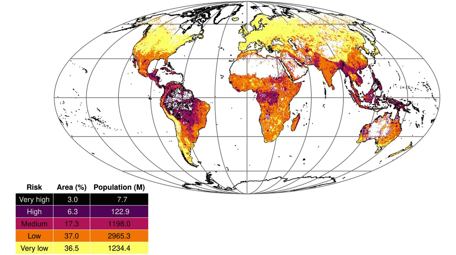
A new global model using machine learning and satellite data maps epidemic-prone diseases across nearly every country, finding about 6.3% of land in the high-risk category and 3% in very high risk (9.3% total), with roughly 20% of people in medium risk. Hotspots cluster in Latin America and Oceania, and population density emerges as the strongest driver of outbreak risk. The study also assesses readiness, showing some regions face high risk but limited health infrastructure, while many high-income countries have stronger capacity. The map is intended to guide surveillance, preparedness, and rapid response for threats including Disease X, and the research was published in Science Advances.
Reading Insights
1
38
17 min
vs 18 min read
97%
3,592 → 106 words
Want the full story? Read the original article
Read on Earth.com