
Record-Breaking Pacific Heatwave and Super El Niño Set to Warp 2026-27 Weather
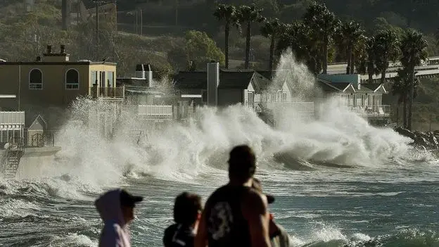
A rare convergence of a massive Pacific marine heatwave and a potentially record-breaking 'super El Niño' is expected to intensify global weather extremes through 2027. The heatwave, present since May 2025, has raised surface temperatures by 3-4°C, while the El Niño is projected to peak by December. This combination threatens to cause severe flooding in California, drought in the Pacific Northwest, and significant marine ecosystem collapse, with scientists warning that climate change is amplifying these natural cycles.
Key points
- The Pacific marine heatwave, active since May 2025, has pushed surface temperatures 3-4°C above average, causing severe stress to marine life and coastal infrastructure.
- NOAA confirmed the onset of El Niño in June 2026, with a 63% probability of it becoming a 'very strong' event, potentially the most intense in recorded history.
- California faces heightened flood risks due to sea levels rising 15-30cm above normal, while the Pacific Northwest expects reduced snowfall and increased drought conditions.
- Marine ecosystems are under severe strain, with oxygen levels dropping and nutrient circulation disrupted, leading to potential die-offs of fish and shellfish.
- Global warming is believed to be 'supercharging' El Niño events, with recent studies showing a 36% intensification of these cycles over the past 40 years.
Background
This development follows earlier reports in August 2026 indicating that global warming is altering fundamental Pacific-Indian Ocean climate links, reducing historical predictability. Additionally, seasonal forecasts for the 2026-27 winter suggested a complex pattern of wetter conditions in the South and variable snow in the West, with El Niño expected to influence regional moisture and temperature anomalies.
How outlets are covering it
BBC and The Atlantic emphasize the unprecedented scale of the combined heatwave and El Niño, with The Atlantic noting water temperatures around Kiritimati are 3-4°C above normal. The Asheville Citizen Times and Newsday focus on regional impacts, highlighting that while the Southeast and Northeast may see wetter or milder winters, the Pacific Northwest faces severe drought. While BBC and The Atlantic stress the immediate marine and coastal devastation, Newsday points out that some regions like Long Island may experience muted hurricane activity and warmer winters, illustrating the varied global impacts of the same climate event.
Why it matters
The convergence of these two phenomena threatens to exacerbate global food insecurity, as the UN World Food Program has warned of potential famine in multiple regions due to crop failures. The economic impact could reach billions of dollars from wildfire damage and infrastructure failures, while the long-term ecological consequences for marine biodiversity may be irreversible. This event underscores the accelerating influence of climate change on natural weather cycles, making extreme weather events more frequent and intense.
What to watch
The El Niño is expected to peak by December 2026 and dissipate by spring 2027. Scientists are monitoring whether the marine heatwave will persist or be disrupted by strong tropical storms. Long-term forecasts suggest 2027 could become the hottest year in recorded history due to the combined effects of El Niño and global warming. Continued monitoring of sea surface temperatures and atmospheric patterns will be crucial for predicting regional weather impacts and mitigating potential disasters.
- Two giant warming patterns are brewing in the Pacific and warping US weather BBC
- This El Niño Will Be Unlike Any in the Past Eight Decades The Atlantic
- Strengthening El Niño could shake up fall weather across the US. Here’s what to expect FOX Weather
- Will there be a 'super El Niño' this year? How it could affect NC The Asheville Citizen Times
- What a historic El Niño year means for Long Island's weather forecast Newsday
Want the full story? Read the original reporting
Read on BBC