
"First Alert: Twin Cities Braces for Wind-Driven Snow and Blizzard Conditions"
TL;DR Summary
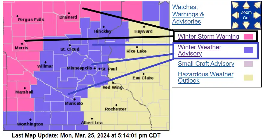
A record-breaking March storm continues to bring snow to western, central, and northern Minnesota, with the Twin Cities and central Minnesota expected to experience the worst of it during Tuesday morning's rush hour. Rain in the Twin Cities will change to snow as colder air moves in, potentially leading to heavy wind-driven snow and hazardous road conditions. Snowfall totals of 1-4 inches are expected in the Twin Cities, with up to 6 inches possible in the northern areas. Winter storm and blizzard warnings remain in effect for various parts of Minnesota, making for a challenging commute on Tuesday morning.
- Storm continues; wind-driven snow Tuesday morning for Twin Cities MPR News
- MN weather: Rain turns to snow Tuesday morning FOX 9 Minneapolis-St. Paul
- FIRST ALERT: Storm will bring heavy rain today, more snow tomorrow KEYC
- Justin Liles: Blizzard conditions and ice tonight WDIO
- First Alert: Accumulating snow still on the way through Tuesday Northern News Now
Reading Insights
Total Reads
0
Unique Readers
51
Time Saved
4 min
vs 5 min read
Condensed
88%
821 → 99 words
Want the full story? Read the original article
Read on MPR News