Batmobile Gets Winter-Ready Tease for The Batman, Part II
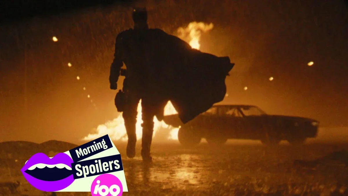
Matt Reeves posts a behind-the-scenes image of the Batmobile testing snow tires, hinting at wintry action sequences for The Batman, Part II.
All articles tagged with #snow
Matt Reeves posts a behind-the-scenes image of the Batmobile testing snow tires, hinting at wintry action sequences for The Batman, Part II.
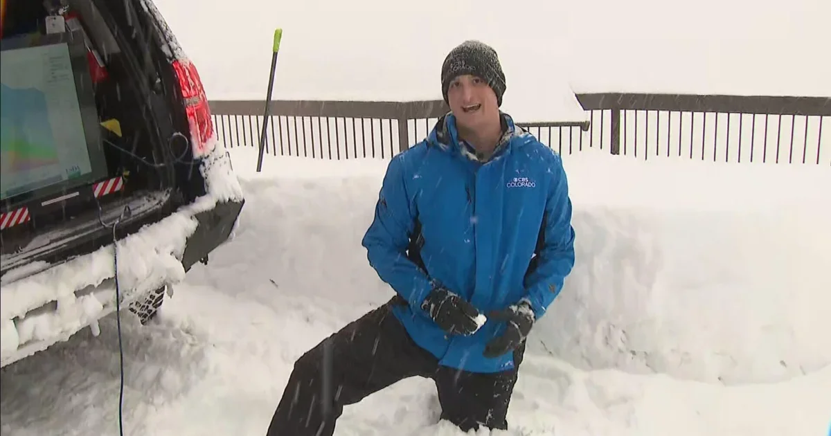
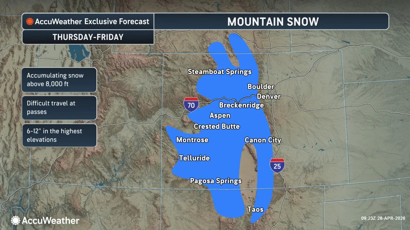
A spring snowstorm moved through Colorado, bringing rain in Denver before turning to heavy snow and slick roads. A jackknifed semi on I-70 slowed traffic, and Denver and Aurora announced Wednesday school closures with many Front Range districts following. Denver is projected to accumulate 3–6 inches by Wednesday, while northern and central mountains see heavier totals (Estes Park ~20 inches, Rabbit Ears Pass >1 foot). CDOT plans about 100 snowplows; travelers should expect slick conditions and possible further freeze warnings after the storm.
Winter storm warnings stretch across parts of Colorado and Wyoming from May 4–6 as a Canadian cold front brings heavy snow—up to two feet in northern mountains—along with slick roads and possible power outages, while a broad storm system promises rain, thunderstorms and wintry mix from the Plains to the Northeast in the coming days.

Snowflake has fallen about 40% this year and is viewed as undervalued due to its consumption-based revenue model (not tied to seat counts) and accelerating AI-driven data growth. With backlog/RPO up more than 40%, the article argues the market has misunderstood the stock and reiterates a Buy rating, presenting the dip as a buying opportunity rather than a SaaS collapse.
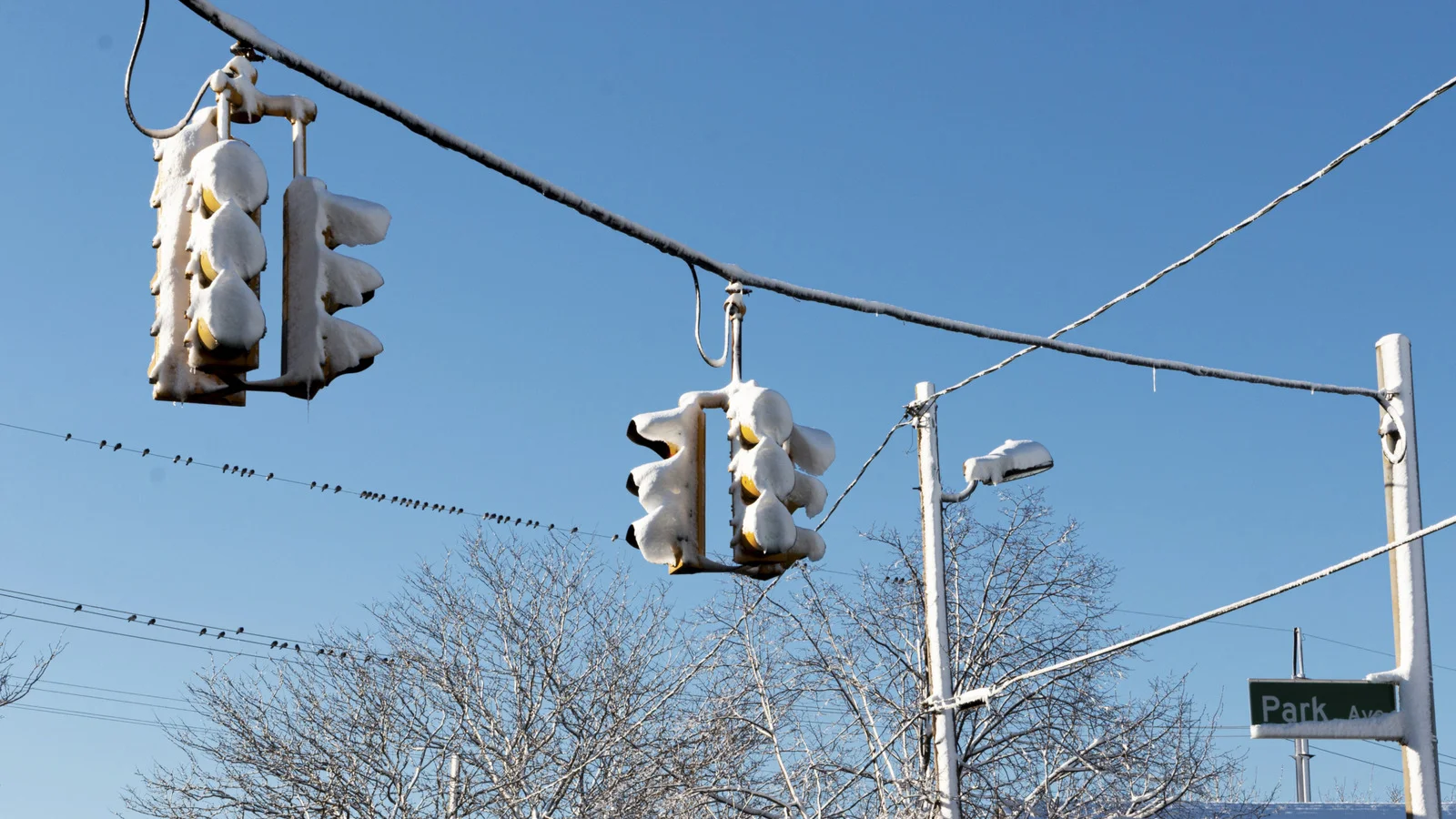
Snow-scoop visors and snow-cone shields are passive attachments on traffic-light visors designed to prevent snow from obscuring the signal. Two main approaches—louvered, vented snow-scoop visors (like the SWARCO McCain design) and clear acrylic snow cones (from Snow Proof Signals LLC)—sit over or inside the hood to shed or vent snow without electrical heating. These durable, maintenance-friendly solutions evolved from early glare-blocking hoods and gas-lit signals to today’s LEDs, improving visibility and reducing snow-related outages.
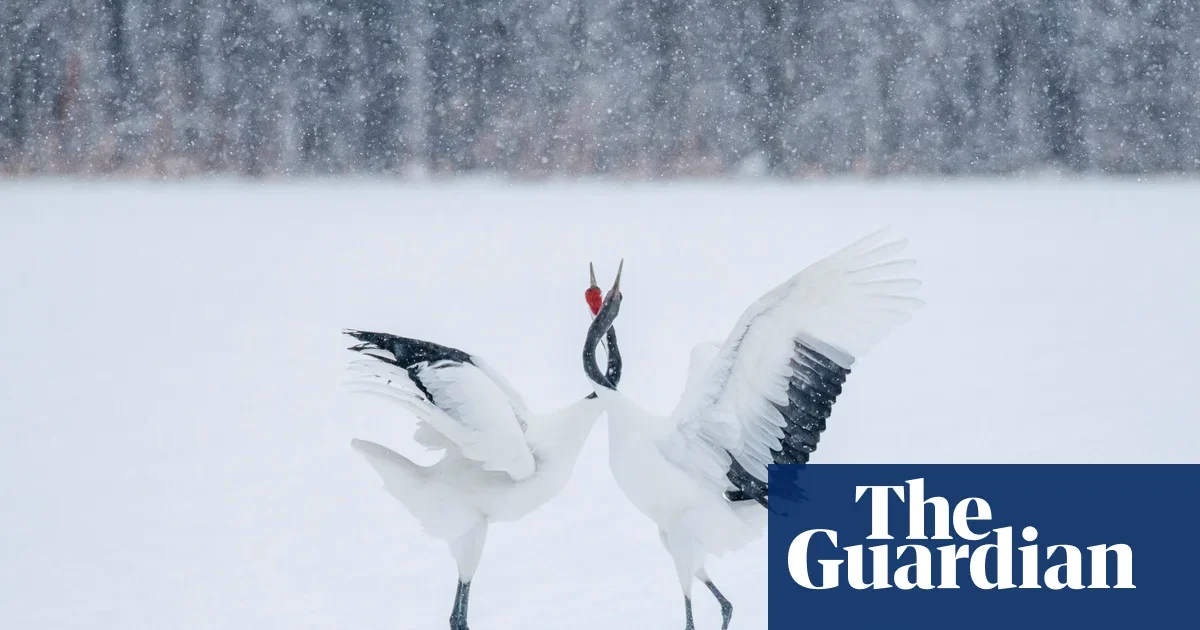
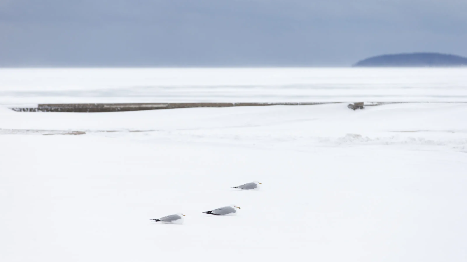
Elizabeth Sanjuan’s Silent Snow collects 40 monochrome photographs from four winters in Hokkaido, turning a colourless, snowbound landscape into minimalist, ink-drawn-like images that emphasize design, silence, and nature’s resilience, with notes on the camera models used.
Michigan’s Upper Peninsula bore the brunt of the blizzard, with Mount Arvon in Baraga County at 39 inches in the past 48 hours and Herman/Sundell around 36 inches; Spalding (35), Negaunee (33.7) and National Mine (30) followed as top totals, with many UP locations in the 20–30 inch range over the same period. A broader list shows significant 24‑hour snowfall across northern Michigan (e.g., Cusino Lake 27.5
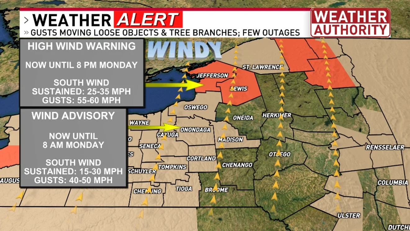
Central New York faces an active weather pattern: strong winds tonight with wind advisories, a potential for damaging gusts up to 60 mph and isolated tornado risk Monday afternoon along a cold front, followed by wet snow Monday night and a dramatic drop in temperatures that could cause a flash freeze Tuesday morning; conditions are expected to calm by midweek as winter gives way to spring.
Northwest Iowa is experiencing blizzard conditions with 30-50 mph winds and icy, snow-covered roads, and travel is not advised. Storm Lake has declared a Snow Emergency from March 15 at 10:00 p.m. to March 18 at 6:00 a.m., restricting overnight parking on certain streets to help plow crews clear streets.
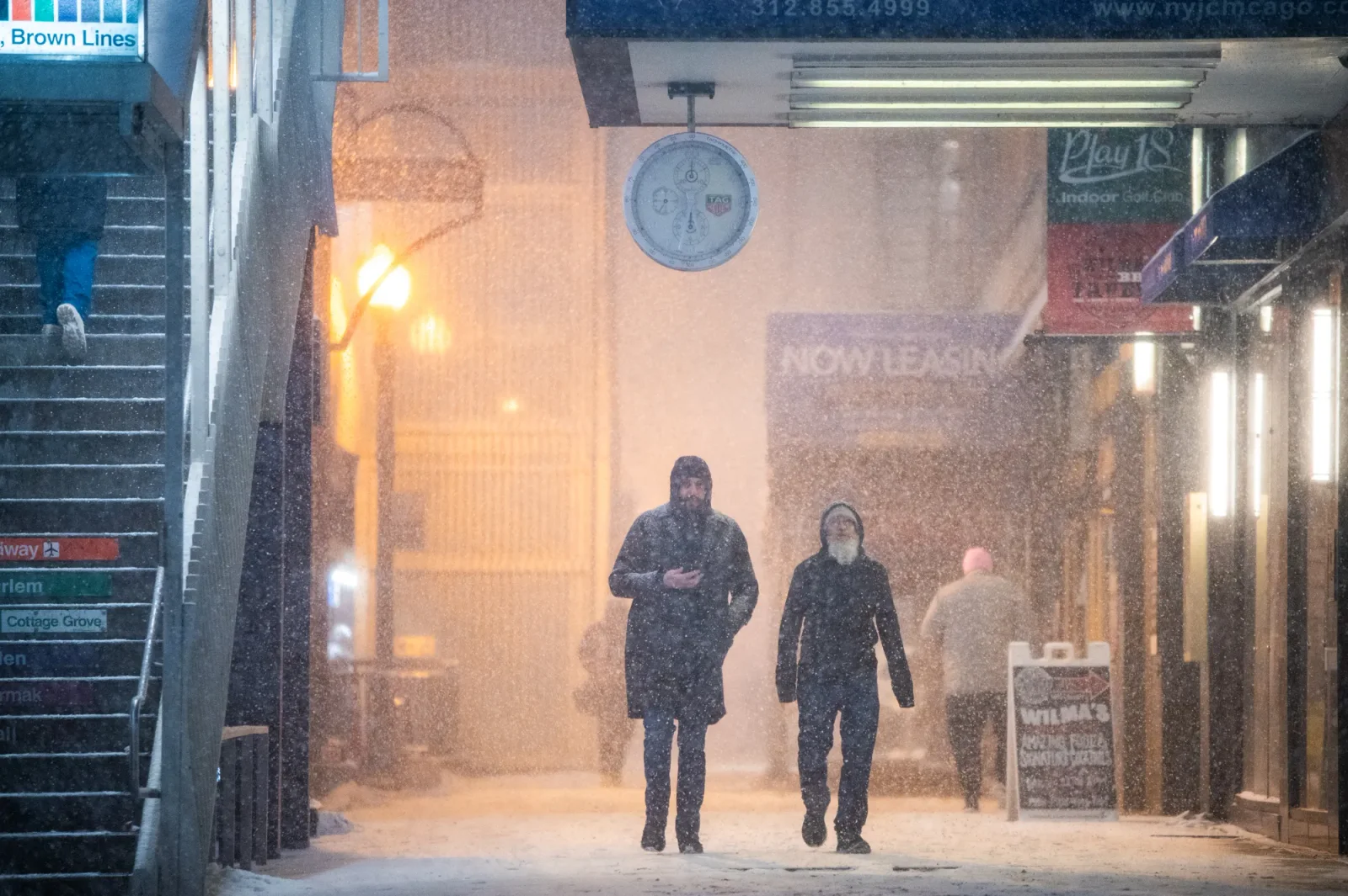
The National Weather Service warns Chicago will swing from a mild weekend to wintry conditions, with rain and storms Sunday turning to snow and temperatures plunging from the 60s to the teens by Tuesday, accompanied by gusty winds and potential drifting snow; a brief warm spell may return later in the week, and lows could dip near 10 degrees Monday night into Tuesday morning. The Metropolitan Water Reclamation District has issued a water-use advisory to help reduce flood risk.
A blizzard warning has been issued for McHenry County and surrounding counties as a cold front brings several inches of snow and winds up to 45 mph, creating whiteout conditions and dangerous travel for the Monday morning commute; travel is urged to be avoided and motorists should prepare winter survival kits.
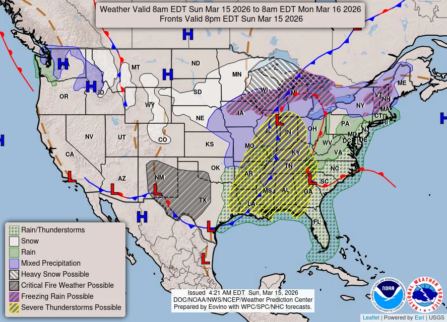
A broad storm system is delivering heavy snow in the Upper Midwest, damaging winds across the Plains, and flooding in Hawaii, while forecasters warn a line of severe storms with damaging winds and several tornadoes could sweep the Eastern U.S. by Monday, threatening travel and causing widespread flight cancellations and power outages.
Gov. Tony Evers declared a state of emergency ahead of a significant winter storm sweeping Wisconsin, enabling faster mobilization of resources. The northeast is under a blizzard warning with potential snow totals of up to two feet in some areas, while Dane County is forecast to see 4–8 inches and regions near the Wisconsin Dells could reach a foot; the system is expected to linger through Monday as Wisconsinites are urged to plan and stay safe.
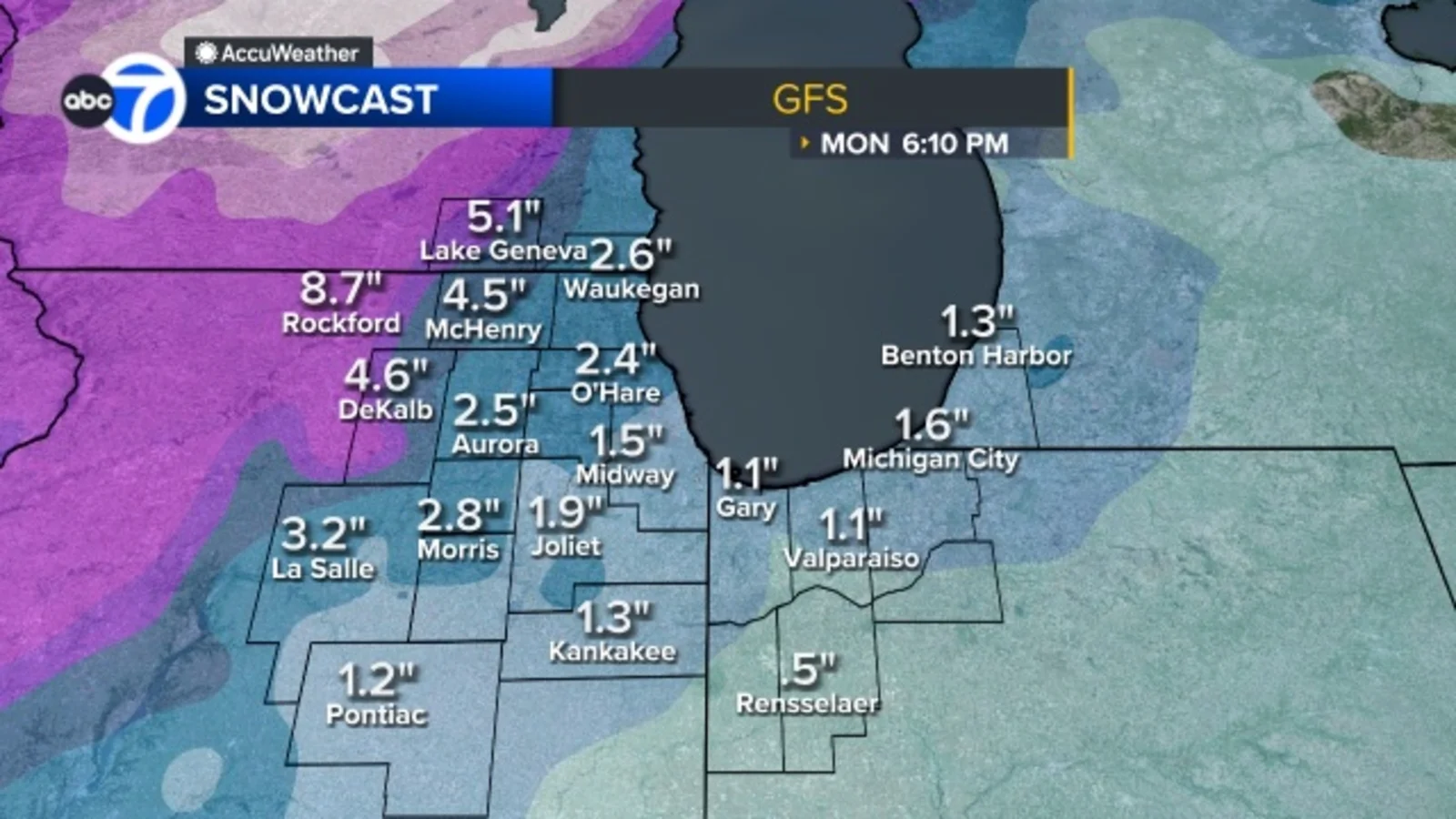
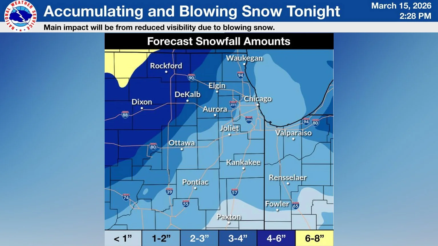
A multi-round storm system is forecast to hit the Chicago area this Sunday: an initial round of thunderstorms 9 a.m.–noon, a second round 4–9 p.m. with damaging wind gusts, and a late-night third round around 1 a.m. Monday that brings snow through the morning rush (1–4 inches possible). Most of the region faces a Level 2 severe-weather risk, with northern suburbs at Level 1; a Winter Weather Advisory covers several counties Sunday night into Monday, and a High Wind Warning is in effect for Kankakee County and Northwest Indiana with gusts up to 60 mph.
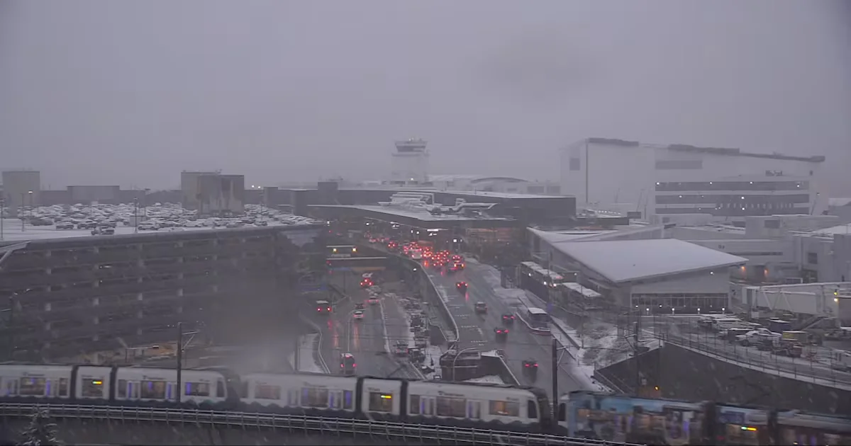
Snow at Seattle-Tacoma International prompted a ground stop for arriving flights, causing widespread delays and several cancellations. Departures were allowed to continue, but inbound traffic was sequenced to space landings. The FAA extended the stop into the afternoon with about 47-minute inbound delays and roughly 1 hour 6-minute departure delays; a later ground delay extended into the evening (average around 62 minutes), leaving some travelers waiting for hours or facing cancellations.