
Gulf disturbance Invest 92-L likely to form tropical depression, bringing rain to Florida Panhandle
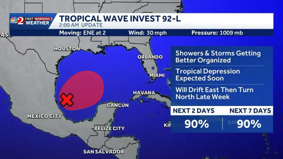
A weather disturbance in the southwestern Gulf of America, designated Invest 92-L, has an 80% to 90% chance of strengthening into a tropical depression within two days. While strong wind shear may limit its intensity, the system is expected to bring heavy rainfall to the Florida Panhandle and central Gulf Coast by the end of the week.
Key points
- The National Hurricane Center (NHC) reports that Invest 92-L currently has 30-mph winds and a central pressure of 1009 mb, with a 90% chance of becoming a tropical depression in the next two days.
- The system is located over the Bay of Campeche and is forecast to move east-northeast before turning north, potentially reaching the central Gulf Coast by the weekend.
- Strong vertical wind shear in the northern Gulf is expected to prevent the system from organizing into a strong tropical cyclone, with only a 15% chance of it becoming a hurricane.
- The Florida Panhandle is already saturated with over 8 inches of rain, raising concerns for additional flooding if the system delivers more heavy downpours.
- If the system strengthens into a named storm, it would be assigned the name Isaias, though meteorologists describe the current development as 'relatively sloppy' and broad.
Background
This development follows a series of Gulf disturbances earlier in the 2026 hurricane season, including Invest 97L, which strengthened into a tropical storm and impacted the Texas and Louisiana coasts in late August. Those earlier systems also highlighted the recurring pattern of low-pressure systems forming in the Bay of Campeche and moving toward the U.S. Gulf Coast, often bringing significant rainfall to the region.
How outlets are covering it
WESH 2 News emphasizes the high probability of tropical depression formation and notes that it is too early to determine specific impacts on the northern Gulf Coast or Central Florida. In contrast, the Pensacola News Journal focuses on the immediate threat of heavy rainfall to the Florida Panhandle, noting that local soils are already saturated. While WESH cites an 80% chance of development, the Pensacola News Journal reports that AccuWeather forecasters believe wind shear may limit the system's potential, though it will still bring tropical moisture. FOX Weather and WFLA-TV meteorologists agree that any resulting system will likely remain weak and disorganized.
Why it matters
Residents in the Florida Panhandle and central Gulf Coast face a heightened risk of flooding due to saturated ground and incoming tropical moisture. Even if the system does not strengthen into a major storm, the potential for heavy rainfall could exacerbate flood conditions in areas already affected by recent storms.
What to watch
The National Hurricane Center will continue to monitor Invest 92-L as it moves through the Gulf. If it strengthens into a tropical depression, it may be assigned the name Isaias. Forecasters expect the system to reach the central Gulf Coast by the end of the week, with the primary threat being heavy rainfall rather than high winds or storm surge.
- System in Gulf could develop into tropical depression this week, NHC says wesh.com
- A tropical storm could form in Gulf of Mexico in coming days The Washington Post
- Tropical disturbance to bring Florida Panhandle a rainy weekend Pensacola News Journal
- Tropical trouble shifts closer to home as new disturbance could drench parts of the Gulf Coast FOX Weather
- First Alert Forecast: Lower humidity and drier weather to start the week, as we watch the Gulf late week KPLC 7 News
Want the full story? Read the original reporting
Read on wesh.com