
Gulf System Isaias Intensifies, Threatening Gulf Coast with Hurricane-Force Winds
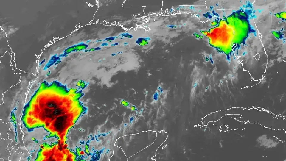
A tropical disturbance in the Gulf of Mexico, initially labeled Invest 92L, has rapidly intensified into Tropical Storm Isaias. The National Hurricane Center forecasts the system will strengthen into a Category 2 hurricane before making landfall between Mississippi and Florida on Friday. Hurricane and storm surge watches are now in effect for parts of the Gulf Coast, with heavy rainfall and flash flooding expected.
Key points
- The National Hurricane Center (NHC) upgraded the system to Tropical Storm Isaias, with sustained winds reaching 65 mph as of Wednesday evening.
- Forecasters predict Isaias will strengthen to Category 1 by Thursday and Category 2 by Friday morning, with a landfall expected between Gulf Port, Mississippi, and Panama City, Florida.
- Hurricane watches are in effect from Bay St. Louis, Mississippi, to Indian Pass, Florida, while storm surge watches cover areas from the Mississippi River mouth to Yankeetown, Florida.
- The system is forecast to bring 5 to 10 inches of rain to coastal Mississippi, Alabama, and the Florida Panhandle, with a moderate risk of flash and river flooding.
- Wind gusts up to 75 mph are possible along the Alabama and Florida coasts, with a level two risk for severe weather, including tornadoes and waterspouts.
Background
This development follows earlier warnings from our archive on October 5, which noted an 80-90% chance of tropical depression formation for the same Gulf disturbance. At that time, forecasters anticipated heavy rain for the Florida Panhandle but noted that strong wind shear might limit the system's intensity. The rapid intensification into a hurricane represents a significant escalation from those initial projections.
How outlets are covering it
Outlets agree on the system's rapid strengthening and the threat to the northern Gulf Coast, but they emphasize different regional impacts. WDSU and WCTV focus on the severe weather and storm surge risks for Mississippi, Alabama, and the Florida Panhandle, noting that the forecast track has shifted eastward, reducing the threat to southeast Louisiana. CBS News Atlanta highlights the potential for increased showers, thunderstorms, and gusty winds in North Georgia, which is on the eastern side of the circulation. AccuWeather, cited by USA Today, warns that saturated ground in the region could lead to renewed flash flooding from southern Georgia to southeast Louisiana. While all sources acknowledge uncertainty in the exact track and intensity, they concur that the system poses a significant threat to the Gulf Coast by the weekend.
Why it matters
The rapid intensification of Isaias into a hurricane poses a significant threat to the Gulf Coast, with potential for life-threatening storm surge, heavy rainfall, and severe weather. Residents in the affected areas need to prepare for possible power outages, flooding, and wind damage. The eastward shift in the forecast track has reduced the threat to some areas but increased the risk for others, highlighting the need for close monitoring of the system's progress.
What to watch
The next complete NHC advisory is scheduled for 4 p.m. Wednesday, with hurricane hunters expected to investigate the system to provide valuable data for refining the forecast. Residents in the affected areas should review their hurricane plans, check supplies, and follow updates from local weather services and the NHC. The system is expected to make landfall between Friday evening and Saturday, with the biggest impacts to the Mississippi, Alabama, and Florida Panhandle Gulf Coast.
- Will the system in the Gulf impact the US? See spaghetti models USA Today
- Hurricane trackers monitoring tropical disturbance in Gulf: Here's how it could affect Georgia CBS News
- Gulf development odds reach 90%: What we know about Invest 92L WDSU
- Growing potential for Invest 92L to intensify into Hurricane Isaias as data reveals its track uncertainty FOX Weather
- The latest on Invest 92L in the southern Gulf WCTV
Want the full story? Read the original reporting
Read on USA Today