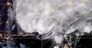
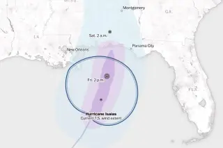
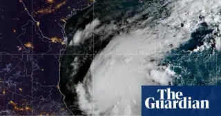
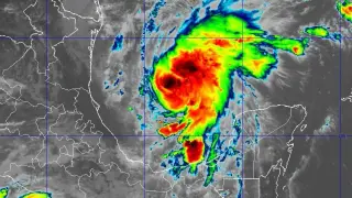
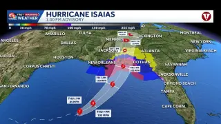
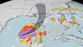
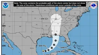
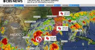
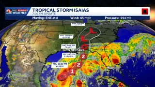
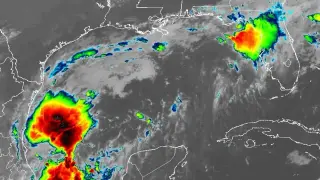
Hurricane Isaias is strengthening as it approaches the northern U.S. Gulf Coast, with landfall expected between late Friday and early Saturday. The storm, the first of the 2026 Atlantic season, poses risks of hurricane-force winds, significant storm surge, and heavy rainfall across parts of Mississippi, Alabama, and Florida.
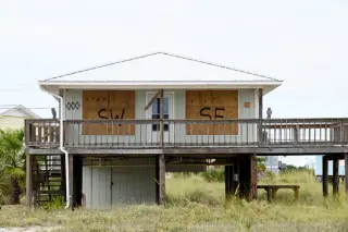
Hurricane Isaias made landfall near Destin, Florida, late Friday as a Category 2 storm, bringing life-threatening storm surge and heavy rains to the northern Gulf Coast. The storm, the first of the 2026 Atlantic season, briefly reached Category 3 strength before weakening. It is now moving north across Alabama and into the Tennessee Valley, with warnings for flash flooding and tornadoes. Over 697,000 customers lost power, and mandatory evacuations were issued in parts of Florida and Alabama.
Hurricane Isaias made landfall near Destin, Florida, at 9:30 p.m. EDT on Friday, October 9, 2026. By 11:00 p.m., the storm had weakened to a Category 1 hurricane with maximum sustained winds near 90 mph. Radar data indicated winds of 105 to 110 mph hitting the coast just before landfall. The National Hurricane Center expects the system to move across Alabama and into the Tennessee Valley over the weekend, continuing to produce gusty winds and flash flooding even after it becomes post-tropical.
Hurricane Isaias, the first major storm of the 2026 Atlantic season, is making landfall in the Florida Panhandle as a Category 3 hurricane. The storm is expected to bring significant storm surge, heavy rainfall, and tornado risks to the northern Gulf Coast, with impacts stretching inland into Alabama and Georgia through Saturday.
Tropical Storm Isaias intensified into the first hurricane of the 2026 Atlantic season, posing a significant threat to the northern U.S. Gulf Coast. Forecasters expect landfall between late Friday and early Saturday, with potential Category 3 strength, heavy rainfall, and storm surges up to 7 feet. Officials in Florida and Alabama have declared states of emergency, while the storm’s late-season arrival highlights the impact of a strong El Niño on Atlantic activity.
Hurricane Isaias, the first storm of the 2026 Atlantic season, is forecast to make landfall on the U.S. Gulf Coast by Friday as a Category 1 or 2 hurricane. The National Hurricane Center warns of 5 to 7 feet of storm surge from Mississippi to Florida and heavy rainfall. Major oil producers Shell and Chevron are evacuating workers and suspending production. Florida and Alabama have declared states of emergency, while the storm threatens to disrupt the Georgia-Alabama college football game and impact natural gas prices.
Hurricane Isaias is forecast to strengthen to a Category 2 storm before making landfall on the northern Gulf Coast late Friday or early Saturday. The National Hurricane Center predicts maximum sustained winds of 110 mph, with potential storm surge reaching 7 feet in parts of Alabama and Florida. Mandatory evacuations have been ordered in Florida’s Okaloosa County, and governors in Florida and Alabama have declared states of emergency for dozens of counties. The storm is expected to bring 3 to 10 inches of rain, damaging winds, and isolated tornadoes to the region, with significant impacts on oil production and college football.
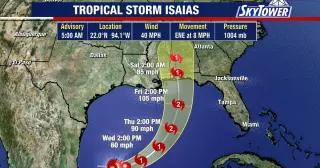
Tropical Storm Isaias has intensified into the first hurricane of the 2026 Atlantic season, with forecasters predicting it will reach Category 2 strength before making landfall on the northern Gulf Coast late Friday or early Saturday. Florida Governor Ron DeSantis has declared a state of emergency for 25 counties in response to the approaching system. The storm is currently moving east-northeast at eight miles per hour, with winds reaching 85 mph and a central pressure of 975 millibars. While wind shear is expected to weaken the system shortly before landfall, officials warn of significant storm surge and tornado risks along the coast from the Florida Panhandle to the Mississippi-Louisiana border. Residents in affected areas are urged to finalize their emergency plans as the hurricane approaches.
Hurricane Isaias, the 2026 Atlantic season's first hurricane, is forecast to make landfall on the northern Gulf Coast late Friday or early Saturday. The storm is expected to bring dangerous storm surge, heavy rainfall, and strong winds to Mississippi, Alabama, and the Florida Panhandle. State of emergency declarations and mandatory evacuations have been issued in response.
Tropical Storm Isaias has intensified into the first hurricane of the 2026 Atlantic season, with sustained winds reaching 75 mph. The National Hurricane Center forecasts landfall between eastern Louisiana and the western Florida Panhandle late Friday or early Saturday. While the storm may peak as a Category 2, it is expected to weaken to a tropical storm or lower-end hurricane upon landfall due to high wind shear. Residents in 25 Florida counties and 40 Alabama counties are under state of emergency declarations, with mandatory evacuations issued in parts of the Florida Panhandle. Primary hazards include 3 to 10 inches of rain, storm surge of 5 to 7 feet, and potential tornadoes.
Tropical Storm Isaias intensified into a hurricane late Wednesday, becoming the first hurricane of the 2026 Atlantic season. The National Hurricane Center forecasts it will make landfall along the northern U.S. Gulf Coast between late Friday and early Saturday. A hurricane warning is in effect from Ocean Springs, Mississippi, to the Florida Bay/Gulf county line, with a storm surge warning extending to Yankeetown, Florida. The system is expected to bring 3 to 10 inches of rain to the central Gulf Coast and potentially reach the Ohio Valley by midweek next week.
Hurricane Isaias, the first storm of the 2026 Atlantic season, has intensified to Category 1 strength in the Gulf of Mexico. It is forecast to strengthen further and make landfall along the northern Gulf Coast late Friday or early Saturday, bringing hurricane-force winds, significant storm surge, and heavy rainfall to parts of Mississippi, Alabama, and Florida.
A tropical disturbance in the Gulf of Mexico, initially labeled Invest 92L, has rapidly intensified into Tropical Storm Isaias. The National Hurricane Center forecasts the system will strengthen into a Category 2 hurricane before making landfall between Mississippi and Florida on Friday. Hurricane and storm surge watches are now in effect for parts of the Gulf Coast, with heavy rainfall and flash flooding expected.
A powerful nor'easter struck the U.S. Atlantic Coast in late September 2026, causing severe flooding and erosion from North Carolina to New York. The event coincided with a strengthening El Niño, raising concerns about increased winter storm activity. Atlantic City recorded its highest water levels since Superstorm Sandy in 2012, while Rockaway Beach in Queens suffered massive sand loss, creating 14-foot cliffs. Experts attribute the extreme surge to a combination of strong onshore winds, high tides near a full moon, and accelerated sea-level rise along the mid-Atlantic. While the storm highlighted immediate vulnerabilities, it also serves as a potential indicator of the wetter, stormier conditions expected during the upcoming El Niño winter.
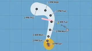
Category 4 Hurricane Lowell remains powerful off Hawaii as Kauaʻi County is under a tropical-storm watch with tropical-storm conditions possible by late Monday. Forecasts show a northwest then north-northeastward track with increasing forward speed, and potential 1–3 feet of storm surge in surge-prone areas. Rainfall could total 4–8 inches on Kauaʻi (up to 12+ inches in spots), 2–6 inches on the Big Island (isolate up to 10 inches), and 2–4 inches on Maui, raising risks of flash flooding and mudslides. Officials urge monitoring forecasts, stocking emergency supplies, and avoiding floodwaters while preparations continue.