
Hurricane Nolo weakens to Category 1, but life-threatening flood risk remains for Hawaii
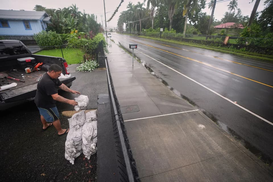
Hurricane Nolo has weakened to a Category 1 storm and is moving west, away from Hawaii’s Big Island. While the threat of direct hurricane-force winds has diminished, the National Hurricane Center warns that significant rainfall could still cause life-threatening flooding and mudslides on the Big Island and Maui. The storm’s path has shifted due to a blocking high-pressure system, reducing expected rainfall totals from earlier forecasts.
Key points
- Nolo’s center is now about 160 miles south of South Point, Hawaii, with maximum sustained winds of 90 mph, down from a Category 2 status earlier in the week.
- The National Hurricane Center has downgraded the threat level for the Big Island from a hurricane watch to a tropical storm warning, as the storm’s track has shifted further offshore.
- Rainfall totals for the eastern and southern Big Island are now expected to be 8 to 12 inches, with maximum amounts of 16 inches, down from earlier forecasts of up to 35 inches.
- Maui is also at risk, with potential rainfall totals of up to 10 inches, which could trigger mudslides and flooding in steep terrain.
- A High Surf Warning remains in effect for the southeast shores of the Big Island, with dangerously large waves of 12 to 16 feet expected.
Background
This is the third hurricane to threaten Hawaii in two months, following Hurricane Lala in August, which brought 20 to 30 inches of rain to the Big Island. The current active season is linked to a record-strong El Niño pattern, which has created warmer-than-average sea surface temperatures in the eastern Pacific, fueling rapid hurricane formation. Conversely, the Atlantic has seen no hurricanes this season due to subsidence caused by the same atmospheric patterns.
How outlets are covering it
The Washington Post emphasizes the downward revision in rainfall forecasts, noting that the storm’s offshore track has halved the expected totals, reducing the risk of 'catastrophic' flooding. Hawaii News Now focuses on the immediate threats, highlighting the High Surf Warning and the continued risk of flash flooding and mudslides, while also noting that Nolo is forecast to intensify again before weakening. The Honolulu Star-Advertiser confirms the storm’s movement away from the islands but does not provide detailed forecast updates, focusing instead on local events and community preparedness. All sources agree that while the direct hurricane threat has lessened, the risk of severe flooding and dangerous surf remains significant.
Why it matters
The continued threat of heavy rainfall and dangerous surf poses a significant risk to life and property in Hawaii, particularly in areas already vulnerable to flooding and mudslides. The storm’s behavior highlights the impact of El Niño on Pacific hurricane activity, which could have long-term implications for climate patterns and weather forecasting. Residents and visitors are urged to remain prepared and heed local officials' advice, as conditions could change rapidly.
What to watch
Nolo is expected to move westward, with rainfall tapering by Sunday evening. The storm is forecast to intensify into a major hurricane on Sunday before weakening. Residents should continue to monitor weather alerts and prepare for potential flooding and dangerous surf conditions. The National Hurricane Center will provide updates as the storm's path and intensity evolve.
- As Hurricane Nolo stalls near Hawaii’s Big Island, serious flooding likely The Washington Post
- Hurricane Nolo remains nearly stationary just south of Hawaii Island Hawaii News Now
- Hurricane Nolo ‘meanders’ south of Hawaii island, bringing showers and gusty winds Honolulu Star-Advertiser
- Hurricane Nolo Updates: Storm Spins Off Hawaii, Bringing Thread of Flooding The New York Times
- Nor'easter pounds Mid-Atlantic, New England coastlines; Hurricane Nolo targets Hawaii NPR
Want the full story? Read the original reporting
Read on The Washington Post