
Nor'easter brings hazardous surf and rain to Maine, sparing region worst impacts
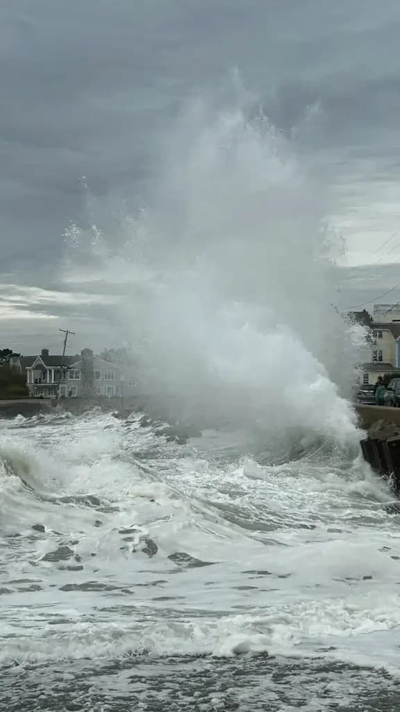
A nor'easter moving north along the mid-Atlantic coast has brought hazardous beach conditions, heavy rain, and gusty winds to southern Maine and New Hampshire. While the storm is peaking this weekend, forecasters indicate the region is on the northern fringe, sparing it the most severe impacts seen further south.
Key points
- Heavy waves and rip currents have created dangerous conditions in coastal Maine, with 'sneaker waves' submerging vehicles in Kennebunk.
- Scattered rains began early Saturday and are expected to become moderate to heavy through Monday before the storm exits on Tuesday.
- Gusty winds up to 40 mph and 10-foot waves are predicted for the Seacoast, with a high risk for rip currents.
- Officials advise residents to stay indoors and away from the ocean due to potential downed tree limbs and minor coastal flooding.
Background
This storm follows a period of significant weather and political activity in Maine, including a recent rally by Vice President J.D. Vance and ongoing concerns regarding the lobster industry following Canada's tariff exemptions.
How outlets are covering it
The Portland Press Herald emphasizes the immediate, localized danger in Maine, citing independent meteorologist Jason Nappi's observation of 'sneaker waves' submerging cars in Kennebunk. In contrast, Seacoastonline and the National Weather Service highlight that New Hampshire and southern Maine are on the 'northern fringe' of the storm, predicting less severe winds and rainfall compared to Boston, where 20-foot waves are expected. WGME notes that surfers were drawn to the coast ahead of the storm, highlighting the contrast between the recreational appeal and the subsequent hazardous conditions.
Why it matters
The nor'easter poses significant safety risks to coastal communities, including vehicle damage, coastal flooding, and dangerous rip currents. The storm's impact on infrastructure and daily life underscores the need for residents to heed official warnings and remain indoors during peak wind and wave activity.
What to watch
The storm is expected to gradually diminish by Sunday evening, with winds and waves subsiding. Rain may continue into Monday and Tuesday, but the most hazardous conditions are expected to pass by then.
- Effects from nor’easter hit Maine, create dangerous conditions Portland Press Herald - Maine Sunday Telegram
- Nor’easter to bring hazardous beach conditions, rain to southern Maine coast Portland Press Herald - Maine Sunday Telegram
- Surfers head to Maine to catch waves ahead of weekend nor’easter WGME
- Nor’easter outlook for Seacoast NH and Maine: Here's what local officials expect Seacoastonline.com
- Nor'easter will bring fringe impacts to Maine as it stalls south of Long Island newscentermaine.com
Want the full story? Read the original reporting
Read on Portland Press Herald - Maine Sunday Telegram