North Texas Braces for High-Impact Severe Weather Tonight
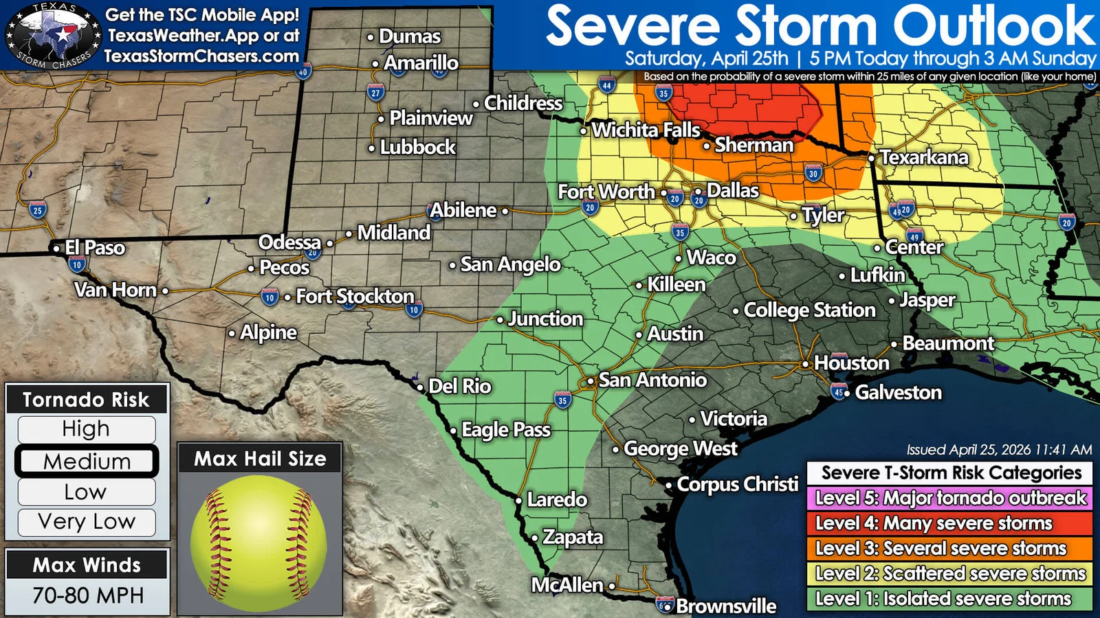
A significant severe weather setup is likely this evening across North Texas, eastern Texoma, and Northeast Texas, with a Level 4 risk near the Red River into Northeast Texas and a Level 3 risk farther north into the DFW area. The main threats are very large hail (4-5 inches), damaging winds (70-80 mph), and a tornado risk, especially near the Red River. Storms could form around 4-5 PM west of the Metroplex and may intensify quickly, with the tornado threat increasing around 6-7 PM and another batch moving southeast from southern Oklahoma into Northeast Texas around 7-9 PM. Most areas may stay dry, but any storms that do form could be dangerous quickly, so stay alert, have multiple warning sources, and seek shelter in a sturdy interior room if warnings are issued. Live coverage and radar tracking are planned by Texas Storm Chasers.
- Significant Severe Storm Threat Tonight in North Texas and Northeast Texas Texas Storm Chasers
- Dallas weather: Tornado warnings, watches in effect in North Texas FOX 4 News Dallas-Fort Worth
- Live radar: Tornado warning issued for North Texas counties, several others under watch Dallas News
- Hot, humid, isolated hit-or-miss strong storms KXAN Austin
- Strong storms could interfere with San Antonio’s Fiesta Flambeau San Antonio Express-News
Reading Insights
0
3
5 min
vs 6 min read
88%
1,150 → 143 words
Want the full story? Read the original article
Read on Texas Storm Chasers