
October Front Brings Coastal Wind Advisories and Cooler Temperatures to Florida
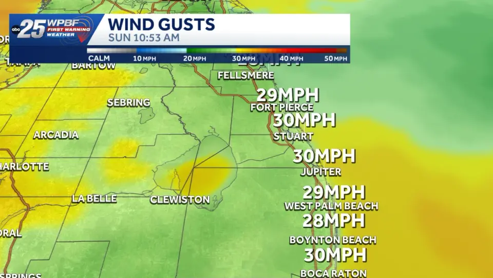
A cold front is impacting Florida on October 18, 2026, bringing hazardous conditions to the east coast while delivering cooler, pleasant weather to the interior. The Treasure Coast and Palm Beaches face a wind advisory with gusts up to 40 mph and high surf reaching 12 feet. Meanwhile, Central Florida and Tampa Bay experience a significant temperature drop, with lows falling into the 60s and 50s, marking the first sustained cool spell since May.
Key points
- A wind advisory is in effect for parts of Indian River County, with sustained winds of 20-25 mph and gusts up to 40 mph.
- High surf advisories are active along the Atlantic coast, with seas reaching 7-12 feet and creating dangerous swimming conditions.
- Tampa Bay is experiencing a small craft advisory from 8 a.m. Saturday through 3 a.m. Tuesday due to gusty northeast winds.
- Central Florida is seeing highs in the upper 70s and low 80s, with an onshore flow bringing coastal concerns.
- Forecasters are monitoring an Atlantic area with a 30% chance of tropical development over the next seven days, though no immediate Florida impacts are expected.
Background
This event follows a series of significant coastal storms in September 2026, including a powerful nor'easter that caused record flooding and wind damage from North Carolina to Massachusetts. The current October front represents a shift from the severe flooding and hurricane-force winds of the previous month to a more typical, albeit impactful, autumn weather pattern.
How outlets are covering it
WPBF emphasizes the hazardous conditions on the east coast, highlighting the wind and high surf advisories. WESH focuses on the pleasant, cool weather arriving in Central Florida, describing it as 'beautiful' fall weather. The Tampa Bay Times provides a detailed breakdown of the temperature drop and the small craft advisory, noting that this cool air is sticking around longer than usual for October. All three sources agree on the general trend of cooling and windy conditions but differ in their emphasis on the severity of the coastal impacts versus the comfort of the interior weather.
Why it matters
The current weather conditions pose immediate risks to coastal residents and maritime activities, with dangerous surf and strong winds. The significant temperature drop also impacts energy usage and daily activities across the state, marking a notable shift in seasonal weather patterns.
What to watch
Residents are urged to secure loose outdoor items, use caution on roads, and stay out of rough ocean waters. The cool weather is expected to persist through the following week, with forecasters monitoring the potential for tropical development in the Atlantic, though no immediate impacts are anticipated.
- Strong winds, dangerous surf hit Treasure Coast, Palm Beaches WPBF
- Fall has arrived with beautiful weather for Central Florida WESH
- Windy & Cooler Sunday as 60s return to Central Florida WKMG
- It's been a pleasant day so far, but how long will this weather last? WINK News
- A cold front is coming to Tampa Bay this weekend, dropping lows into the 60s Tampa Bay Times
Want the full story? Read the original reporting
Read on WPBF