
Severe weather alerts issued for multiple regions in the US.
TL;DR Summary
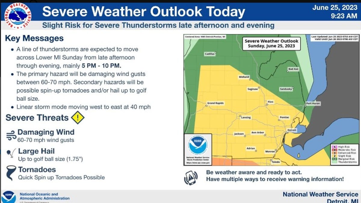
Quick spin-up tornadoes and golf ball-sized hail are possible in southeast Michigan on Sunday evening as a line of thunderstorms is expected to move across the region from 5 to 10 p.m. Damaging wind gusts between 60 and 70 mph are the primary hazard, but non-supercell, quick spin-up tornadoes and hail up to golf ball size will also be possible. The Great Lakes Water Authority issued a storm alert and is asking residents to be prepared, especially those in low-lying areas prone to flooding. The National Weather Service in Gaylord has also issued a severe thunderstorm watch until 7 p.m. for western lower Michigan.
- Weather service: Quick spin-up tornadoes, golf ball-sized hail possible in SE Michigan Detroit News
- Severe Thunderstorm Watch issued for West Michigan WOODTV.com
- Possibility of thunderstorms overnight in St. Louis metro area KTVI Fox 2 St. Louis
- First Alert: Gusty Thunderstorms Possible This Afternoon WILX
- Level 2 out of 5 risk for severe weather for parts of north Georgia Sunday WSB Atlanta
- View Full Coverage on Google News
Reading Insights
Total Reads
0
Unique Readers
10
Time Saved
1 min
vs 2 min read
Condensed
65%
293 → 104 words
Want the full story? Read the original article
Read on Detroit News