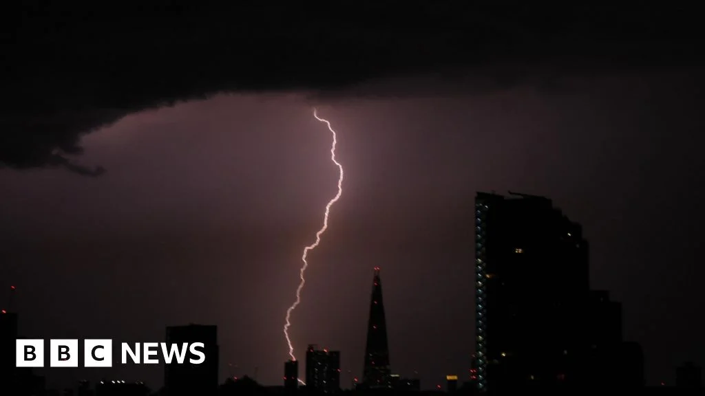
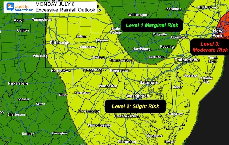
A hyperactive stretch of severe weather is set to hit the central U.S. this weekend, bringing damaging winds, hail and a few tornadoes across Kansas, Oklahoma and Texas over at least four days, with storms peaking Tuesday, according to Washington Post meteorologists Matthew Cappucci and Ben Noll.
A cluster of severe thunderstorms is expected across the Midwest, focusing on Illinois, Indiana and Ohio, with rotating supercells that could produce baseball-sized hail and a tornado risk; a cold front may boost hail while limiting tornadoes, and storms could merge into squall lines by evening, with isolated flooding possible.
A cold front crossing western Pennsylvania is triggering widespread severe storms, with multiple Severe Thunderstorm Warnings in effect for parts of Allegheny, Westmoreland, Beaver, Washington and Butler counties and a Severe Thunderstorm Watch in place for Beaver, Butler, Armstrong, Indiana, Allegheny, Westmoreland, Washington, Fayette and Greene counties until 10 p.m. Sunday. The system could bring large hail, damaging winds, and, in some areas, isolated tornadoes, with heavy rain continuing into the evening and early overnight. Cooler air arrives Monday (highs in the 40s, lows in the 20s Tuesday). A return to sunshine and 50s is expected midweek, with another rain chance late Wednesday night into Thursday. Track storms with radar and local alerts.
A Level 4 out of 5 severe-weather risk stretches from Maryland to South Carolina, with the Mid-Atlantic and Carolinas facing damaging winds, hail, and a few strong tornadoes—centered on the D.C. area—as forecasters warn of a significant outbreak on Monday.
A weather system threatens the DC area with severe storms and possible tornadoes today, followed by a sharp cooldown as colder air moves in; monitor forecasts and heed warnings.
A multi-round storm system is forecast to hit the Chicago area this Sunday: an initial round of thunderstorms 9 a.m.–noon, a second round 4–9 p.m. with damaging wind gusts, and a late-night third round around 1 a.m. Monday that brings snow through the morning rush (1–4 inches possible). Most of the region faces a Level 2 severe-weather risk, with northern suburbs at Level 1; a Winter Weather Advisory covers several counties Sunday night into Monday, and a High Wind Warning is in effect for Kankakee County and Northwest Indiana with gusts up to 60 mph.
A late-season winter storm will sweep from the northern Plains to the Great Lakes this weekend into Monday, bringing widespread heavy snow (roughly 10–30 inches, with some spots near 40) and a corridor of severe thunderstorms that could affect about 11 cities.
A sprawling late-winter storm is set to hit the northern Plains, Midwest and Great Lakes, bringing heavy snow (likely feet), strong winds and reduced visibility, triggering travel disruptions and potential power outages as it edges into southeastern Canada, with thunderstorms and tornado risks in parts of the Plains.
Researchers mounted a UV camera on a modified minivan to capture the ultraviolet corona emitted by trees during thunderstorms for the first time. The team observed 41 bursts in sweetgum and loblolly pine across the U.S. East Coast, with each burst emitting billions of photons at around 260 nanometers. This real but previously unobserved glow could influence forest health and atmospheric chemistry and may play a role in thunderstorm electrification, suggesting such coronae occur across forests worldwide.
Scientists captured the first field evidence of coronae—ultraviolet glows at leaf tips—generated by charge buildup as storms pass over trees. In lab simulations and storm-intercept observations along the US East Coast, researchers logged 41 bursts lasting 0.1–3 seconds, emitting about 100 billion photons per frame at ~260 nm, across species including sweetgum, loblolly pine, maple, and spruce, suggesting a real, widespread electrical glow with potential implications for forest chemistry and how thunderstorms electrify in a warming climate.
Thunderstorms over the Dallas metroplex forced ground stops and flight delays at DFW and Dallas Love Field on Saturday. Love Field’s ground stop extended into early morning and ended around 9 a.m., while DFW delays lifted near noon; a new DFW ground stop was issued briefly from about 12:40 p.m. to 1 p.m. as storms persisted. The FAA is reducing air traffic by about 10% at 40 major U.S. airports, and travelers should check their flight status and TSA wait times via the provided links and stay tuned to WFAA for weather updates.
A strong, deadly tornado ripped through south-central Michigan, killing at least four and damaging neighborhoods in Union City and Three Rivers, as part of a broader severe-weather outbreak across the Plains and Midwest.
A Penn State–led team captured the first in-the-wild coronae—brief ultraviolet glows at leaf tips—during thunderstorms, logging 41 events on multiple tree species across the East Coast in about 90 minutes. Each glow lasts roughly three seconds and can hop between leaves. While coronae had been seen in laboratory tests, this study confirms they occur in nature and may light tens to hundreds of treetop leaves during a single storm, though the displays are invisible to the naked eye.
The Rams-Panthers playoff game in Charlotte faces potential delays due to thunderstorms, which could cause scheduling conflicts with the Packers-Bears game, leading to possible simultaneous broadcasts and NFL scheduling adjustments.
Research links thunderstorms to increased asthma attacks, with data showing a significant rise in ER visits during storm days, highlighting the need for asthma patients to take extra precautions during stormy weather.