
South Florida Flood Watch Active as Upper-Level Disturbance Drives Heavy Rain
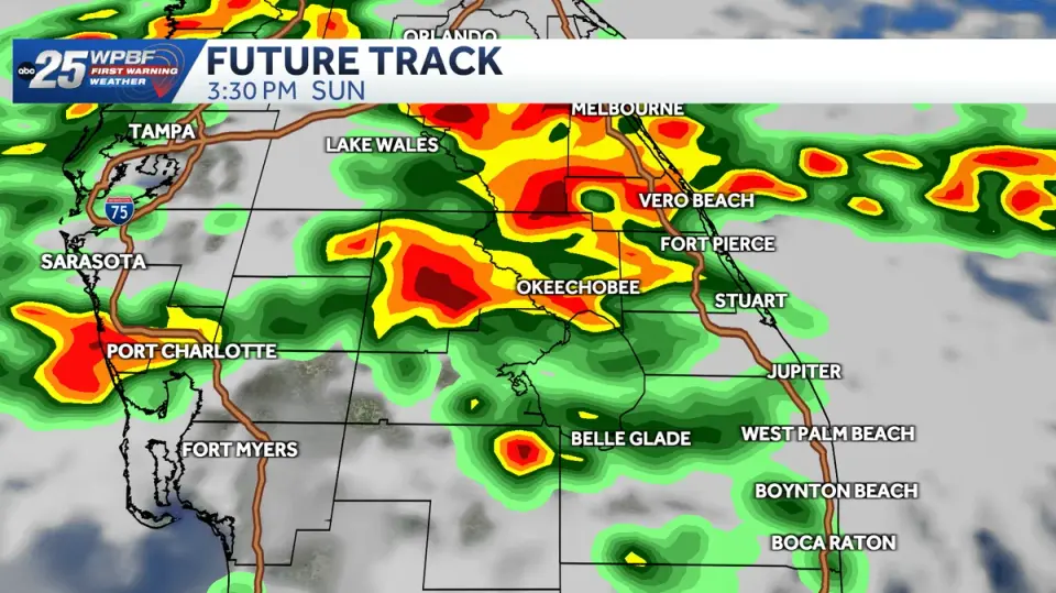
A flood watch remains in effect for South Florida through Monday, November 2, as an upper-level disturbance drives widespread showers and thunderstorms. The National Weather Service warns of 3 to 7 inches of rain in some areas, with flash flooding already occurring in Okeechobee County. Authorities urge drivers to avoid flooded roads, while a cold front is expected to bring cooler temperatures by the end of the week.
Key points
- The National Weather Service issued a flood watch for South Florida through Monday, November 2, at 3 p.m., anticipating 3 to 5 inches of rain, with some areas potentially reaching 7 inches.
- A flash flood warning is active for Okeechobee County until 4:15 p.m., with 3 to 6 inches of rain already recorded. Portions of SR 70 and US 441 are impassable, and water is entering structures.
- Widespread rain is expected across the Gulf Coast, with flood advisories issued for parts of Collier, Hendry, and Glades counties. An additional 1 to 2 inches of rain is forecast for these areas.
- An upper-level disturbance is fueling the storms, but a weak cold front is expected to move through by the end of the week, lowering overnight lows to the 60s and reducing humidity.
Background
This event follows a pattern of severe weather impacts in the region, including heavy rainfall from Post-Tropical Storm Rachel in October 2026, which caused significant precipitation in San Diego County. While unrelated to the current Florida event, it highlights the ongoing challenges of managing infrastructure and water systems during periods of excessive rainfall, as seen in earlier 2026 events in Wisconsin and Chicago.
How outlets are covering it
WPBF and WINK News emphasize the immediate threat of flash flooding in Okeechobee County, with WPBF citing impassable roads and water entering structures. WINK News notes that rainfall totals may average 1 to 2 inches but could reach 4 inches in inland spots. Gulf Coast News focuses on the broader impact across Collier, Hendry, and Glades counties, highlighting poor drainage and low-lying areas. WCTV provides a regional contrast, noting that Tallahassee and the Big Bend will experience lighter rain (under 0.50 inches for most spots) and no severe weather risk, indicating the storm's localized intensity in South Florida.
Why it matters
The flood watch poses significant risks to public safety and infrastructure, with impassable roads and potential structural damage. Residents are advised to avoid flooded roads and prepare for possible power outages and transportation disruptions. The upcoming cold front offers a temporary respite from humidity but underscores the volatility of the current weather pattern.
What to watch
Residents should monitor local news and weather alerts for updates on the flood watch and flash flood warnings. Motorists should avoid flooded roads and plan for potential delays. By the end of the week, a cold front is expected to bring cooler temperatures and drier conditions, reducing the risk of further heavy rainfall.
- Flood watch issued as South Florida braces for heavy rainfall WPBF
- With a soggy Sunday on tap, here's when sunshine returns to the forecast WINK News
- Soggy Sunday: Widespread Rain on the Way Gulf Coast News and Weather
- First Alert Daily: Showers move in to end the weekend ☔ WCTV
- LIVE RADAR: Flash flood warning in effect in Miami-Dade amid thunderstorms NBC 6 South Florida
Want the full story? Read the original reporting
Read on WPBF