
Storms Target Great Lakes to Northeast with Damaging Winds and Flood Risks
TL;DR Summary
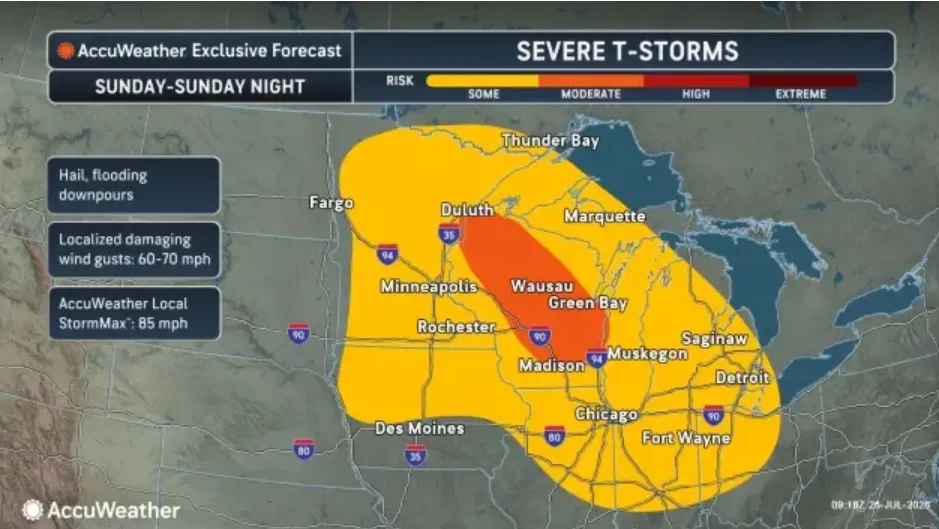
A potent thunderstorm system will sweep from the Plains into the Great Lakes and then toward the Northeast, bringing damaging winds up to about 85 mph, hail, and heavy rain that could trigger flash flooding and travel disruptions along the I-95 corridor from New York City to Raleigh; wet conditions are expected to linger Buffalo to Boston through Tuesday, with severe weather possible in New England by Wednesday. Separately, heat indices of 105–115 F are forecast across much of the central and southern U.S.
- Midwest, East Coast could see damaging winds, flash flooding this week USA Today
- Possible potent storms on Monday prompt NEXT Weather Alert Day in Southeast Michigan CBS News
- Tracking the potential for strong to severe thunderstorms to start next week in Metro Detroit ClickOnDetroit | WDIV Local 4
- STORM WATCH: Heat Sunday, followed by severe storms with damaging winds, & large hail WLUK
- First Alert Weather Day into Sunday night due to risks of severe storms WSAW
Reading Insights
Total Reads
1
Unique Readers
33
Time Saved
2 min
vs 2 min read
Condensed
78%
384 → 84 words
Want the full story? Read the original article
Read on USA Today