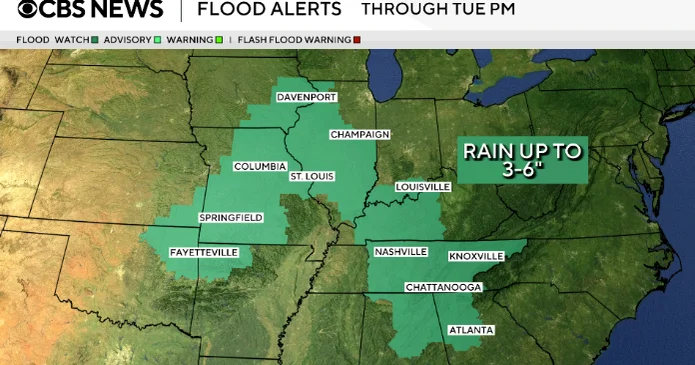
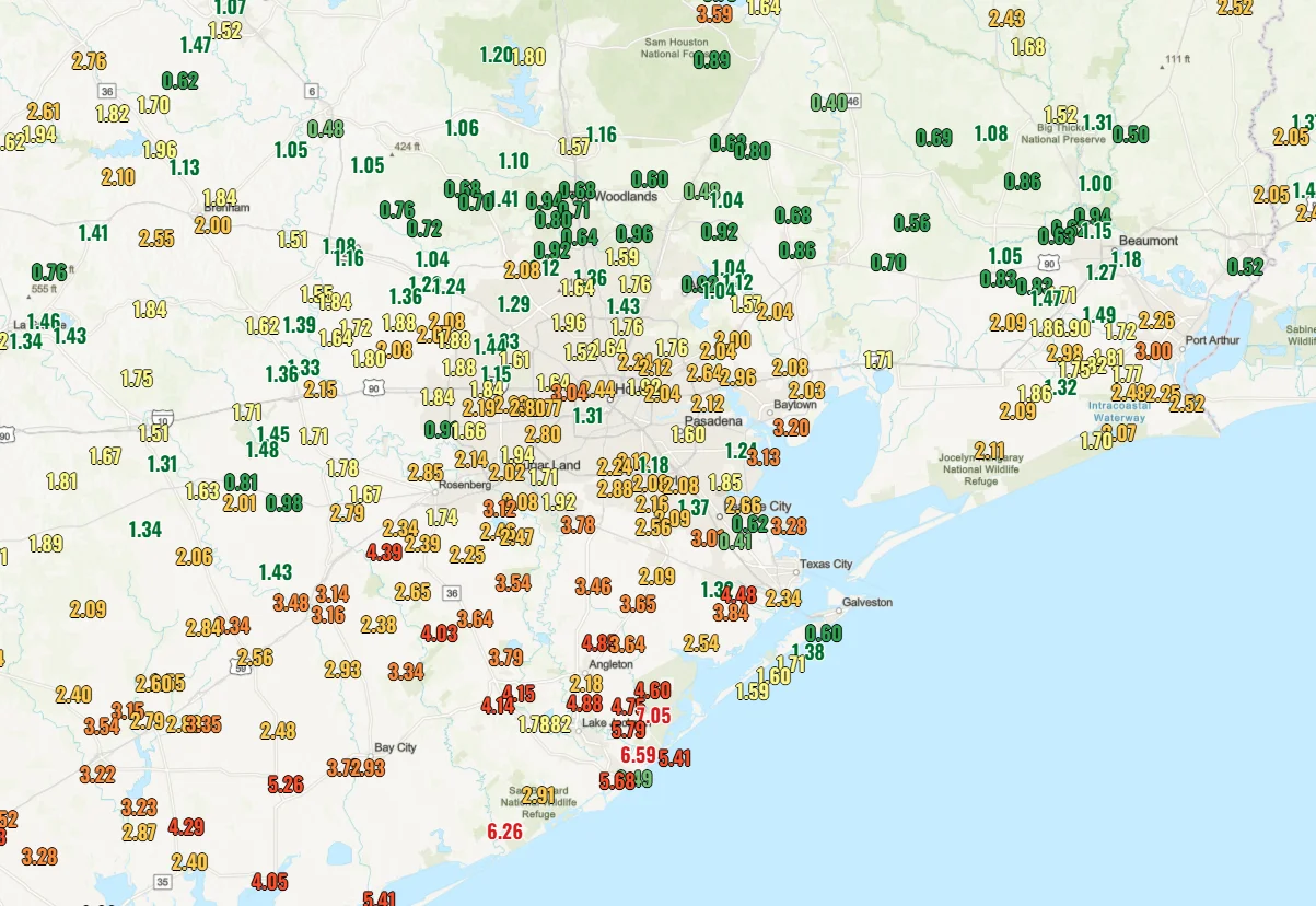
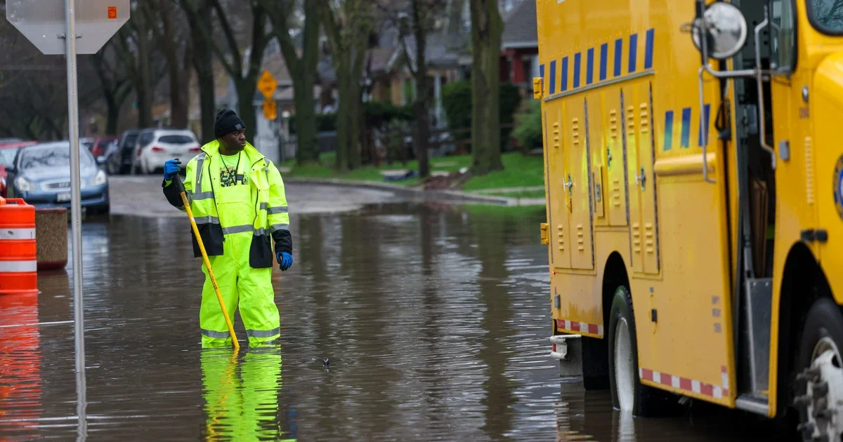
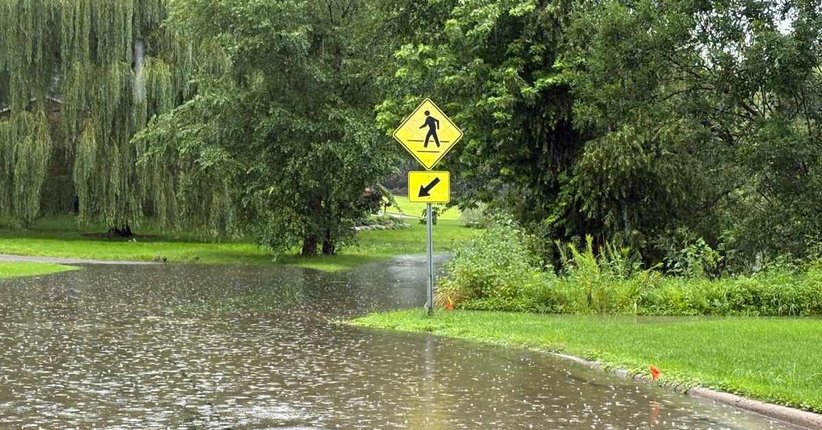
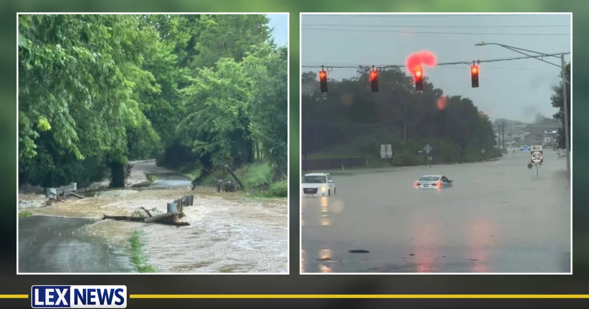
Oahu’s Waialua and Haleiwa communities were ordered to evacuate due to an imminent risk of Wahiawa Dam failure and dangerous flash flooding, with shelters opened and transportation disrupted as residents move to higher ground.
A powerful Kona storm drenched Hawaii with heavy rain, flash floods, landslides and summit snow, washing out roads and destroying a home, while more than 35,000 customers lost power and flood watches and wind advisories remained in effect across Maui, Molokai and the Big Island.
A line of severe thunderstorms is moving from the South through the Ohio Valley into the mid-Atlantic, spawning tornadoes, giant hail, and damaging winds with hundreds of reports. On Wednesday, additional tornadoes and damaging winds are possible across the South, Midwest and East, along with 1–3 inches of rain that could trigger flash flooding; multiple watches are in effect and safety guidance is being shared. Yesterday’s outbreaks included EF1 tornadoes in Illinois and Indiana and large hail across several states.
A severe weather threat including tornadoes and flash flooding is ongoing in the Deep South, with active storms and potential for damaging winds, large hail, and additional heavy rain, affecting areas from Mississippi to South Carolina, while the Northeast experiences rain and snow.
Heavy rain and flash flooding in northern California caused water rescues and at least one death, with significant rainfall in Redding and other areas, driven by atmospheric rivers bringing moisture from the tropics.
A new 24-hour precipitation record of 14.55 inches was confirmed in Wisconsin after severe thunderstorms caused widespread flash flooding, surpassing the previous record of 11.72 inches set in 1946, with the event primarily affecting Milwaukee on August 9-10, 2025.
Tropical Storm Jerry is bringing heavy rain and the threat of flash flooding to the Leeward Islands as it moves away into the Atlantic, with no current threat to the U.S. mainland, and a new tropical wave may develop in the Atlantic but pose no threat to the Caribbean.
Over 25 million people in the Northeast, including major cities like Philadelphia and New York City, are under alert for severe weather and flash flooding due to strong thunderstorms associated with a cold front, with the highest risk from Philadelphia to Bridgeport, Connecticut, expected from Saturday afternoon into the overnight.
A final storm system is bringing heavy rain and flash flood risks to Minnesota, especially the southern regions and Twin Cities, with potential for life-threatening flooding, road closures, and a challenging morning commute due to ongoing storms and saturated ground.
Minnesota faces ongoing flash flooding threats as additional storms are expected to bring heavy rain and strong winds, especially impacting areas already saturated from previous storms, including the Twin Cities and central Minnesota, with potential for significant rainfall through Monday.
Milwaukee experienced historic flash flooding due to over 5.7 inches of rain, causing road closures, water rescues, and the early closure of the Wisconsin State Fair, with more rain expected and ongoing flood risks.
Heavy thunderstorms and record rainfall caused severe flash flooding in Milwaukee and the Midwest, leading to water rescues, event cancellations, and infrastructure damage, with ongoing flood warnings and potential for further rain.
Southeast Wisconsin experienced severe flash flooding from Saturday night into Sunday morning due to heavy rainfall, prompting flood warnings and advisories, with more rain expected.
A flood watch is in effect in central Alabama until 7 a.m. Sunday due to potential flash flooding caused by 2 to 4 inches of heavy rain from slow-moving storms, with additional rain expected across the state.
Heavy rain and storms caused flash flooding across the Tri-State area, leading to road closures, train service suspensions, and flight delays, with emergency rescues and weather warnings issued.